
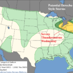
Derecho-style Severe Storms Possible Eastern Ohio Valley to Mid-Atlantic TUE/WED
08/31/2026, 5:08 am EDT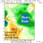
East/Southeast Brazil Forecasts Trend Wetter
09/04/2026, 4:49 am EDT
Climate Impact Company ENSO Climate Diagnostics
Issued: Tuesday September 1, 2026
Highlight: Record-strength El Nino ahead and climate influences of other strong regional SSTA patterns.
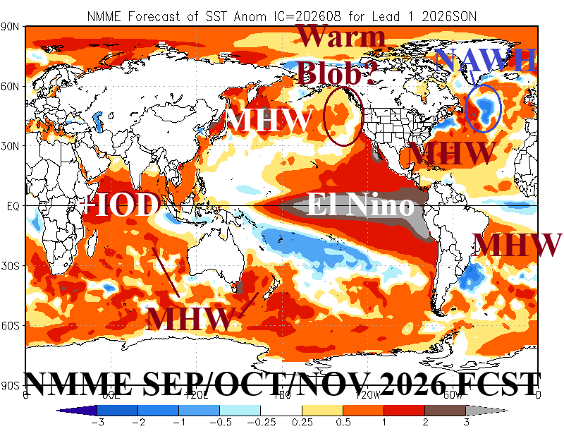
Fig. 1: NMME global SSTA forecast valid for SEP/OCT/NOV 2026.
Discussion: The best initialization and consequently seasonal (SEP/OCT/NOV 2026) outlook of global SSTA is provided by the National Multi-model Ensemble (Fig. 1). Of course, El Nino is vividly apparent in the eastern equatorial Pacific Ocean fueled by the warmest upper ocean heat on record (Fig. 2). Most dynamic Nino34 SSTA forecasts maintain record-strength El Nino by mid-to-late Q4/2026. El Nino 2026-27 influence on climate may have similarities to the last intense episode observed in 2015-16 due to the oceanic warming taking place across vast mid-latitude regions not apparent during previous historic El Nino episodes observed in 1982-83 and 1997-98.
Other regions of influence of strong SSTA signatures, according to NMME, include evolution of positive phase Indian Ocean dipole (+IOD) including a possible marine heatwave (MHW) in the Arabian Sea. Coupled with relative cool SSTA in the Maritime Continent region and northeast of Australia, a set-up for dramatic drying across Indonesia and India and heavy rain East tropical Africa northward to the Middle East is favored. Northern India to Nepal have been very wet, the NMME forecast favors drying ahead. Cool SSTA northeast of Australia favor a dry climate in Queensland. However, MHW’s off the Southeast Coast and West Coast of Australia likely negate traditional dry influence of El Nino.
Another interesting development is the expected strengthening of a MHW east of Brazil while SSTA off Uruguay are cool. This set-up supports an upper trough on the East-central coast of South America encouraging moist low-level flow into Brazil across the MHW. Consequently, short and long-term forecasts have shifted wetter for East Brazil for their spring season.
One possible weakness of the NMME forecast is the lack of warming off the Canadian West Coast. NOAA MHW forecasts suggest a regenerating “warm blob” in the Northeast Pacific, similar with the 2015-16 El Nino. NMME does not indicate the “warm blob” evolution. The lack of a “warm blob” signature suggests a drier climate for Southwest Canada/Northwest U.S. ahead. However, the vigorous MHW off the Southwest Coast of North America coupled with El Nino supports a stormy pattern for California and eastward across the Southern U.S. as the 2026-27 cool season approaches.
NMME maintains the North Atlantic warm hole (NAWH) south of Greenland through SEP/OCT/NOV 2026. The NAWH has been semi-permanent for the past decade and correlated to low pressure troughs aloft compensated for by upper-level high pressure over Europe which explains, in part, why Europe has increased tendency for drought and hot summers and mild winters.
Finally, the peak of the North Atlantic tropical cyclone season is around September 10. Activity so far has been minimal as identified by a very low accumulated cyclone energy (ACE) index (3.1 prior to Eduardo). Of concern is the very warm North Atlantic subtropics generally north of the deep tropics El Nino shear and capable of allowing 1 or 2 robust storms to develop during September.
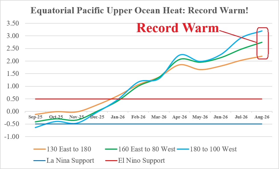
Fig. 2: Monthly upper ocean heat indices across the equatorial Pacific Ocean.