
Drought Concern (in Australia Crop Areas) Increasing
09/25/2026, 8:50 am EDT
Climate Impact Company Daily Feature
Issued: Sunday September 27, 2026
Highlight: NEP25A, MJO, and Major Hurricane Polo combine to flood the Southwest/South-central U.S. this week!
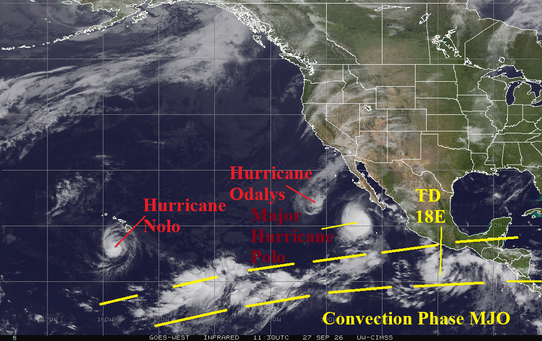
Fig. 1: East Pacific weather satellite view identifying 3 hurricanes and the convection phase of the Madden Julian oscillation.
Discussion: Category-3 Major Hurricane Polo is forecast to initiate a northeast turn toward the Baja California Coast tonight, cross Baja California as a hurricane tomorrow, and gradually weaken crossing Northern Mexico Tuesday (Fig. 1). Polo is the strongest (892 MB) northern hemisphere major hurricane of 2026 edging Major Typhoon Sinlaku (896 MB). A significant contributor to Polo’s intensity is passage across Marine Heatwave NEP25A (Fig. 2) which initiated last year and has produced the warmest anomalous ocean temperatures off the Southwest Coast of North America on record. Additionally, ongoing enhanced (due to the anomalous warm ocean surface) tropical convection associated with the Madden Julian oscillation (MJO) helped to spawn Polo and 5 other major hurricanes in the East Pacific. The MJO advanced through the longitudes of the Americas during recent days helping to ignite the heavy rain event affecting the Northeast U.S. this weekend (Fig. 3). Another widespread heavy rain/flooding event is ahead due to Polo’s transit toward the U.S. this week. NOAA/WPC indicates excessive rain/flooding for Arizona/New Mexico MON/TUE shifting east across the Great Plains and Texas WED and settling on Texas THU (Fig. 4-7). NOAA/WPC indicates 2-4 inches of rain across Arizona/New Mexico to start the week increasing to 3-5 inches across the Great Plains for midweek with jackpot amount near 10 inches south of Dallas for midweek (Fig. 8).
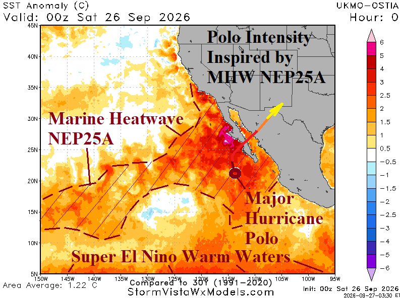
Fig. 2: The southeastern North Pacific daily SSTA analysis identifies the extent and intensity of Marine Heatwave NEP25A.
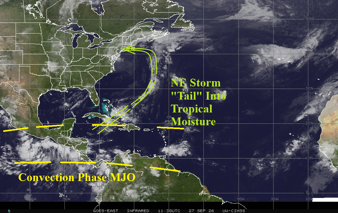
Fig. 3: The eastward extent of the Madden Julian oscillation helped to intensify the Northeast U.S. rain and wind storm this weekend.
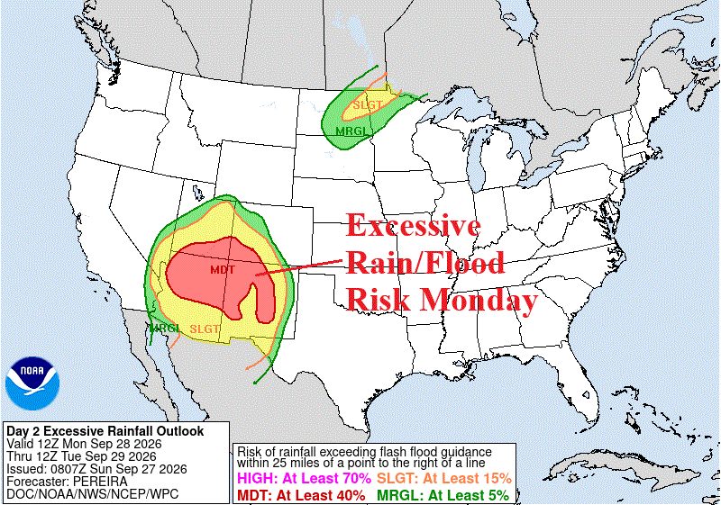
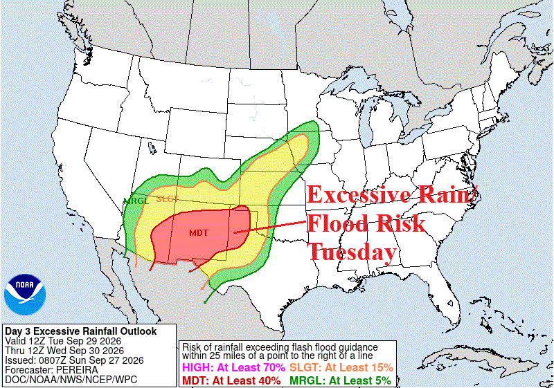
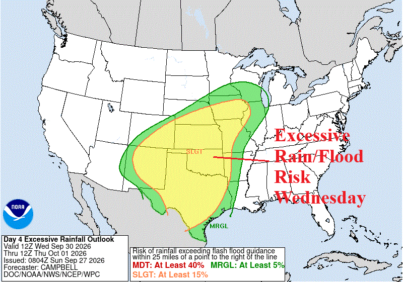
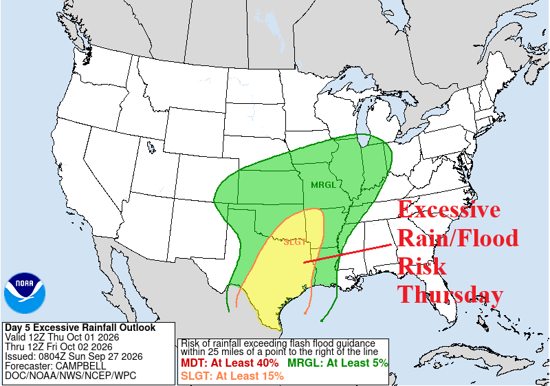
Fig. 4-7: NOAA/WPC excessive rainfall/flooding risk areas for Monday through Thursday.
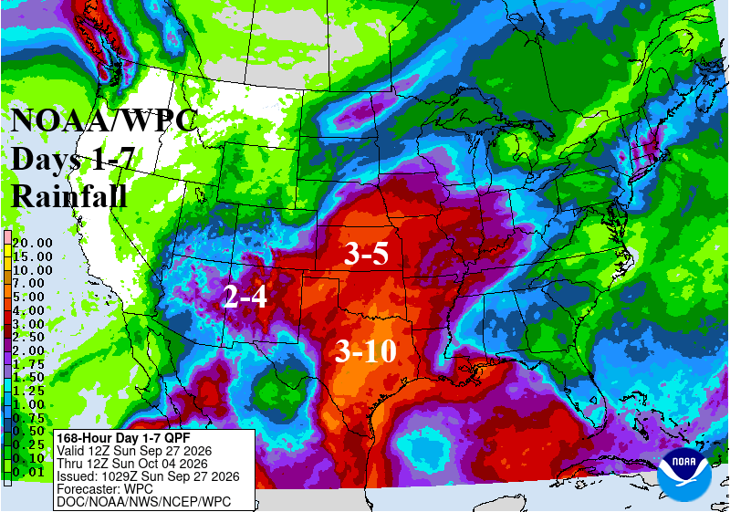
Fig. 8: NOAA/WPC rainfall forecast for the upcoming week.