
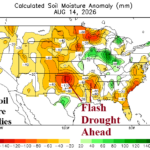
Extremes In U.S. Soil Moisture Anomalies/August Change
08/16/2026, 3:33 pm EDT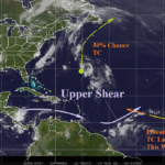
ALERT for Eastern North Atlantic Tropics Tropical Cyclone Later This Week
08/24/2026, 11:53 am EDT

Climate Impact Company U.S. Sunday Report
Issued: Sunday, August 23, 2026
Highlight: Southwest ridge/East trough semi-permanent. Brief break down in pattern allows some warming East U.S. late August. TC ALERT outer tropics.
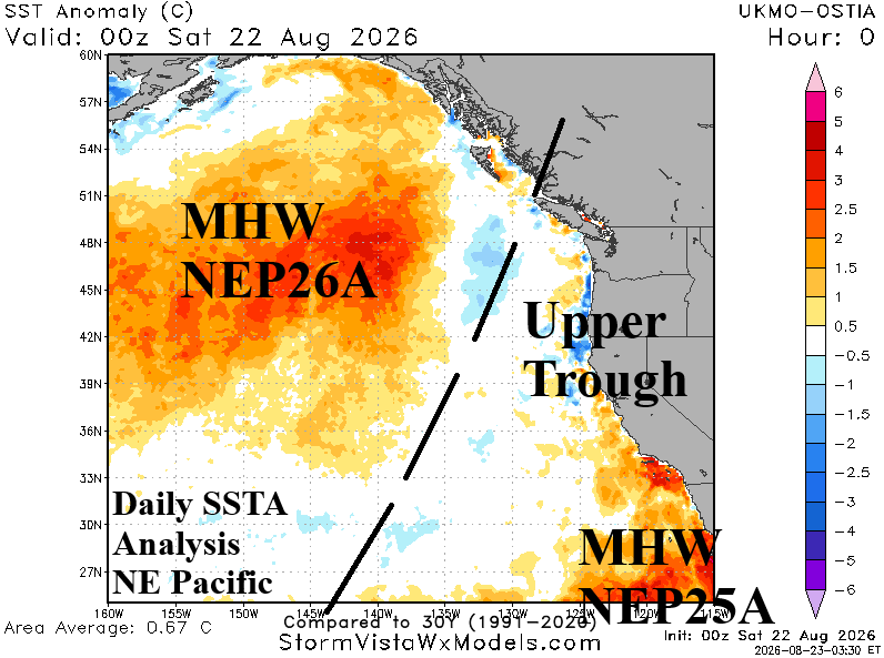
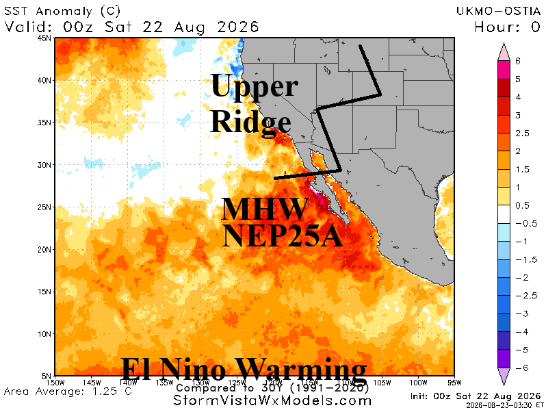
Fig. 1-2: Helping to shape the U.S. late summer upper air pattern across North America…East Pacific marine heatwaves and the cooler waters in-between.
Discussion: A lot of talk about Super El Nino, but the late summer 2026 upper air pattern is shaped mostly by the influence of strong marine heatwaves (MHW) in the East Pacific and the cooler SSTA zone in-between (Fig. 1-2). Most prominent is Super MHW25A, forming late last year and persisting at record warm levels to date, this warm ocean feature is well-correlated to amplified high pressure centered on the Southwest U.S. and causing this sector of the nation to experience their warmest year on record.
The warm influence continues as northeast of MHW25A a roaring hot subtropical ridge remains stagnant to finish summer 2026 (Fig. 3). Downstream from the hot weather associated with the Southwest U.S. ridge is a compensating upper trough cooling the Great Lakes region and vicinity (Fig. 4) in the latest 15-day ECM forecast. The precipitation outlook features thunderstorm activity shifting from the Midwest States during middle August southwestward to Nebraska and Kansas for late summer (Fig. 5).
The heat in the Southwest U.S. extending to Texas and vicinity will pulse eastward briefly and moderate late in August causing a brief warm-up for PJM-East (Fig. 6). During that time there may be one day when Washington, DC reaches 90F.
The latest U.S. population weight CDD forecast identifies the brief warm-up in the East has on the national CDD count for the week ending September 2nd followed by cooling to normal Sep. 3-9 (Fig. 7).
In the tropics, feature southeast of Bermuda drifts north and northeast without any development during the next few days (Fig. 8). Forecast models agree on development of a named storm later this week in the eastern North Atlantic tropics where an ALERT is issued. The long-term expectation of this system is potential for a hurricane likely staying out to sea while turning northward.
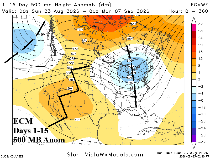
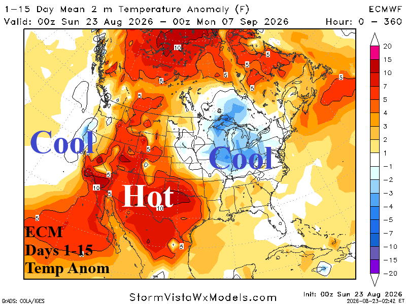
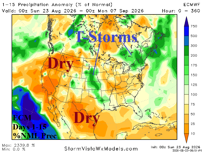
Fig. 3-5: ECM 15-day upper air forecast, temperature anomalies, and %normal rainfall outlooks.
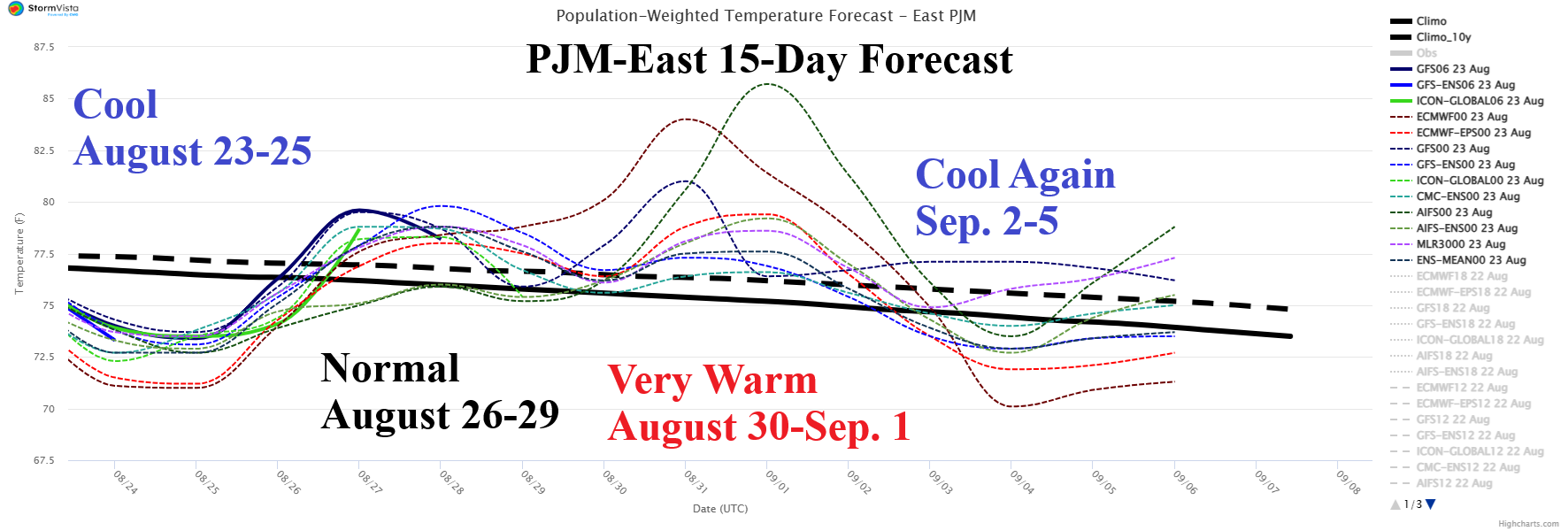
Fig. 6: PJM-East population-weight daily average temperature forecast utilizing all models.
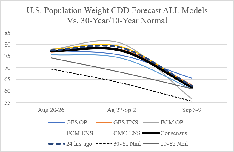
Fig. 7: Utilizing all models, the latest U.S. population-weight CDD forecast through early September compared with the 24-hour ago outlook and normal.
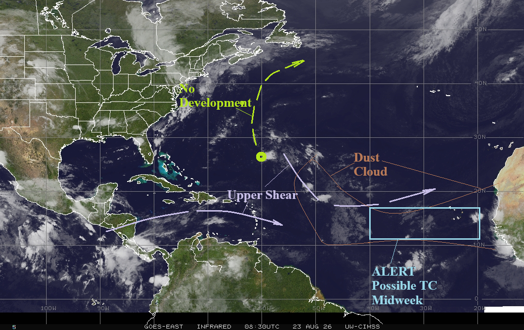
Fig. 8: The North Atlantic basin weather satellite view.