
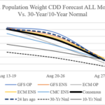
Still Hot U.S. Population Weight CDD Forecast
08/14/2026, 8:50 am EDT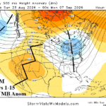
Marine Heatwave NEP25A Shaping The U.S. Upper Air Pattern
08/23/2026, 6:43 am EDT
Climate Impact Company Week 2-4 Outlook
North America
Issued: Sunday August 16, 2026
Highlight: Mid-south heat/accelerating drought roars on; Widening thundershowers week-3/4 ahead as pattern turns very humid.
Charts of the day: U.S. soil moisture anomalies, August change.
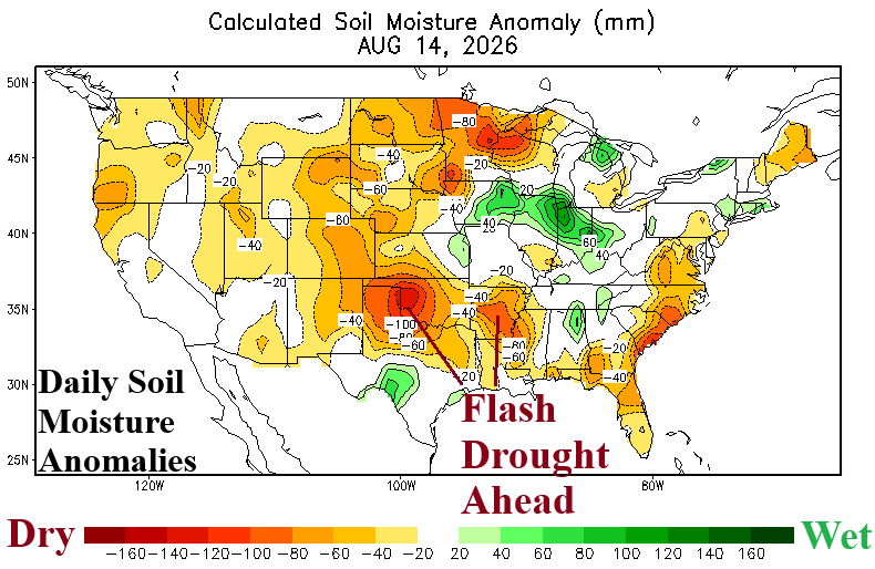
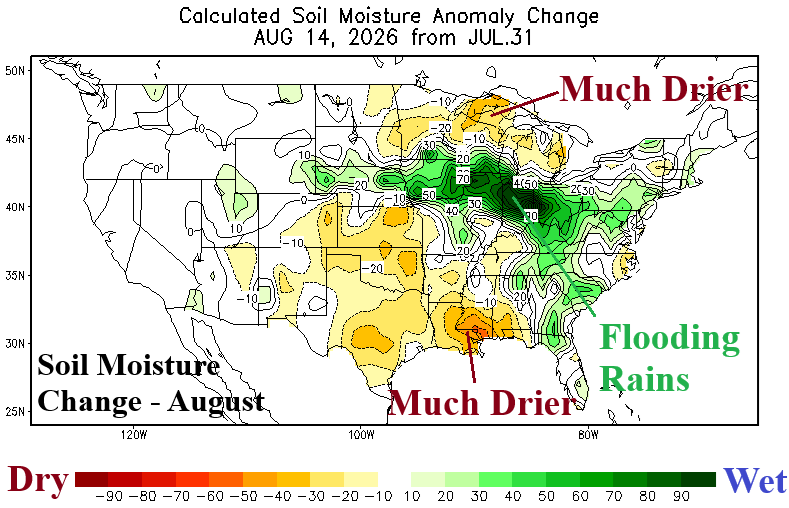
Discussion: Extremes are evolving in mid-August. Flash drought in a dry climate with excessive heat is underway in the Mid-south U.S. Meanwhile, to the north of the rapidly emerging drought, ring of fire thunderstorms is flooding the Midwest States.
Week-2 Ahead (August 23-30, 2026): Punishing Mid-south U.S. heat; New England cooler.
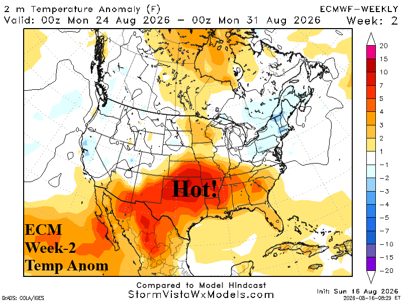
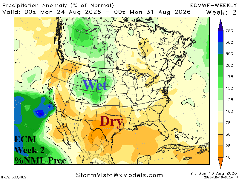
Discussion: Upper trough cools the Northeast while the Mid-south U.S. heat remains intense due to a subtropical high-pressure ridge core directly over the region. Monsoon thunderstorms retreat to the West-central U.S. as the Midwest shifts less wet.
Week-3 Ahead (August 30-September 6, 2026): Southern U.S. heat; Thunderstorms Central Plains//Midwest.
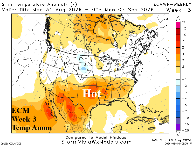
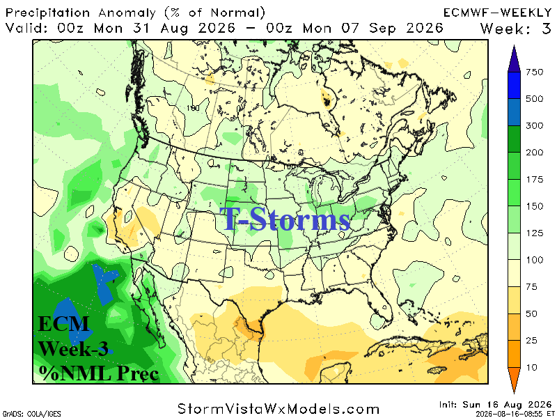
Discussion: The subtropical ridge is sprawling across the Southern U.S. as anomalous heat is expansive. North of the ridge, monsoon moisture shifts eastward igniting a thunderstorm pattern across the Central Plains and Midwest States.
Week-4 Ahead (September 6-13, 2026): Thundery pattern; Mid-south stays hot. California is hotter.
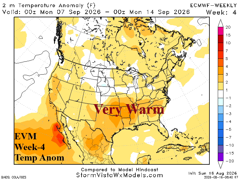
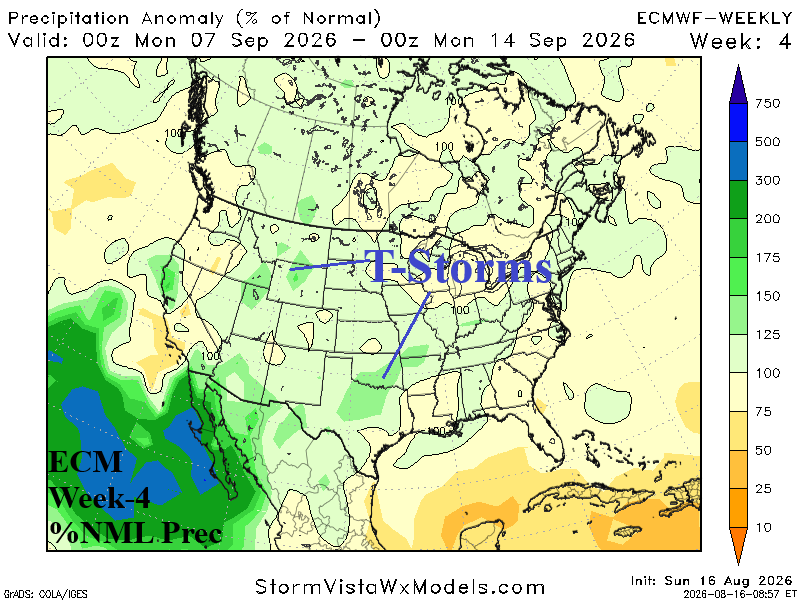
Discussion: Weak upper trough North-central U.S. is forecast by ECM. Feature increases risk of thunderstorm activity across much of the Central U.S. although patchy in character. California shifts hotter and the eastern half of the U.S. is very warm and humid with lingering hot risk across the Mid-south U.S. drought zone.