

GLAAM Strengthens, Indicates El Nino Climate Gaining Intensity
09/10/2026, 11:49 am EDT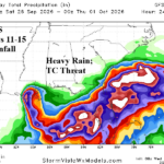
Overnight GFS and ECM Indicate a Potential 11-15-Day Gulf of America/Florida/Southeast U.S. Coast Problem
09/16/2026, 8:46 am EDT
September 2026 Climate Impact Company ENSO Outlook
Issued: Friday September 11, 2026
Highlight: ECMWF precipitation impacts caused by Super El Nino for DEC/JAN/FEB 2026-27.
Executive summary: ECMWF issued new probabilistic climate forecasts yesterday. Super El Nino peak is projected for DEC/JAN/FEB 2026-27. A review of precipitation patterns, anticipated by ECMWF, is provided.


Fig. 1-2: ECMWF precipitation probability forecasts for DEC/JAN/FEB 2026-27 across North America and Europe.


Fig. 3-4: ECMWF precipitation probability forecasts for DEC/JAN/FEB 2026-27 across Central and South America plus Australia and Indonesia.
Discussion: ECMWF precipitation probabilities indicate hostile storm track likelihood in the U.S. for California and the U.S. East Coast (Fig. 1). Shadowing of strong westerly flow aloft carrying storms eastward keeps areas immediately downwind the Continental Divide drier than normal. The “atmospheric river” pattern is embedded within what should be a wildly intense Pacific jet stream this winter season slamming California with many potent storms featuring potential record high elevation snow, flooding events caused by both heavy rain and sea level rise coupled with high waves, and high wind events. California should be bracing for an unusually stormy winter season.
A second potent storm track surges from the Southeast Pacific across the Gulf of Mexico to the U.S. Atlantic Seaboard. Many heavy rain/high wind events are anticipated. El Nino storms produce very low pressure and although cold air delivery into the East Coast storm track is absent this winter season, intense low pressure can generate locally cold air to cause heavy wet snow events for the Appalachian States.
The effects of Super El Nino on Europe winter climate is mild and a lengthy area of above normal precipitation for Eastern Europe and much of Russia (Fig. 2). The northern half of the wet anomaly in Russia should be cold enough to cause mostly snow. If a large veil of snow manages to emerge and persist, sneaky cold air masses could develop in this region.
In South America, summertime is forecast very wet with flood risk in Southeast Brazil while the northern half of Brazil is dry and hotter than normal encountering drought (Fig. 3). Warm SSTA east of Brazil should cause a normally wet summer for Eastern Brazil.
Marine heatwaves (MHW) either side of Australia suggests periods of rain across the southern half of the continent during meteorological summer while El Nino-enforced dryness is likely on the North and East Coast (Fig. 4).
Currently, global SSTA analysis reveals the presence of the prohibitive El Nino episode in place throughout the equatorial East Pacific (Fig. 5). The attendant warmth extending poleward in the East Pacific is intensifying. Note the oceanic warming, separate from El Nino, in the Indian and Atlantic Ocean(s) likely to alert the historical understanding of El Nino-driven climate in unknown ways during the next 3-6 months.
The upper ocean heat associated with El Nino 2026 is unprecedented (Fig. 6) and is causal for consistent record-breaking warm Nino34 SSTA forecasts for the last quarter of 2026 (Fig. 7) indicating likelihood of the strongest El Nino on record.

Fig. 5: Weekly global SSTA analysis revealing the current El Nino and general warmer than normal global ocean surface.

Fig. 6: Equatorial Pacific monthly upper ocean heat tracker indicates record strength warm anomalies have emerged.

Fig. 7: A collection of all models forecasting Nino34 SSTA all indicating record strength for late 2026.