
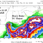
Overnight GFS and ECM Indicate a Potential 11-15-Day Gulf of America/Florida/Southeast U.S. Coast Problem
09/16/2026, 8:46 am EDT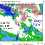
Southern Brazil Rains/Changeable Temperature across South America Into October
09/20/2026, 7:40 pm EDT
Climate Impact Company Daily Feature
Issued: Thursday September 17, 2026
Highlight: NOAA issues new long-lead climate forecasts; Northwest drought strengthens while El Nino precipitation weakens drought east of Divide/Southwest.
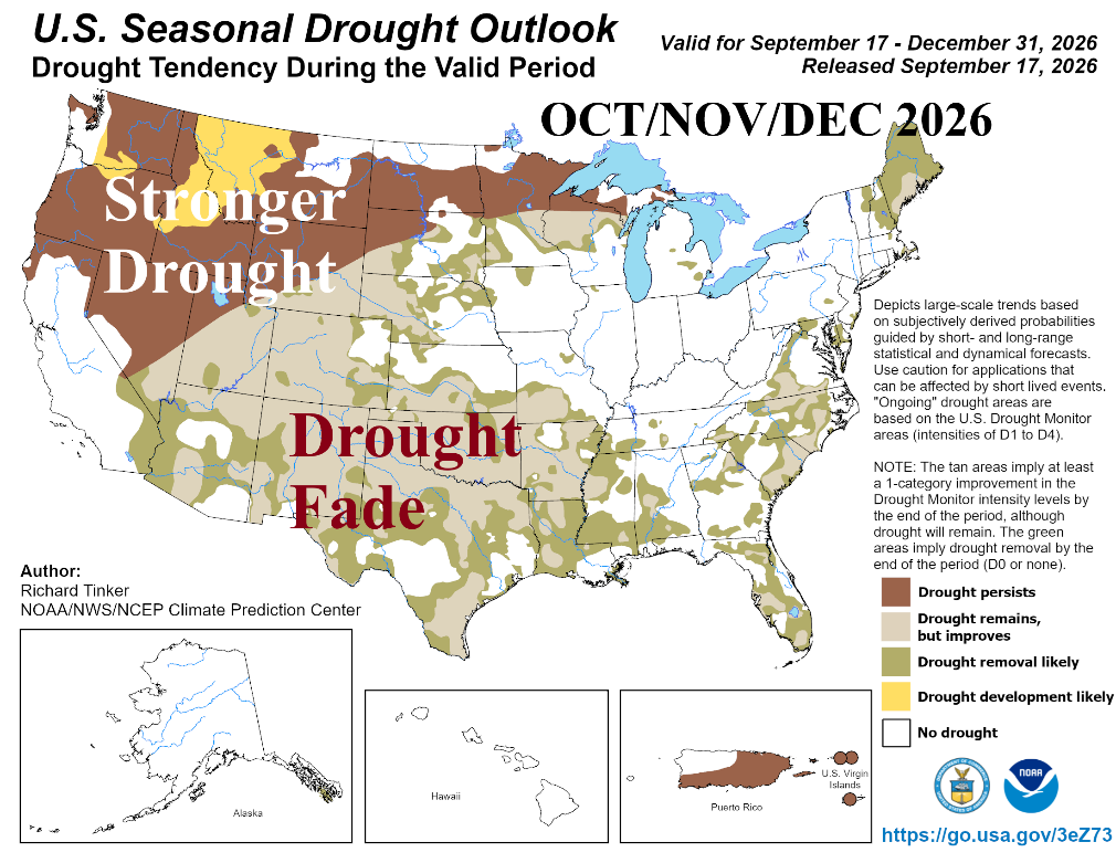
Fig. 1: NOAA/CPC Seasonal Drought Outlook valid for Q4/2026.
Discussion: About 80% of the U.S. is encountering dry-to-drought conditions as calendar summer ends. Amazingly, the wet weather of a Super El Nino will wipe out most of the drought during Q4/2026 except the Northwest States where drought is likely to gain strength (Fig. 1).
The October 2026 Outlook focuses wet weather risk on Texas and continued anomalous warmth throughout the Gulf States and East U.S. (Fig. 2-3). Coastal California can expect Santa Ana wind events producing anomalous warmth. The OCT/NOV/DEC 2026 outlook features high probability of above normal temperatures for most of the U.S. except Texas and vicinity where storminess is persistent. Strongest wet anomalies are across Florida (Fig. 4-5).
The precipitation outlooks favor late season tropical cyclone risk for Texas in October and Florida in November.
The meteorological winter (DEC/JAN/FEB) 2026-27 outlook maintains a classic warm El Nino winter look (Fig. 6) with an intense Southwest, South, and East U.S. storm track (Fig. 7).
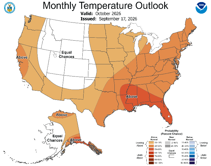
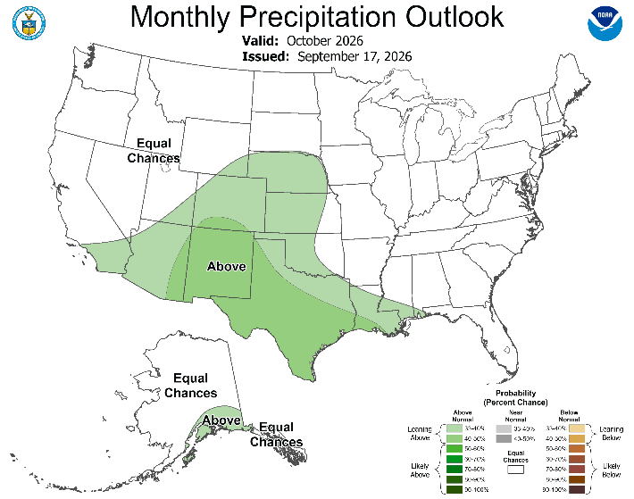
Fig. 2-3: NOAA/CPC temperature and precipitation probabilistic forecast for October 2026.
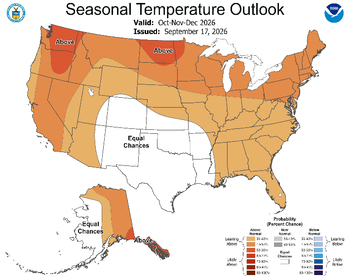
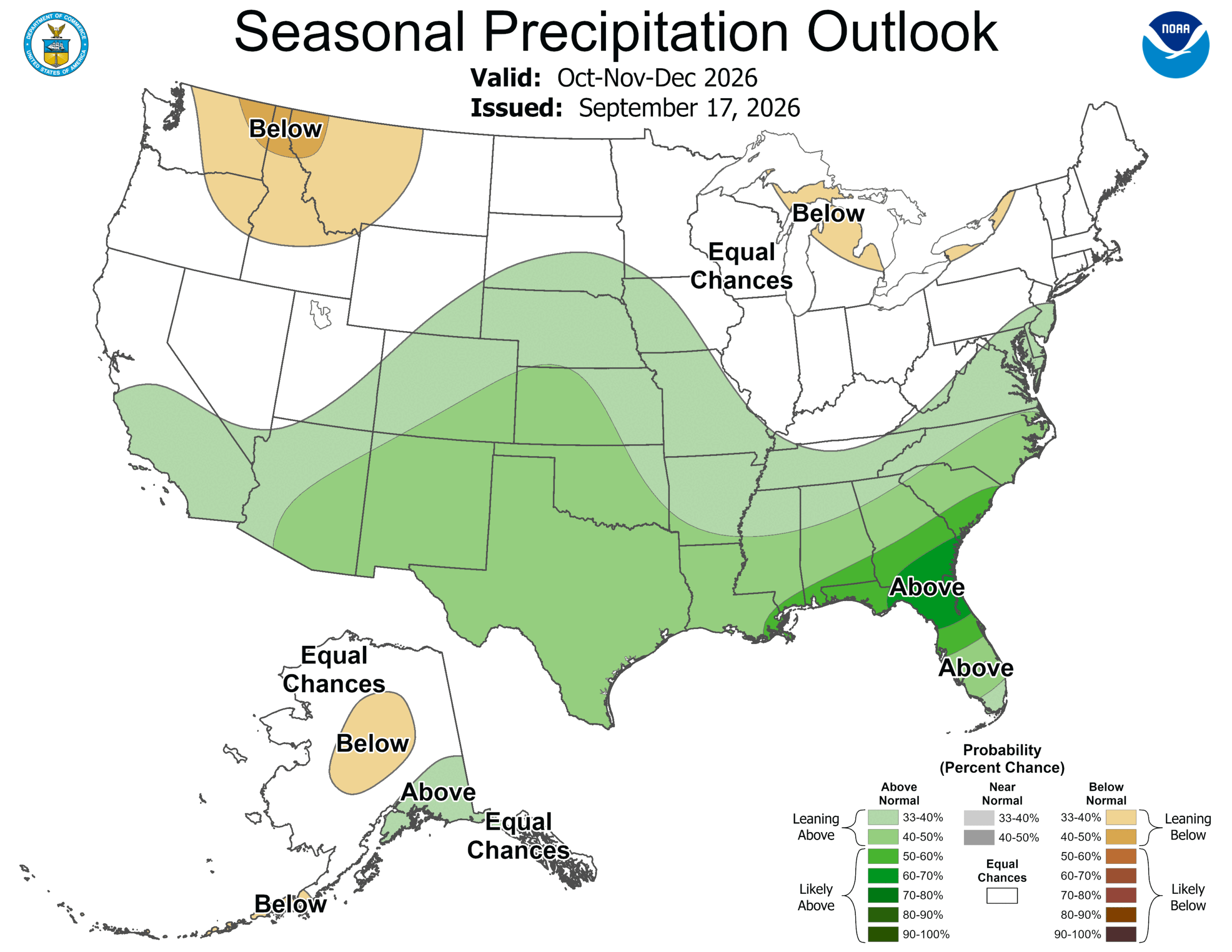
Fig. 4-5: NOAA/CPC temperature and precipitation probabilistic forecast for OCT/NOV/DEC 2026,
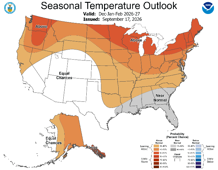
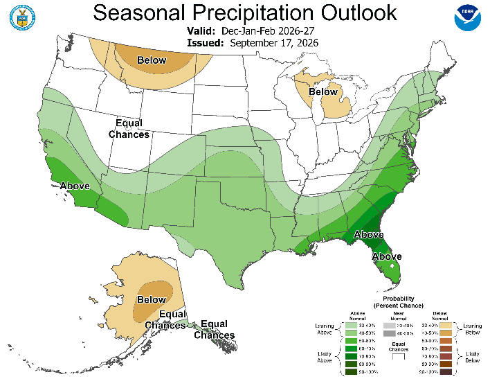
Fig. 6-7: NOAA/CPC temperature and precipitation probabilistic forecast for DEC/JAN/FEB 2026-27,