
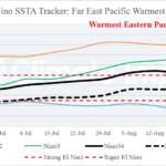
Eastern Equatorial Pacific is Now Record Warm!
09/08/2026, 5:14 am EDT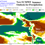
ECMWF El Nino-Driven Precipitation Impacts Caused by Super El Nino for DEC/JAN/FEB 2026-27
09/11/2026, 5:02 am EDT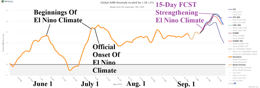

Climate Impact Company North America Medium Range Report
Issued: Thursday September 10, 2026
Highlight: North/Northeast cooler, Wes/Central warmer medium range; Re-widening warmth extended range.
Chart of the day: Strong positive phase Global atmospheric angular momentum, a key signature of strong El Nino climate, expected to strengthen.
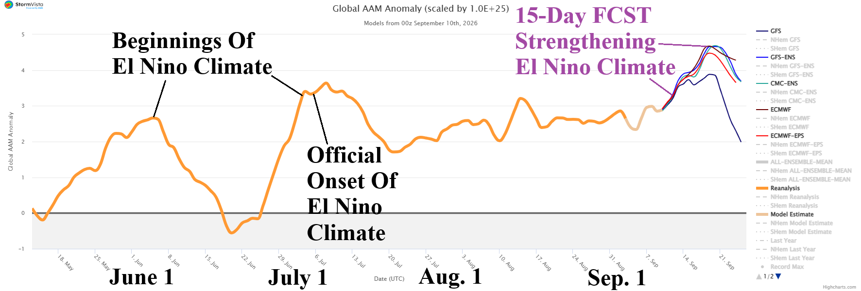
Discussion: An extremely intense positive phase of global atmospheric angular momentum (+GLAAM) developed in esrly July and the strongest intensity fo far is projected to emerge during middle September.
Medium-range 6-10 Day Forecast Valid September 15-19, 2026 (AIFS ENS and 24-hour change)
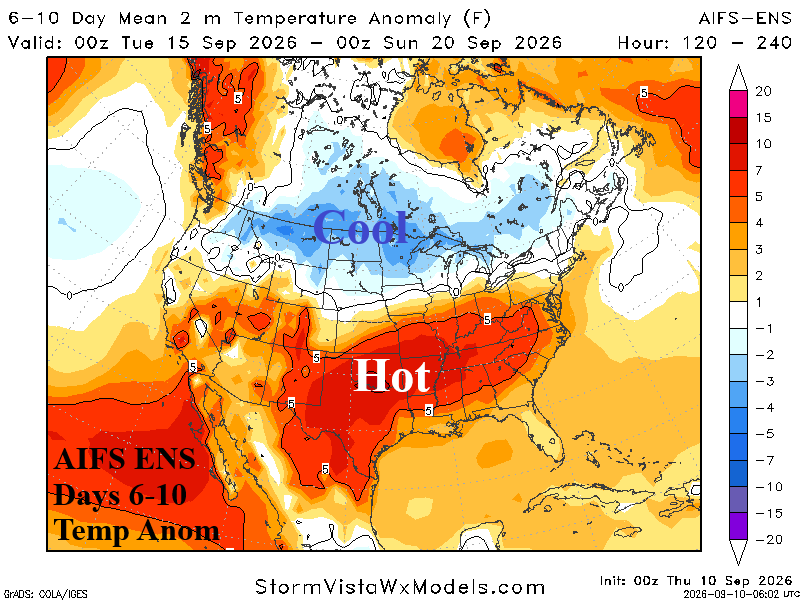
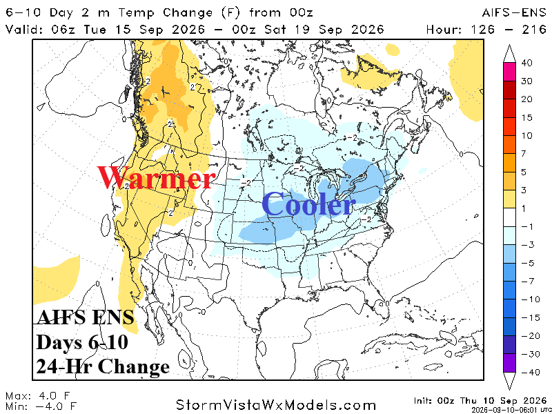
Discussion: Fast jet stream divides cooler North/warmer South regime. Cooler changes Ohio Valley due to wet weather.
Medium-range 11-15 Day Forecast Valid September 20-24, 2026 (AIFS ENS and 24-hour change)
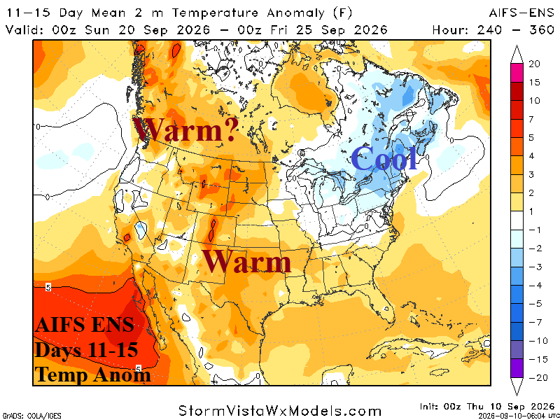
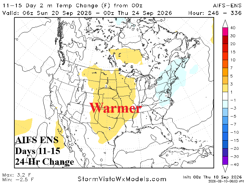
Discussion: Subtropics are configured to support tropical cyclone risk. Central U.S. shifts warmer. The cooler changes Northeast are overstated while Western Canada is too warm.
U.S. Medium-range Precipitation Forecast
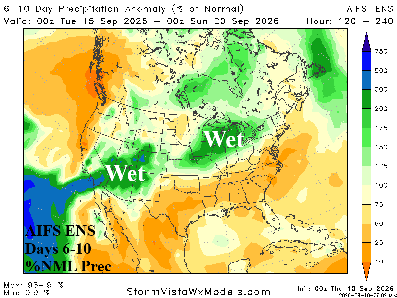
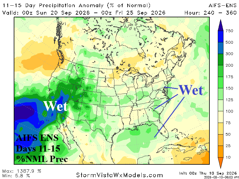
Discussion: Set-up for fast-moving severe storms Ohio Valley in the 6-10-day period. In the 11-15-day period near the coast tropical cyclone risk is cited.
Days 16-20 Extended range Temperature Forecast valid September 25-29, 2026
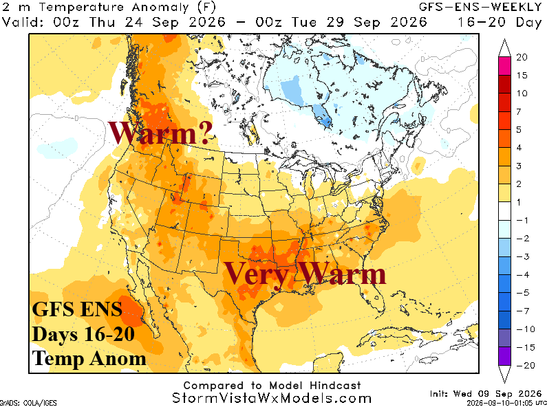
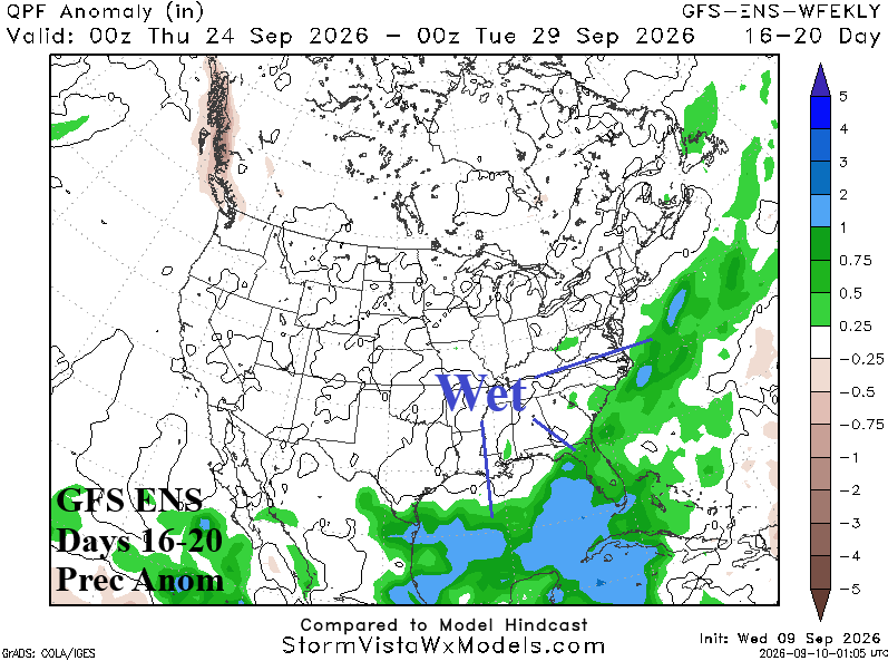
Discussion: Nationally, the pattern shifts warmer (again) during late September.