
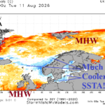
Cooling SSTA Surrounding Northern Europe Foreshadows Incoming Cool Trough
08/12/2026, 5:25 am EDT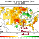
Extremes In U.S. Soil Moisture Anomalies/August Change
08/16/2026, 3:33 pm EDT
Climate Impact Company U.S. Medium Range Report
Issued: Friday August 14, 2026
Highlight: Mid-south U.S. heatwave maintained; Northwest steadily warmer.
Chart of the day: U.S. population weight CDD forecast.
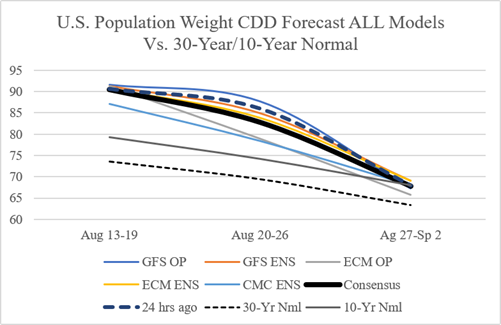
Discussion: The U.S. population weight CDD forecast indicates a slow decline in anomalous warmth from peak hot week ending August 12th to near normal for the week ending Sep. 2.
Medium-range 6-10 Day Forecast Valid August 19-23, 2026 (ECM ENS and 24-hour change)
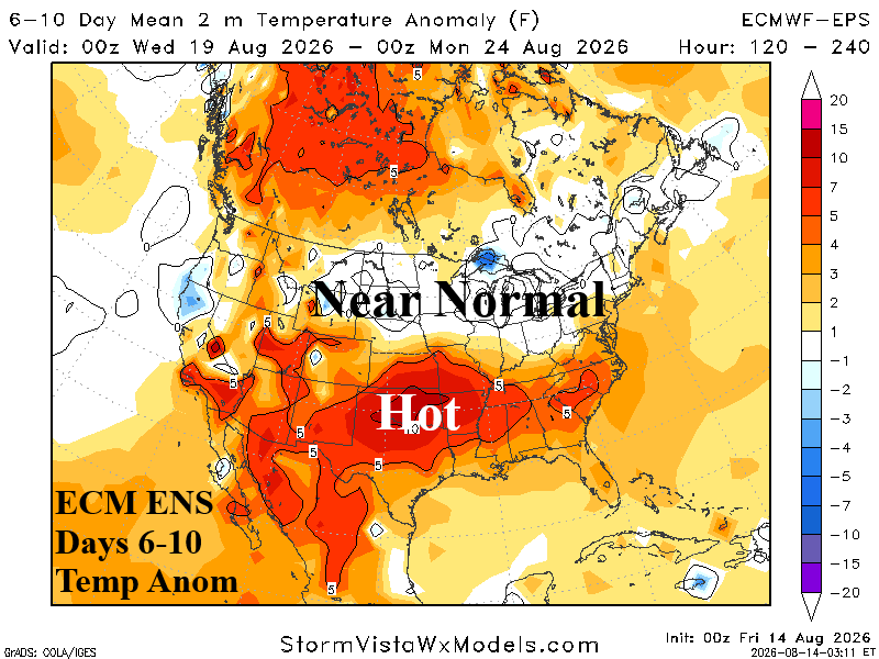
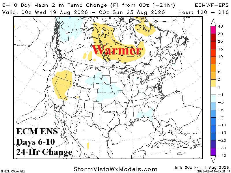
Discussion: Intense heat remains across the flash drought source region in the Mid-south U.S. The heat expands across the Southeast U.S. and into the Carolinas touching Southern Virginia.
Medium-range 11-15 Day Forecast Valid August 24-28, 2026 (ECM ENS and 24-hour change)
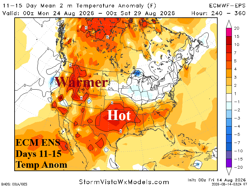
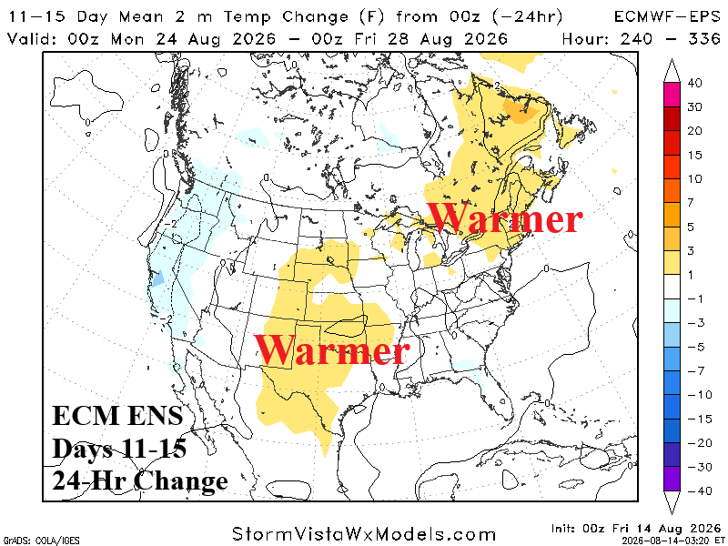
Discussion: The Mid-south hot air mass source region is slightly less intense. The Northwest shifts warmer from days 6-10 although slightly cooler since yesterday. The Midwest to Northeast remains temperate.
U.S. Medium-range Precipitation Forecast
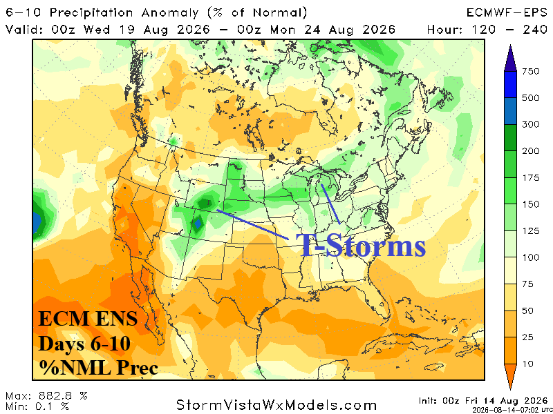
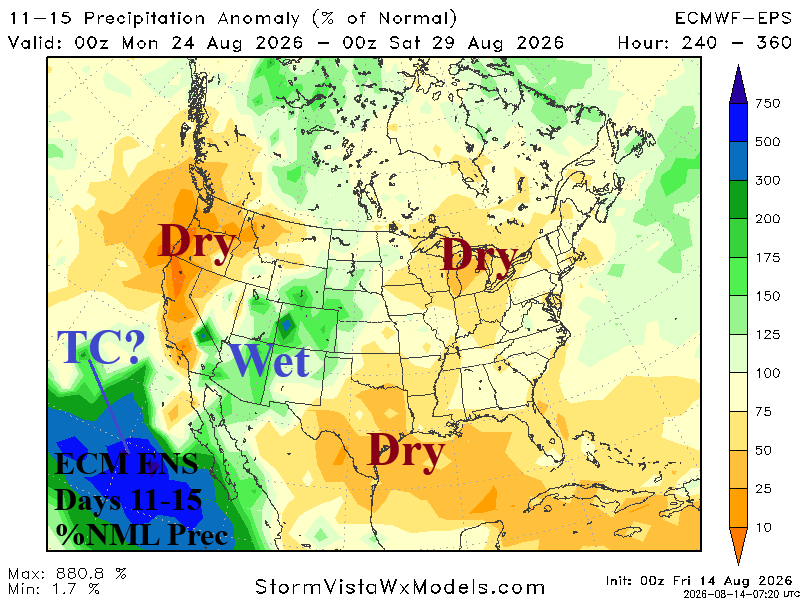
Discussion: Arc of thunderstorms stretch from Colorado to the Great Lakes in the 6-10-day period. Severe thunderstorms are likely. In the 11-15-day period, wet weather clings to the Interior West. There is a possibility of a northward displaced tropical cyclone to the southwest of California.
Days 16-20 Extended range Temperature Forecast valid August 29-September 2, 2026
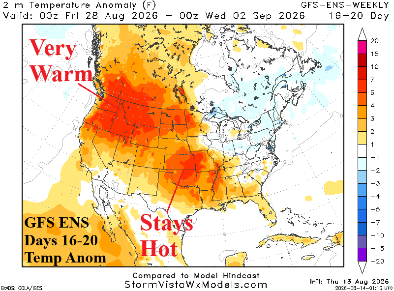
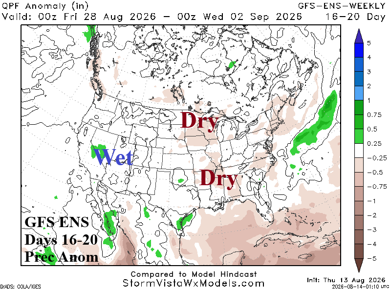
Discussion: GFS ENS indicates strengthening heat across the northwest quadrant of the U.S. while the Mid-south heatwave is maintained.