
Ongoing Northwest U.S. Air Quality Alert; Core of Dust/Smoke Shifts Southward in Washington This Week
08/10/2026, 4:23 am EDT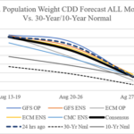
Still Hot U.S. Population Weight CDD Forecast
08/14/2026, 8:50 am EDT
Climate Impact Company Week 2-4 Outlook
Europe/Western Russia
Issued: Wednesday August 12, 2026
Highlight: Relief into late August followed by regenerating warmth and dryness during first half of September.
Charts of the day: Cooling waters surrounding Northern Europe foreshadow upper trough next week.
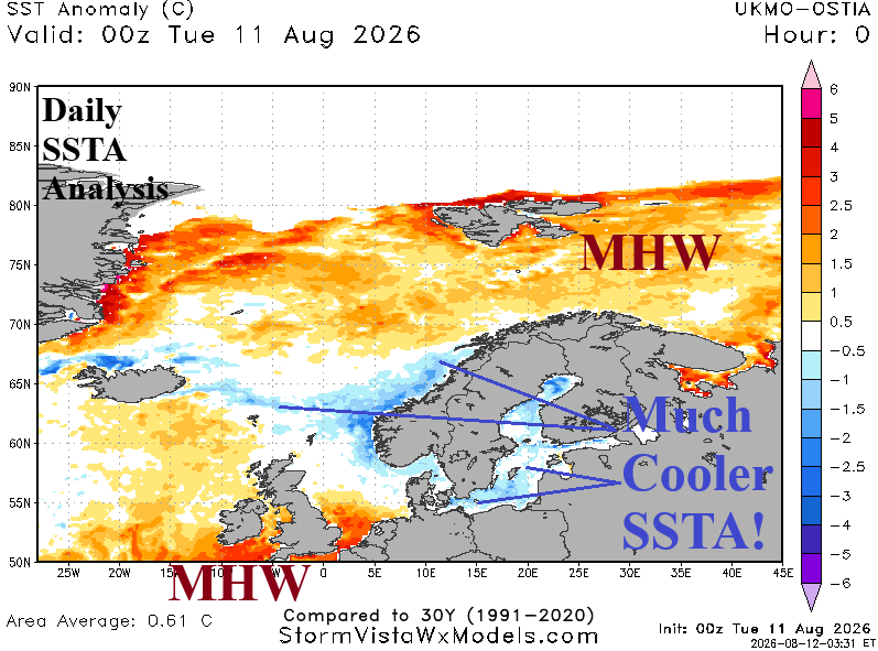
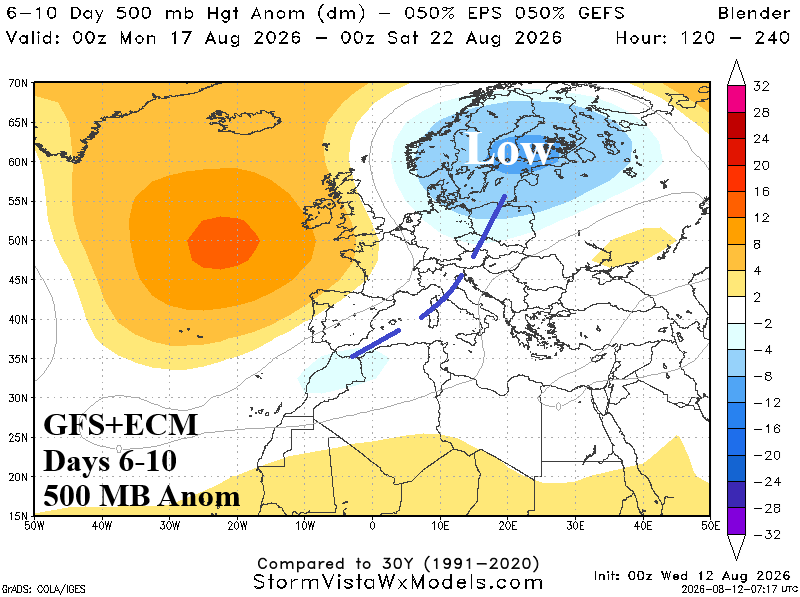
Discussion: Dramatic cooling of SSTA surrounding Northern Europe foreshadows an upper trough bringing a late August pattern change for Europe as an upper trough emerges next week and lasts into late month.
Week-2 Ahead (August 23-30, 2026): Heat has shifted eastward.
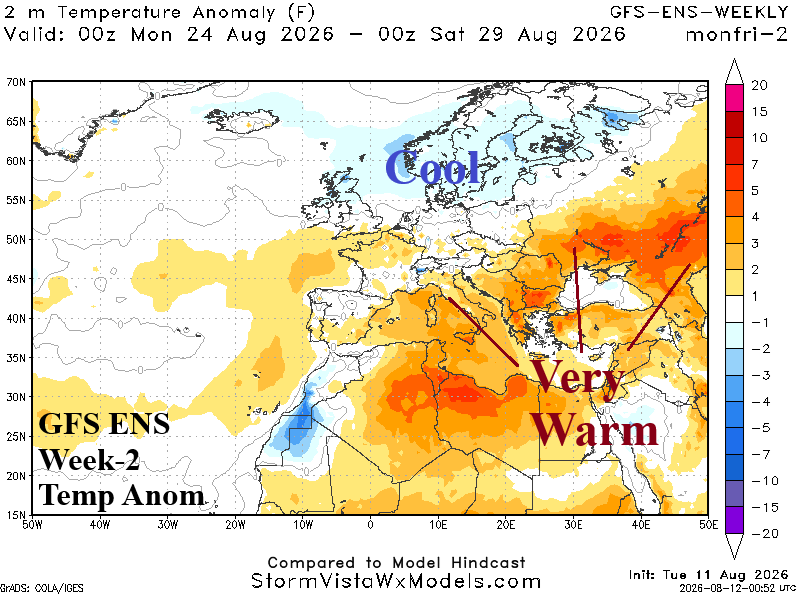
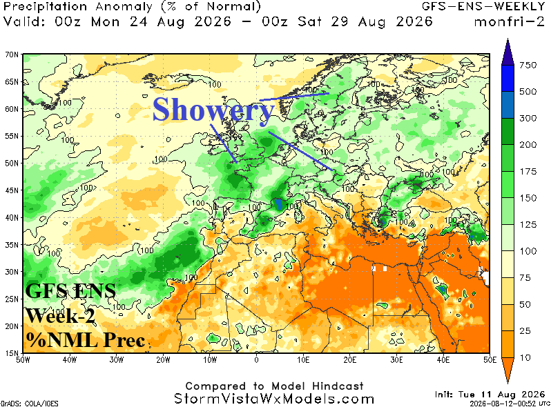
Discussion: Welcomed showery weather across Europe extends to Western Russia. The very warm to hot regime shifts to the Black Sea region and Southwest Russia.
Week-3 Ahead (August 30-September 6, 2026): Very warm/dry pattern regenerates.
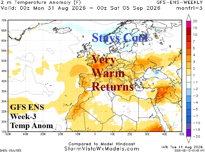
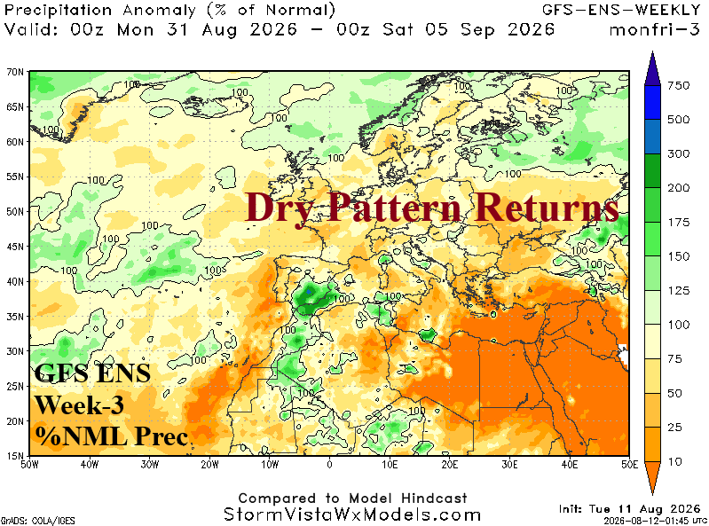
Discussion: High pressure extends across Europe and regenerates the very warm and dry pattern. Northern Europe will stay cool.
Week-4 Ahead (September 6-13, 2026): Dryness continues.
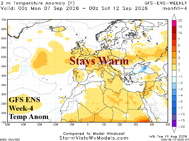
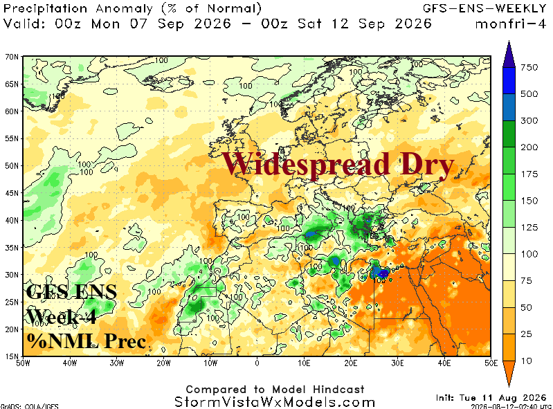
Discussion: The warm pattern lingers, centered on Southern Europe, and lacking extremes. Much of Europe is drier than normal.