08/05/2026, 4:57 am EDT

Hottest London/Paris CDD’s On Record

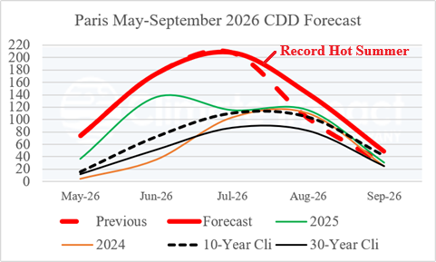
Paris/Orly observed a record 208 CDD during July 2026 eclipsing the previous high mark of 192 (2006). June also produced a record CDD and August 2026 is projected in the top five hottest although a hotter value is certainly possible.
08/04/2026, 4:44 am EDT

Some Forecast Models Insisting a Tropical Cyclone Strikes The U.S. West Coast in August

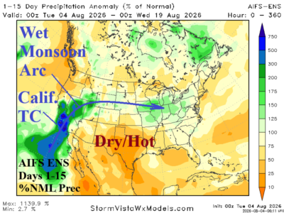
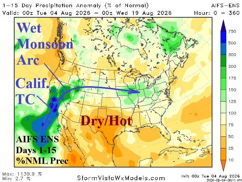
ECM ENS identifies the wet arc of moisture through the Southwest U.S. to the Colorado Rockies and into the Midwest U.S. in the latest 15-day forecast. Interestingly, AIFS ENS is farther to the west with the arc featuring remnants of a tropical cyclone striking California early in the 11-15-day period. The strong Southwest U.S. Monsoon is inspired by an intense marine heatwave off the coast of Southwest North America.
08/04/2026, 4:39 am EDT

Most of August Stays Dry and Hot South/West Europe

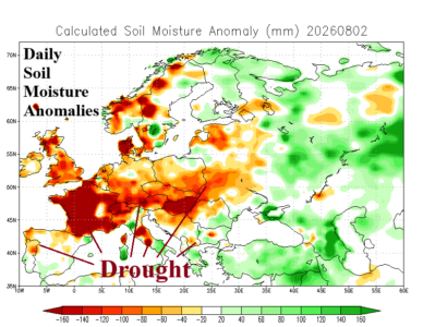
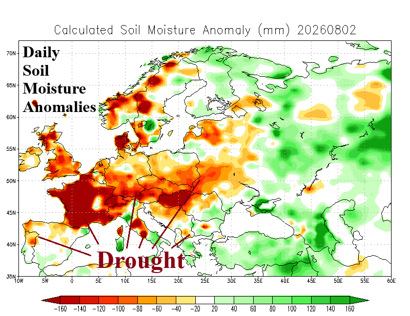
The super drought covering much of Europe continues to expand during early August. During the past week, very little rainfall was observed across the southern 2/3 of Europe including the immediate Black Sea region.
08/03/2026, 6:07 am EDT

The 2026 Seasonal Forecast Cut Lower – Again Due to Developing Super El Nino

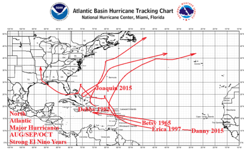
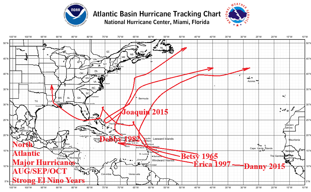
Climate Impact Company has revised the 2026 North Atlantic basin tropical cyclone season activity forecast LOWER to 9 tropical storms, 3 hurricanes, and 2 major hurricanes. The ACE index forecast is 50. The CIC forecast is similar with the Colorado State University downward revision. ECMWF rainfall probability forecasts indicate this year’s activity is heavily biased toward the subtropics with very limited deep tropics development. The outlook is revised lower due to the evolving super El Nino and the suppressing effects of El Nino on tropical cyclone development.
08/03/2026, 5:59 am EDT

U.S. Pattern Features Both Excessive Heat and Heavy Rainfall

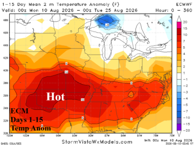
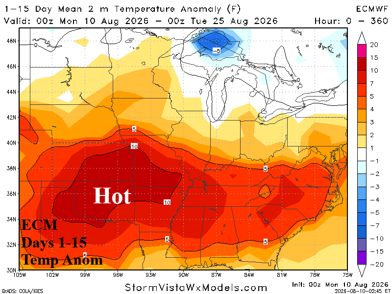
A wetter pattern is expected to develop during the next 15 days due to a Southwest U.S. wet monsoon moisture feed from 4-Corners arcing through the Missouri Valley and eastward. Graph Cast 15-day rainfall forecasts indicate heavy rain risk centered on the Missouri Valley and eastward throughout the Atlantic States. The 24-hour change highlights the wetter trend in the Midwest States while the Mid-south U.S. is drier and hot. Consequently, Midwest soil moisture increases while drought risk expands from Western Oklahoma eastward toward Arkansas and includes Northern Texas.
08/02/2026, 1:59 pm EDT

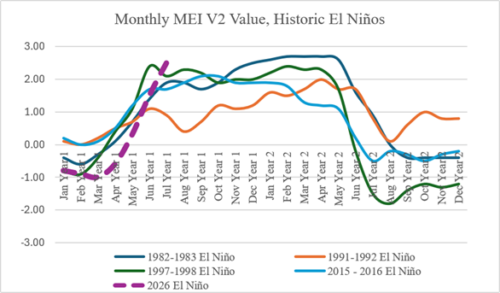
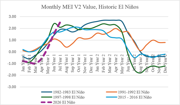
Strongest El Nino on Record Developing Now

The daily Nino12 SSTA is a buoyantly warm +4.04C which is frighteningly impressive! Weekly Nino12 SSTA exceeding +4.0C occurred only once, during the 1982-83 El Nino when +4.5 was observed in late June 1983 during the mature phase of that El Nino episode. Entering August, 2026-27 El Nino is in its infancy.