
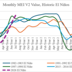
Strongest El Nino on Record Likely by Q4/2026, Ending Time Projected for Middle of 2027
08/06/2026, 8:50 am EDT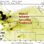
Ongoing Northwest U.S. Air Quality Alert; Core of Dust/Smoke Shifts Southward in Washington This Week
08/10/2026, 4:23 am EDT
Climate Impact Company U.S. Medium Range Report
Issued: Friday August 7, 2026
Highlight: Cooler changes develop Northeast; Ohio Valley to Mid-Atlantic severe storms.
Charts of the day: +EAWR causes East U.S. (cooler) pattern change.
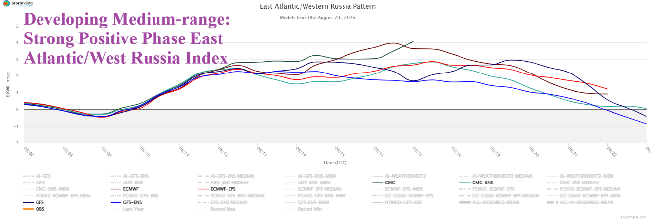
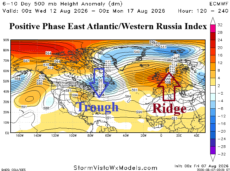
Discussion: Strong positive phase of the Eastern Atlantic/Western Russia index supports an evolving trough in the East U.S. and lingering ridge in Europe.
Medium-range 6-10 Day Forecast Valid August 11-15, 2026 (ECM ENS and 24-hour change)
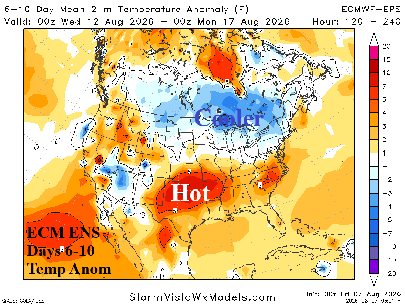
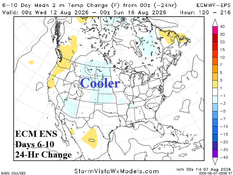
Discussion: ECM ENS is today’s forecast model of choice. Indicated is an amplifying trough over Southern Quebec into New England. Cool weather in Ontario/Quebec/Great Lakes region shifts into the Northeast Corridor late in the period. Hot weather consolidates over the Southern Great Plains and Southeast U.S.
Medium-range 11-15 Day Forecast Valid August 16-20, 2026 (ECM ENS and 24-hour change)
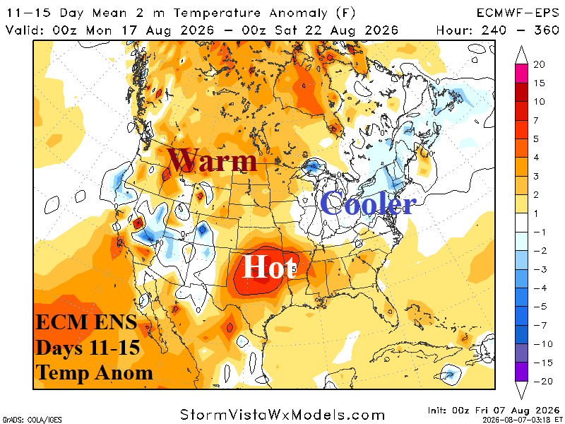
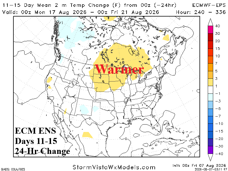
Discussion: Upper trough broadens in the East while the subtropical high-pressure system remains over Eastern Texas with an attendant ridge amplifying northwestward into Western Canada. Hot weather remains in the Mid-south U.S. while the East is temperate (except hot Southeast). Western Canada is rewarming,
U.S. Medium-range Precipitation Forecast
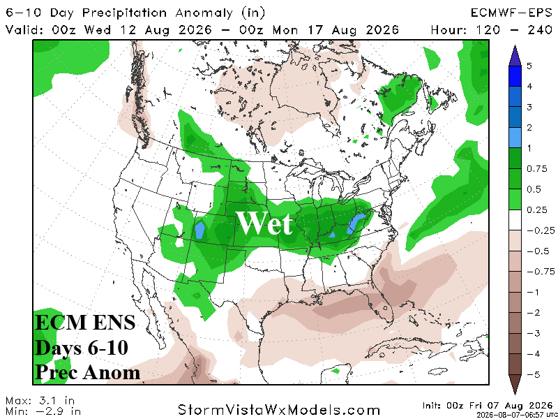
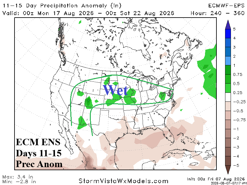
Discussion: Arc of Southwest U.S. wet monsoon moisture into the Central Great Plains and eastward toward the Mid-Atlantic States is stronger in the 6-10-day period. Midwest to Mid-Atlantic severe weather pattern is indicated. The wet monsoon arc is less intense in the 11-15-day period.
Days 16-20 Extended range Temperature Forecast valid August 21-25, 2026
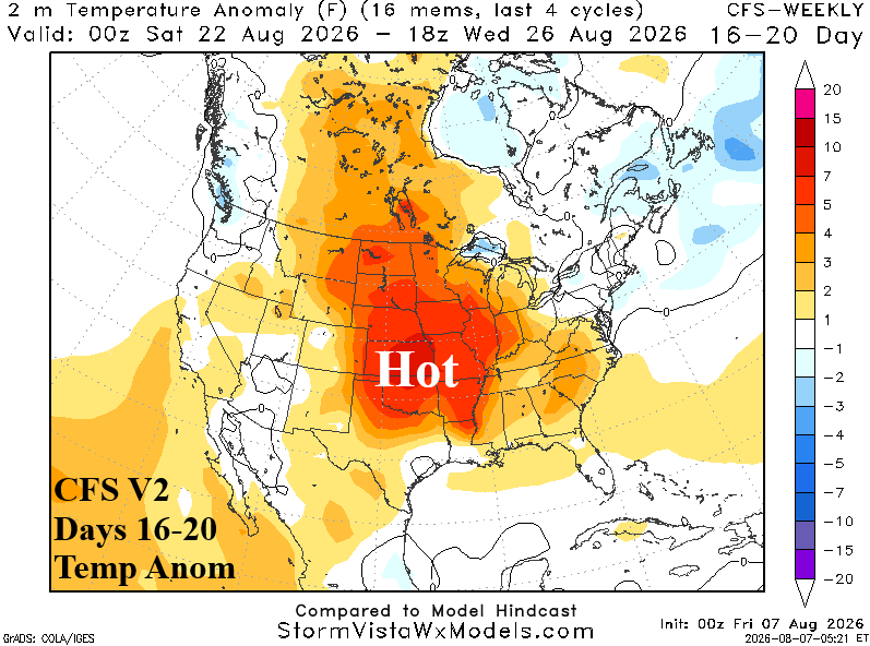
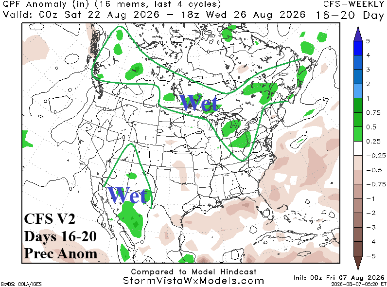
Discussion: Expansion of hot weather is favored in the Central U.S. during the 16-20-day period while the Northeast stays temperate. Hot weather can sneak into Virginia/North Carolina. The West Coast is near normal, a low confidence forecast.