
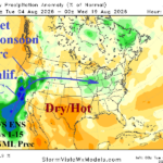
Some Forecast Models Insisting a Tropical Cyclone Strikes The U.S. West Coast in August
08/04/2026, 4:44 am EDT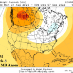
Tracking The Shifting North America High Pressure Late August/Early September
08/13/2026, 10:25 am EDT
Climate Impact Company Research Report
Issued: Tuesday, August 11, 2026
The 2026 North Atlantic basin tropical cyclone season concern: Storms that El Nino shear fails to turn northward and the warmest North Atlantic basin on record for a strong El Nino.
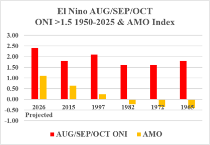
Fig. 1: Strong El Nino years as defined by operational Nino index (ONI) >1.5 during AUG/SEP/OCT 1950-2026 and the Atlantic multi-decadal oscillation (AMO) index.
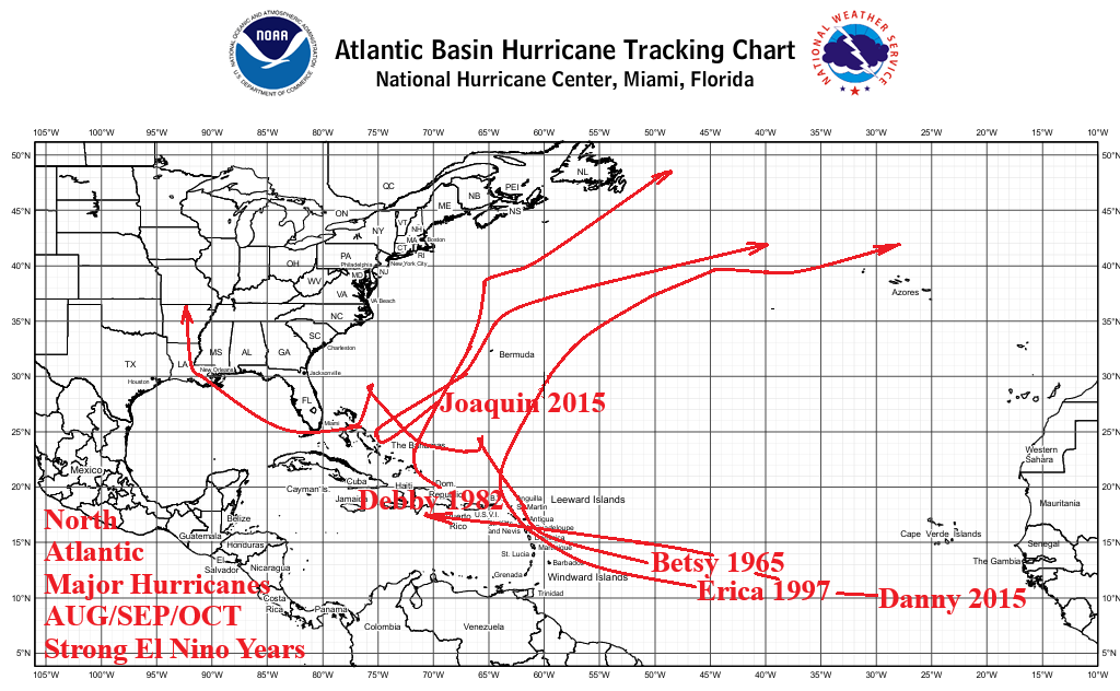
Fig. 2: Tropical cyclone tracks of systems reaching major hurricane strength during strong El Nino years (AUG/SEP/OCT) 1950-2025.
Discussion: El Nino episodes are associated with increased westerly shear in the upper troposphere across the North Atlantic basin tropical latitudes inhibiting tropical cyclone formation. Currently, a strong El Nino is present in the equatorial East Pacific region and forecast to become a record-breaking super El Nino later in 2026. The warmest AUG/SEP/OCT operational Nino index (ONI) in the 1950-2026 climatology is forecast. Making the 2026 El Nino unique is the accompanying strong warming of the North Atlantic as implied by the projected Atlantic multi-decadal oscillation (+AMO). During the 2026 North Atlantic basin tropical cyclone season El Nino-induced westerly shear aloft will battle the potential energy represented by a warmer than normal North Atlantic basin determining the season’s activity and intensity level.
Have major hurricanes occurred during past strong El Nino AUG/SEP/OCT timeframes? ONI >1.5 during AUG/SEP/OCT were observed in 2015, 1997, 1982, 1972, and 1965 (Fig. 1). Note the gradual increase in AMO for each strong El Nino year. As expected, strong El Nino years are not good producers of major hurricanes in the North Atlantic ranging from two in 2015 to zero in 1972 and one in 1997, 1982, and 1965 (Fig. 2).
In 2015, two major hurricanes were observed. Danny briefly was a category-3 major hurricane in the central North Atlantic tropics just after mid-August. Joaquin reached category-4 major hurricane status drifting north-northeast to the east of the Bahamas eventually striking Bermuda during early October.
In 1997, Erika reached category-3 major hurricane status while turning north-northeastward to the northeast of Puerto Rico during early September.
In 1982, Debby reached category-4 major hurricane status while traveling northeastward well off the U.S. East Coast in mid-September.
No major hurricanes were observed in 1972 while 1965 yielded one major hurricane (category-4 major hurricane Betsy during early September) which had damaging impacts on the Bahamas, Southern Florida, and Louisiana.
Summary: Historically, major hurricanes observed during AUG/SEP/OCT of strong El Nino years are minimal. Only 1 of 5 analog years produced 2 major hurricanes (2015) possibly related to a warmer North Atlantic basin. In 2026, the North Atlantic basin is projected twice as warm as 2015. Notable storms were Joaquin (2015) and Betsy (1965) for having southwesterly tracks into warmer ocean water to cause significant strengthening as westerly El Nino shear failed to turn these storms northward.