
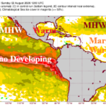
The 2026 Seasonal Forecast Cut Lower – Again Due to Developing Super El Nino
08/03/2026, 6:07 am EDT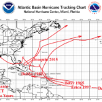
Climate Research: Major Hurricanes During Strong El Nino Years
08/11/2026, 5:42 am EDT
Climate Impact Company Week 2-4 Outlook
North America
Issued: Tuesday August 4, 2026
Highlight: Tropics try to get involved with West U.S. weather pattern; Mid-south U.S. drought development.
Charts of the day: The Wet Southwest U.S. Monsoon arc through the Midwest.
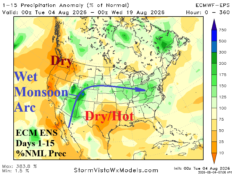
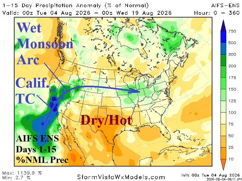
Discussion: ECM ENS identifies the wet arc of moisture through the Southwest U.S. to the Colorado Rockies and into the Midwest U.S. in the latest 15-day forecast. Interestingly, AIFS ENS is farther to the west with the arc featuring remnants of a tropical cyclone striking California early in the 11-15-day period. The strong Southwest U.S. Monsoon is inspired by an intense marine heatwave off the coast of Southwest North America.
Week-2 Ahead (August 9-16, 2026): Wet arc Southwest to Midwest.
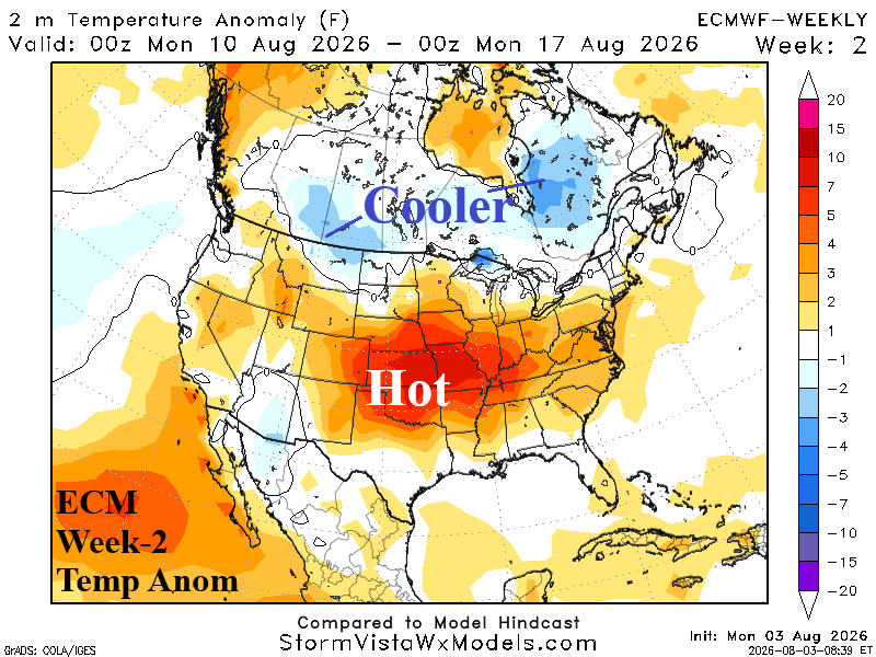
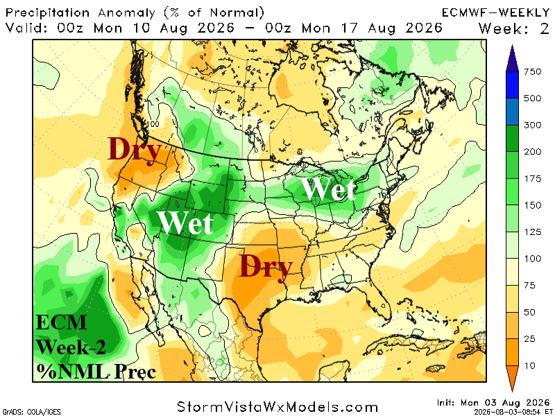
Discussion: The ECM identifies the wet arc from the Southwest U.S. to the Midwest States with heat and dryness to the south, centered on the Mid-south U.S. The Northwest cools but remains dry.
Week-3 Ahead (August 16-23): Needed rainfall shifts into Northwest U.S.
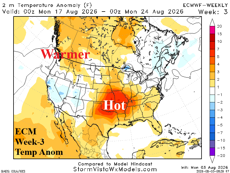
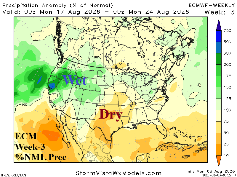
Discussion: The wet Southwest U.S. pattern shifts north to the Northwest States. Southwest Canada stays mostly dry and warmer. Hot and dry weather remains centered on the Mid-South U.S.
Week-4 Ahead (August 23-30): Tropics involved with West U.S. weather.
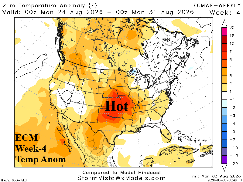
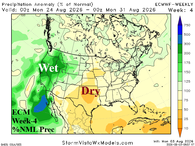
Discussion: Forecast models remain interested in threatening the U.S. West Coast with a northward surge of tropical activity that weakens but unloads plenty of rain! East of the wet arc, the Mid-South U.S. remains targeted by ECM for drought development.