
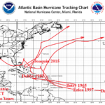
Climate Research: Major Hurricanes During Strong El Nino Years
08/11/2026, 5:42 am EDT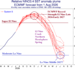
An Abrupt End to El Nino Early 2027; La Nina Possible by Mid-year
08/14/2026, 5:42 am EDT
Climate Impact Company Week 2-4 Outlook
North America
Issued: Thursday August 13, 2026
Highlight: Mid-south severe heat slowly eases; New very warm hot/dry area is Southwest Canada.
Charts of the day: Where does the high pressure go?
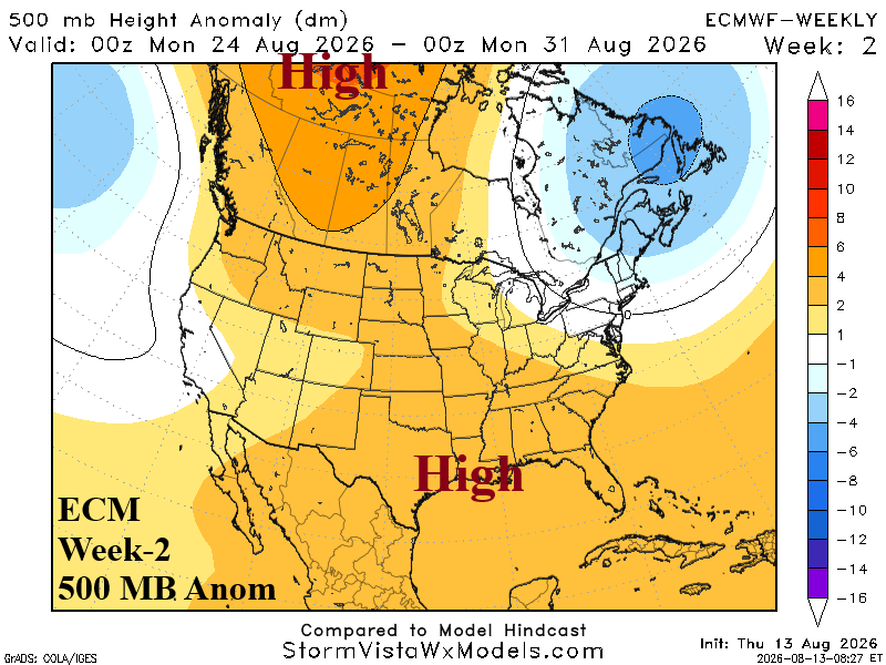
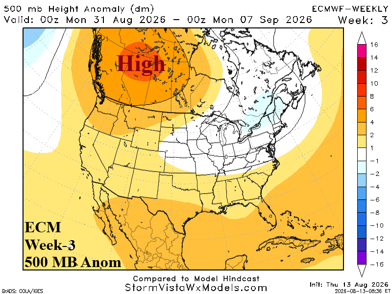
Discussion: Titanic high pressure triggers a severe heatwave centered on the Mid-south to Southeast U.S. through next week. The last week of August finds the high pressure broadening but losing intensity across the southeast quadrant of the U.S. The upper trough over Southeast Canada strengthens and in response, upstream ridge in Western Canada amplifies. The Western Canada ridge becomes a dominating upper feature in early September.
Week-2 Ahead (August 23-30, 2026): Ongoing monster heatwave Mid-south U.S.; Warmer Western Canada.
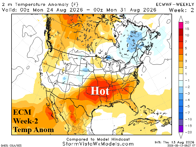
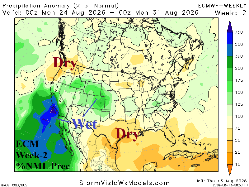
Discussion: Mid-south heat continues accompanied by flash drought Oklahoma and Arkansas to the northwest Gulf Coast. The West U.S. wet monsoon is active. Western Canada warmth is increasing.
Week-3 Ahead (August 30-September 6, 2026): Western Canada heat/dryness; Gulf States stay hot and dry.
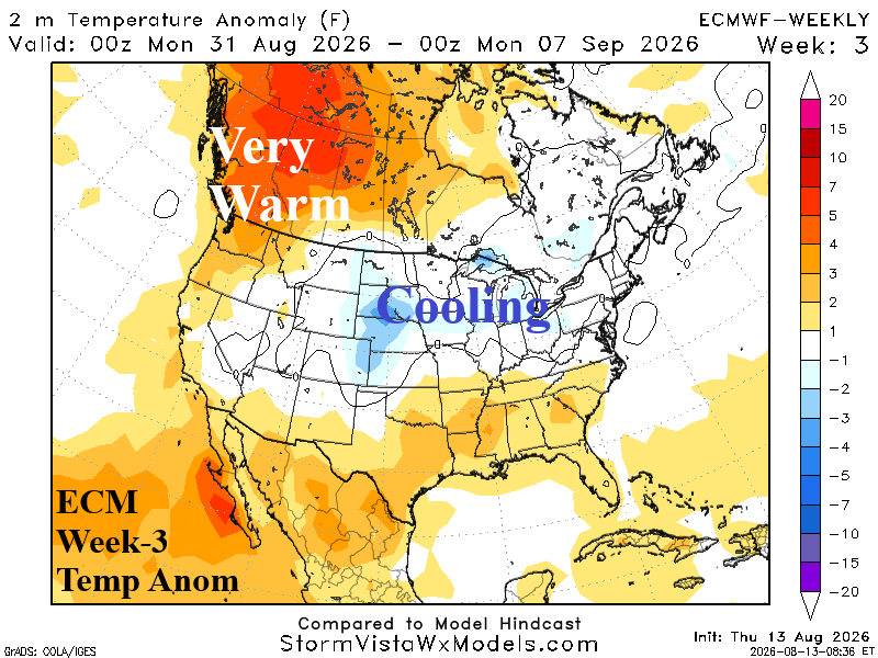
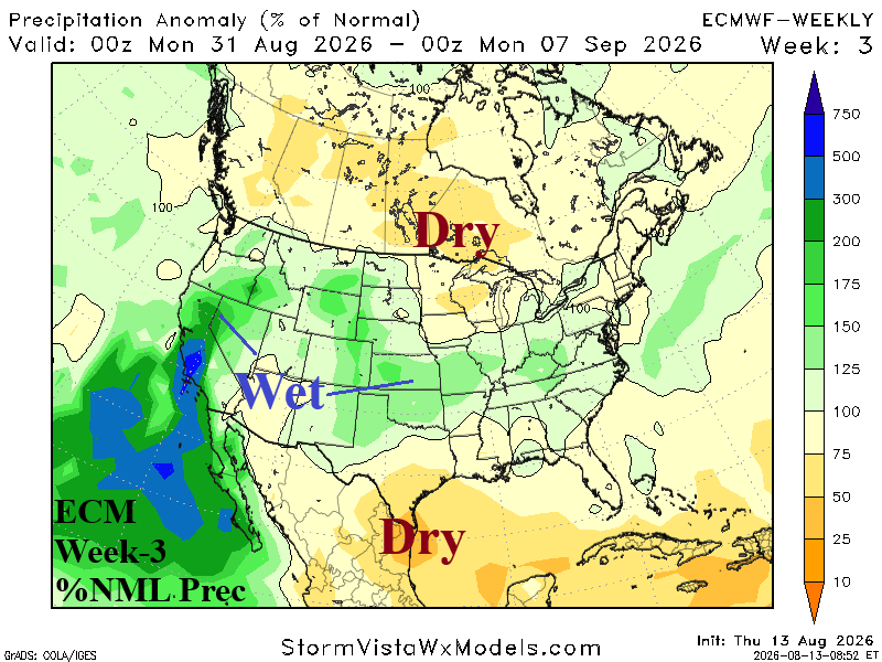
Discussion: Western Canada warmth and dryness will amplify fire concern; Some thundershower activity reaches the Northwest States. The Mid-south heatwave is easing although the Gulf States stay hot and dry. Expansive thunderstorm activity brings drought relief to the Great Plains.
Week-4 Ahead (September 6-13, 2026): Thundershowers reach into drought-parched Texas/Oklahoma.
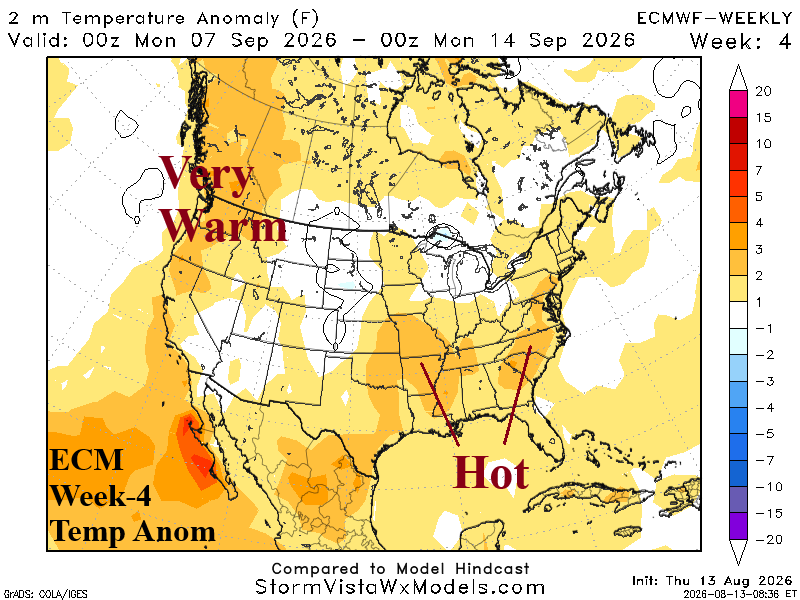
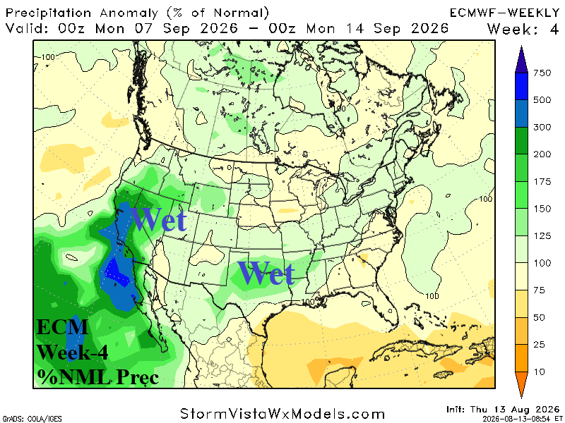
Discussion: Wet weather reaches Texas to Arkansas in the form of gully-washer thunderstorms. The East Coast shifts warmer as mid-September approaches. Northwest U.S. warmth continues while wet monsoon moisture fuels California to Wyoming thundershowers.