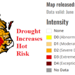
Mid-Atlantic Drought is a Worry! Influence on Excessive Heat Risk for Mid-Summer!
06/25/2026, 1:55 pm EDT
Hottest Week in U.S. of Past 10 Years: July 3-9, 2026
06/28/2026, 10:15 am EDT

Climate Impact Company U.S. Medium Range Report
Issued: Friday June 26, 2026
Highlight: Intense heat East starts July. Heat may shift westward in the extended range.
Charts of the day: GLAAM goes strong El Nino; Highest effects on GWO in phase 5, 6, and 7.
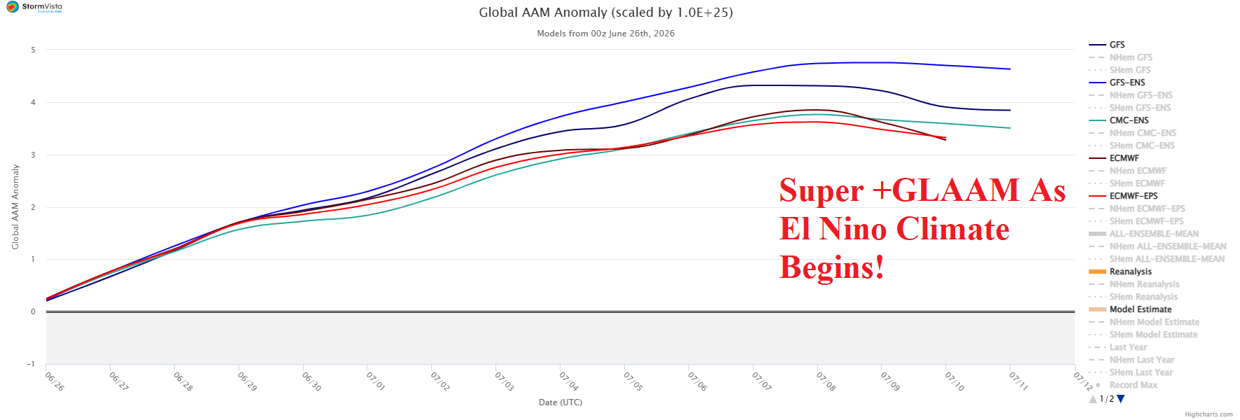
Discussion: Increased westerly wind in the middle latitudes is characteristic of an El Nino climate, particularly during the winter season. Increased westerlies in the middle latitude is well represented by positive phase of global atmospheric angular momentum (GLAAM) index. The 15-day GLAAM forecast indicates evolution of a dramatic positive phase. An El Nino climate rapidly develops during July. Initially, the +GLAAM effect is in phase_5, phase_6, and phase_7. Impacts on northern hemisphere weather are abundant. Expect an increase in Pacific tropical cyclones and marked increase in El Nino intensity during phase_5. In phase_6, westerly wind bursts can generate in the equatorial Pacific continuing El Nino strengthening. This phenomenon is often coinciding with strong Madden Julian oscillation and coupled with El Nino turns the East Pacific and Mexico wet (tropically active and Indonesia/Southeast Asia/India dry). In phase_7, negative North Atlantic oscillation and potentially cooler climate in the East U.S. as suggested by AI models.

Medium-range 6-10 Day Forecast Valid July 1-5, 2026 (ECM ENS and 24-hour change)
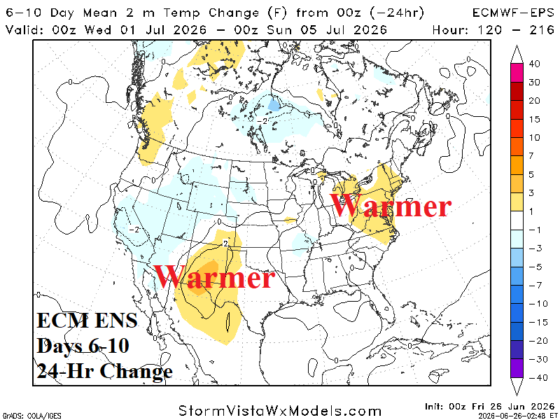
Discussion: Intense heat whacks the Midwest to Mid-Atlantic U.S. and includes ERCOT and SERC. The northern Mid-Atlantic forecast shifts hotter.
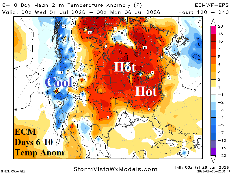
Medium-range 11-15 Day Forecast Valid July 6-10, 2026 (ECM ENS and 24-hour change)
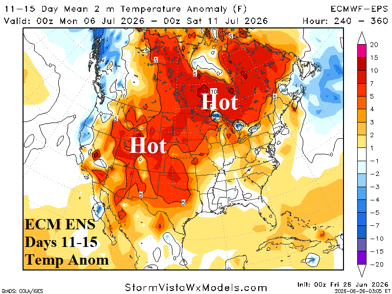
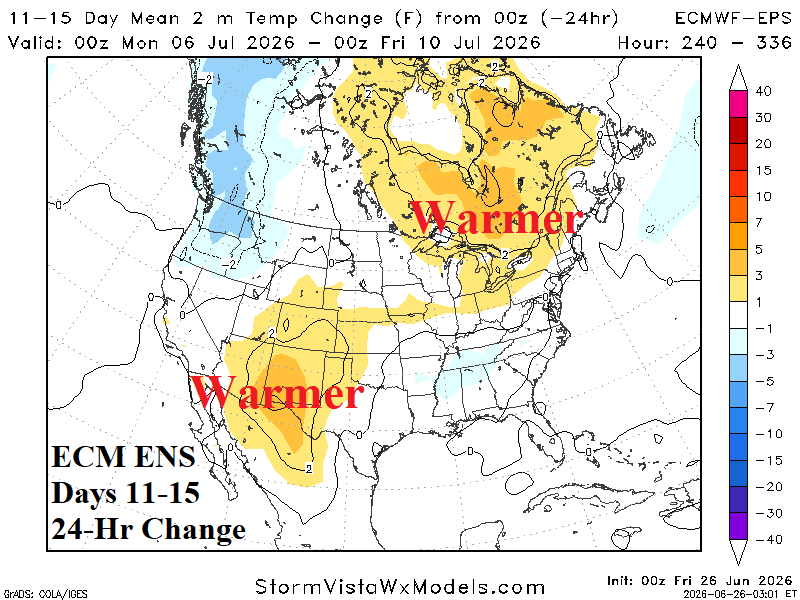
Discussion: Hot weather affects most of the U.S. except the Southeast thanks to a wetter pattern and the Northeast Coast due to backdoor cold fronts off the ocean. The Southwest continues to trend hotter due to a delayed wet monsoon. *Learning point: El Nino can cause a delay in the Southwest wet monsoon.
U.S. Medium-range Precipitation Forecast

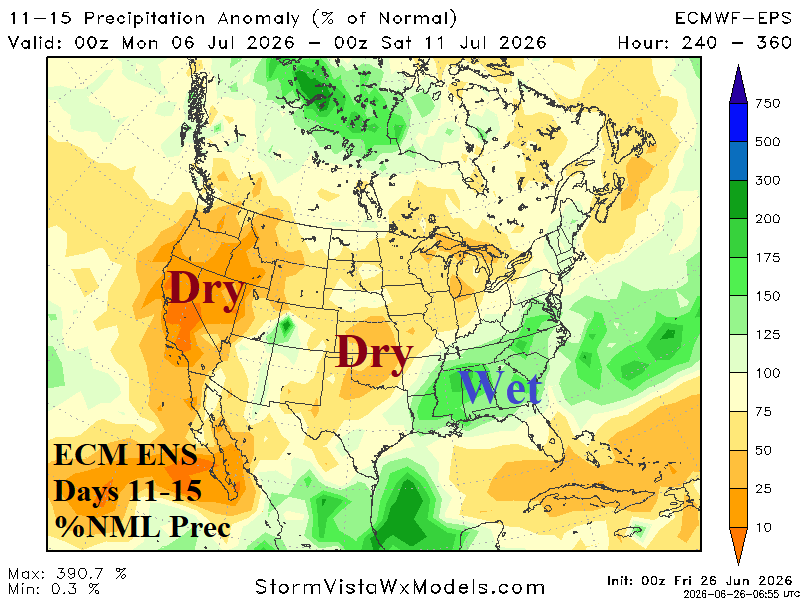
Discussion: The West shifts drier, the Southwest wet monsoon is delayed, and 6-10-day Midwest U.S. rains abate after d-10 when the Southeast shifts wetter.
Days 16-20 Extended range Temperature Forecast valid July 11-15, 2026
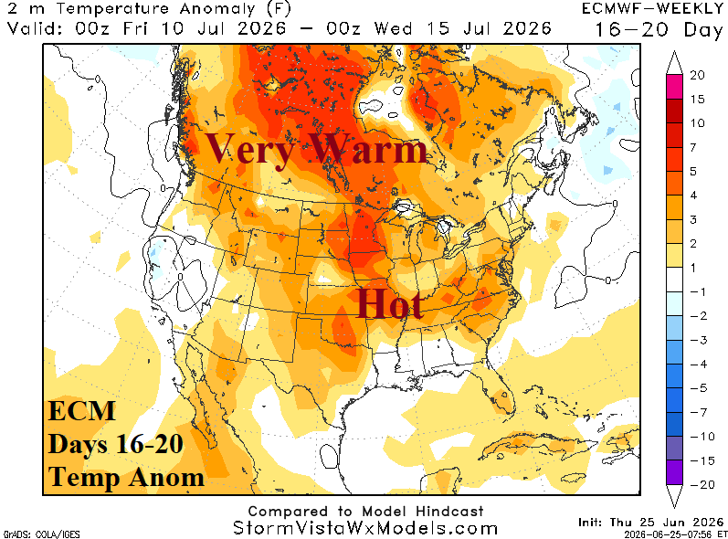
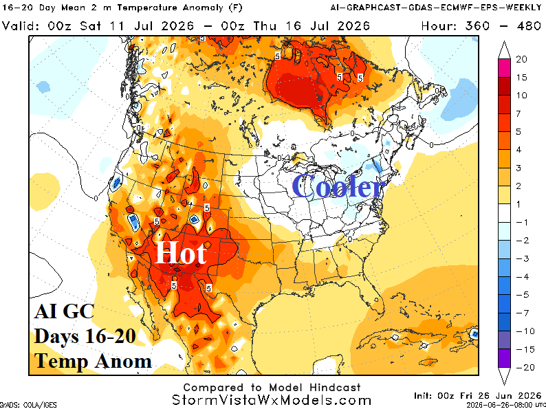
Discussion: Aerial coverage of D0-D4 dry-to-drought conditions in the U.S. has lowered to 69% as of yesterday. The change is about 10% lower than 6 weeks ago. However, near 70% is still quite high as mid-meteorological summer approaches and is a hot bias to U.S. climate as implied by the ECM 16-20-day forecast. Synoptic forecasts, lead by a shift into phase_7 of the global wind oscillation (GWO) suggest evolution of a negative North Atlantic oscillation which would cool the Northeast U.S. and AI models are bullish on this solution. ECM is alone with the hot pattern and the cooler AI solutions are favored by markets. But! A classic opportunity for sneaky hot, especially in the drought-ridden Mid-Atlantic region.