09/09/2025, 4:57 am EDT

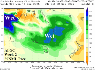
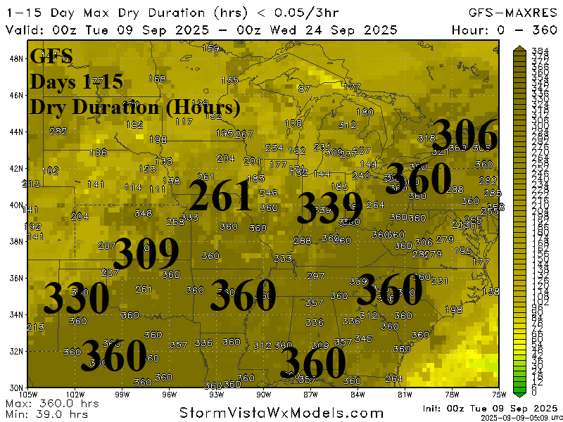
Late calendar summer dryness is excessive across the East/South U.S. as GFS indicates 360 consecutive hours of no rain from Central Texas to Western Pennsylvania and into the Southeast U.S. Consequently, drought development during late meteorological summer in the Ohio Valley is likely to expand southward.

