12/10/2025, 11:56 am EST
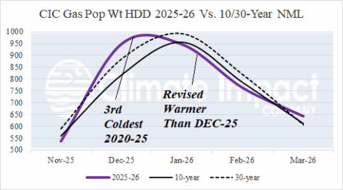
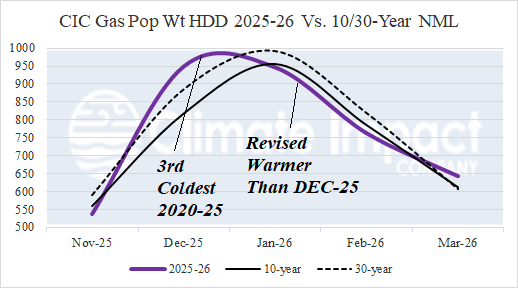
The DEC-25 U.S. gas population weight HDD is revised colder to 949, the coldest DEC since 2010 and 3rd coldest of this century. Previously, cold JAN-26 forecasts reversed warmer with mid-NOV updates and then colder with the early DEC projection. Operational models are shifting much warmer for JAN-26 therefore a warmer revision is necessary. The JAN-26 HDD forecast warms from 981 to 947 which ranks 13th coldest of 2020-25.
