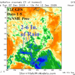
Deluge of Rain for Central/East-central South America
12/07/2025, 2:46 pm EST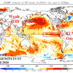
La Nina Shifts to Neutral Phase Early 2026; El Nino in 2026 is Likely
12/09/2025, 4:55 am EST
Climate Impact Company U.S. Medium Range Report
Issued: Monday December 8, 2025
Highlight: Cold retreat, operational/AI models warm the extended range.
Charts of the day: HDD forecasts, particularly AI, shift warmer into 2026.
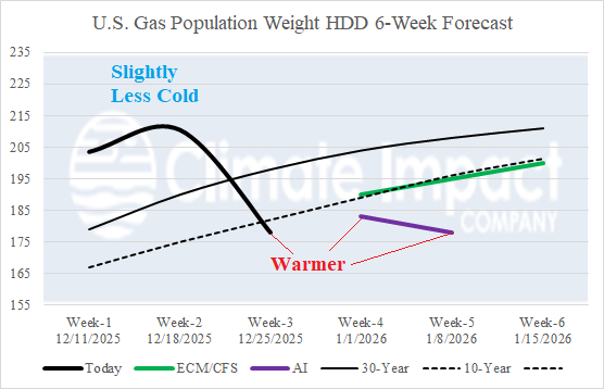
Discussion: Theme of the Monday morning extended range U.S. temperature anomaly forecast is warmer. The most dramatic warmer change is the consensus of operational models forecast for the week ending Christmas Day and AI estimates for early January.
Medium-range 6-10 Day Forecast Valid December 13-17, 2025 (ECM ENS left and 24-hour change right)
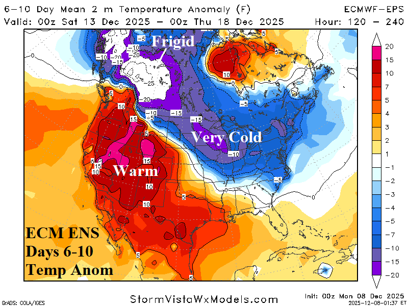
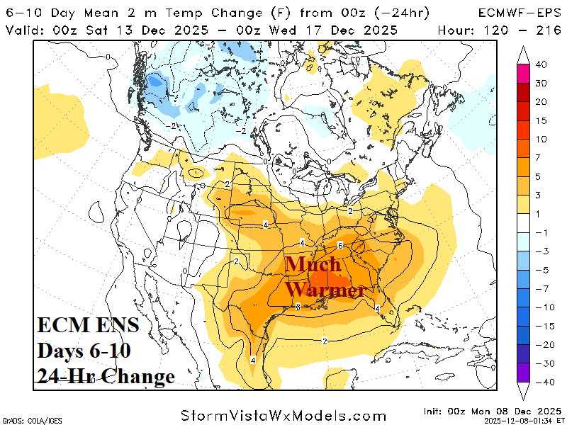
Discussion: Western Canada is frigid with piling snows most potent across the Western Canadian Prairies. The cold extends eastward reaching the Atlantic Seaboard moderating with distance from the source region. South of the cold arc, the U.S. is very warm.
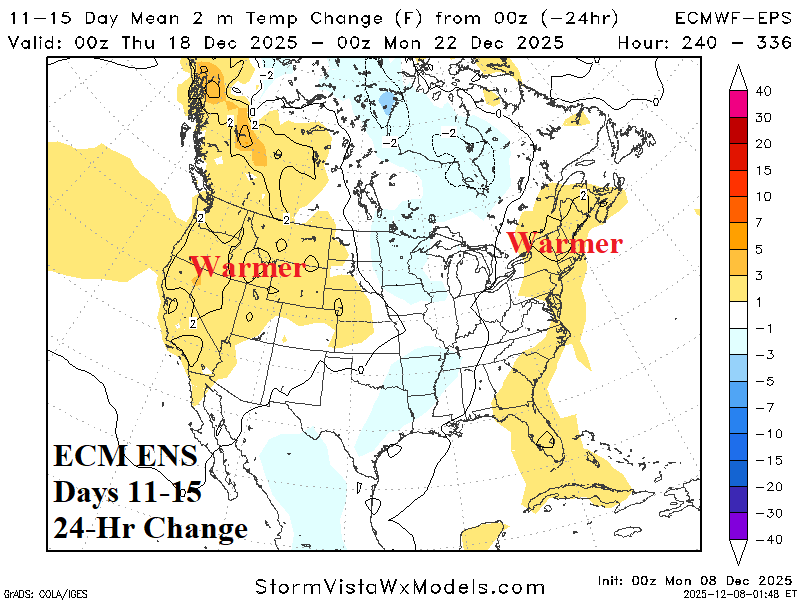
Medium-range 11-15 Day Forecast Valid December 18-22, 2025 (ECM ENS left and 24-hour change right)
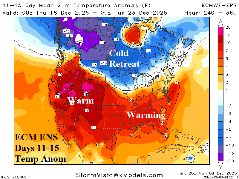
Discussion: The storm track shifts to the Northwest U.S. featuring heavy rain and mountain snow and causes increased milder Pacific influence across the U.S. The bold cold retreats and above normal snow cover across the northern half of the U.S> is likely to erode.
U.S. Medium-range Precipitation Forecast
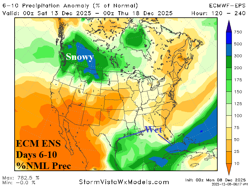
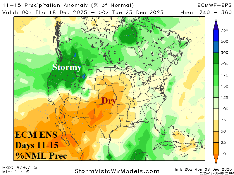
Discussion: ECM ENS continues to project heavy snows enhancing the Southwest Canada cold in the 6-10-day period. In the 11-15-day period, the storm track shifts south to the Northwest U.S. The Southwest and Central U.S. are dry during the period. The East Coast is dry during the 6-10-day period with some marginal wet weather to follow days 11-15.
Days 16-20 Extended range Temperature Forecast valid December 23-27, 2025
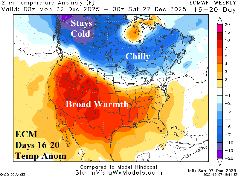
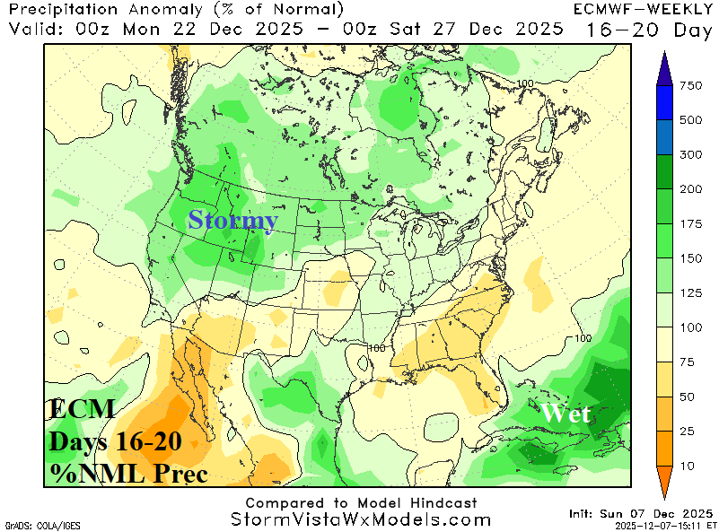
Discussion: The cold retreats to Canada in the extended range while most of the U.S. shifts warmer, especially in the Mid-south/Southeast States.