01/20/2026, 5:14 am EST

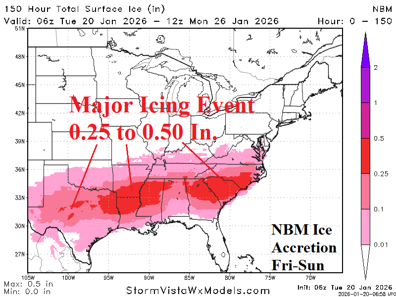
A major icing event is forecast for parts of north-central Texas, northern Louisiana/southern Arkansas and eastward across northern Mississippi to South Carolina for late this week and weekend. Dallas and Atlanta are in the major icing threat zone.