04/29/2025, 4:23 pm EDT
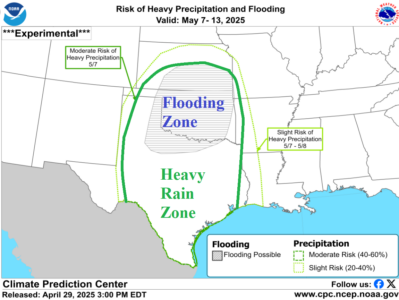
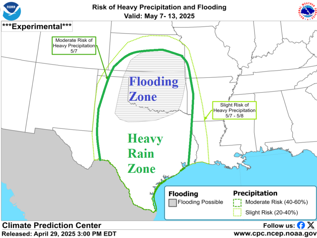
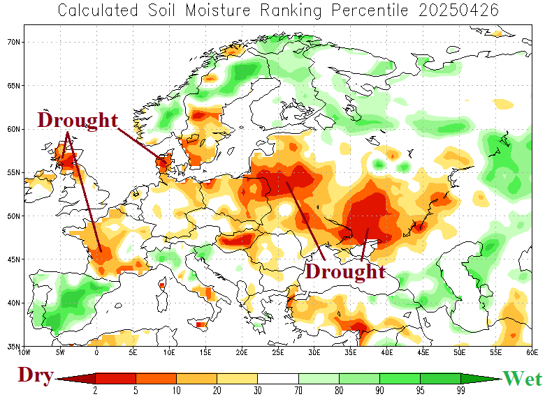
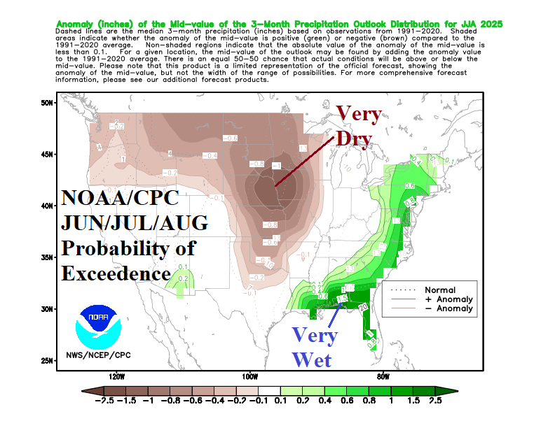
Ongoing flooding in Oklahoma to Texas will intensify as another 7-10 inches of rain is possible over the next 1-2 days. River flooding, travel hazards, power outages, and crop damage increase. A second event is likely next week! The hardest hit area for flooding is Oklahoma likely to exceed the intensity of the Ohio/Mississippi River flooding event of early April.
