12/16/2025, 5:46 am EST
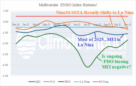
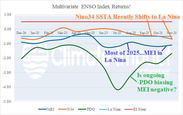
An important climate diagnostic, missing since last April, has returned this month: Multivariate ENSO index (MEI). The MEI identifies the response of the atmosphere (30S to 30N) to the Pacific equatorial sea surface temperature anomaly (SSTA) regime. Note that the conventional climate diagnostic to identify ENSO phase, the Nino34 SSTA, only recently shifted to La Nina. A La Nina regime is indicated by MEI all but APR and MAY of the past 12 months.