02/20/2026, 5:24 am EST
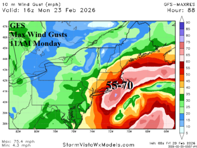
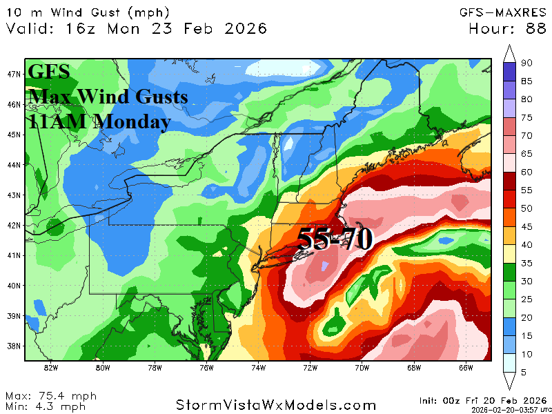
Given the low-pressure forecasts, high wind is a major issue with the SUN/MON Northeast Coastal storm. Utilizing the aggressive GFS forecast, wind gusts in the 45-65 mph range should be expected Sunday evening on the Mid-Atlantic Coast extending inland to I-95. By late Monday morning, wind gusts approach hurricane force across southeastern Massachusetts. High wind and heavy snow combination could produce blizzard conditions.
