09/15/2025, 11:45 am EDT
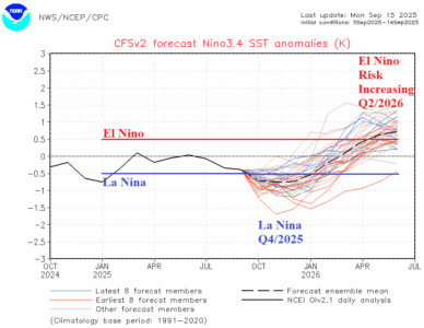
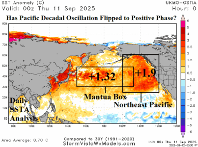
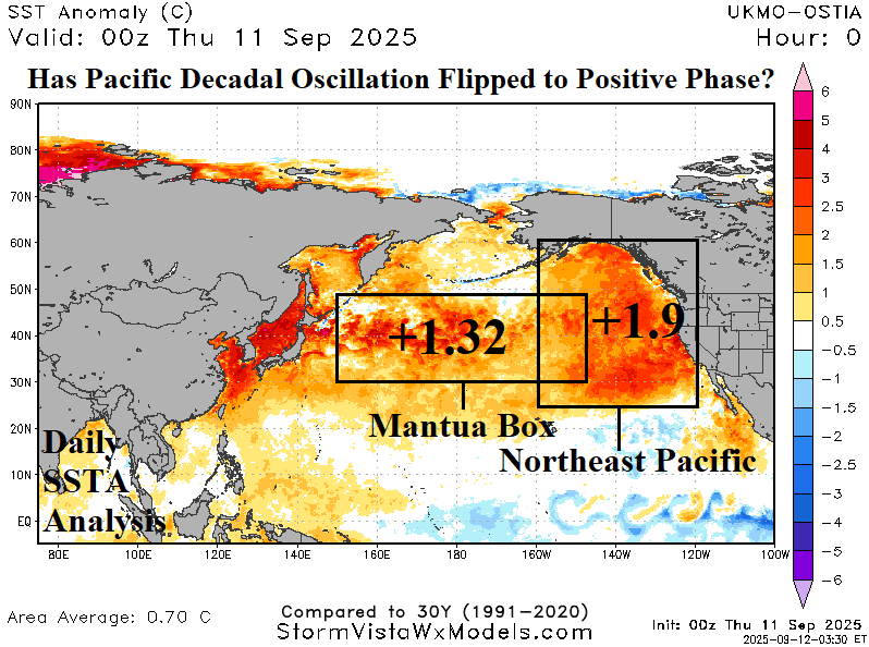
Emergence of the marine heatwave in the Northeast Pacific potentially increases the risk of El Nino in 2026 as the anomalous warm water spreads to the tropics. The NCEP CFS V2 Nino34 SSTA forecast continues to edge into El Nino territory Q2/2026. The change in ENSO will be applied to new season 1-4 ahead forecasts. The upcoming La Nina is a relatively short duration episode.
