10/05/2025, 10:04 am EDT
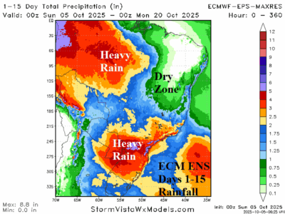
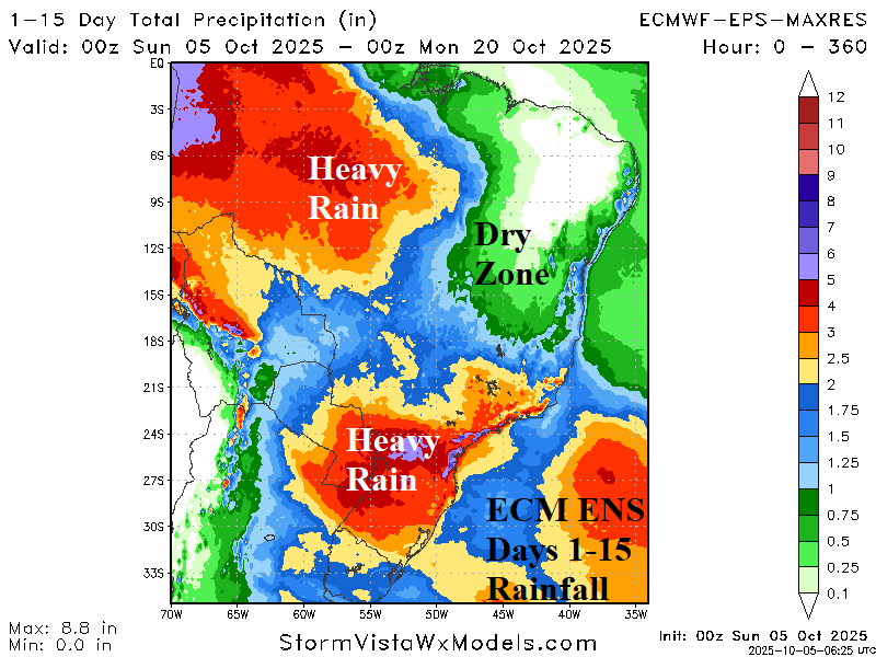
Departing September, GRACE-based soil moisture anomalies analysis reveals improving conditions in the central/east-central Brazil soybean-growing areas while harsh drought in the southern soybean-growing areas receives beneficial rainfall in the latest 15-day outlook. The far eastern soybean growing-areas remain in drought with a dry outlook during the next 15 days.

