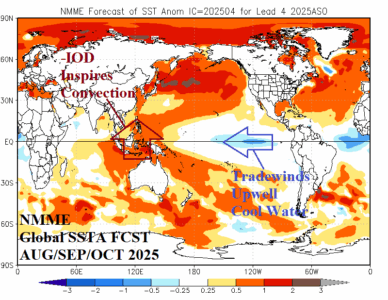
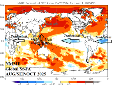
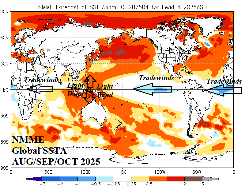
The opinion of Climate Impact Company is that -IOD generation – which is expected – will regenerate La Nina for later this year which would enhance seasonal tropical cyclone activity in the North Atlantic basin.
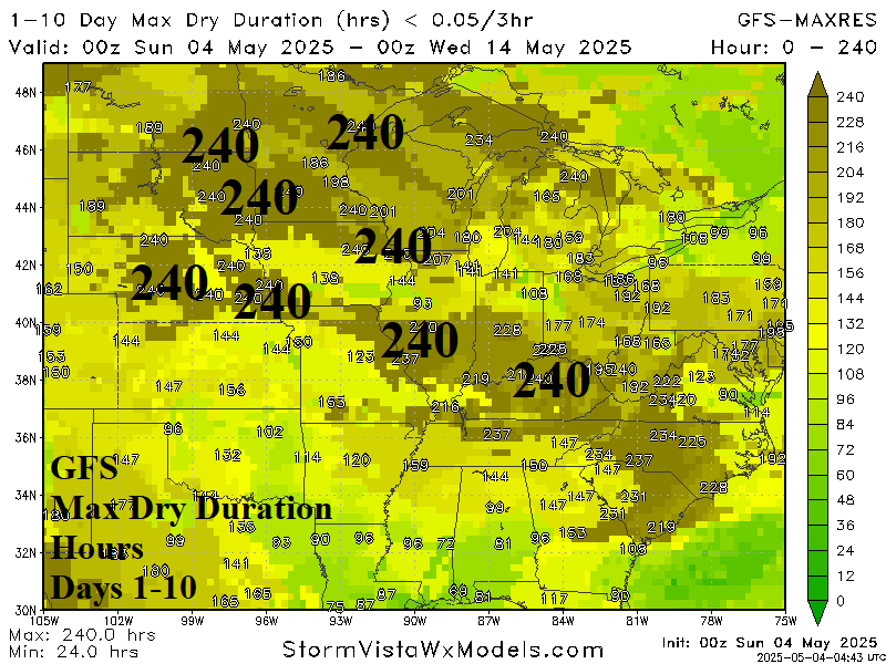
The dry duration forecast through the next 10 days is a full 240 hours across parts of the Upper Midwest and Midwest States as areas missing the heavy rains of April are watching for drought development. In the Black Sea region where strong drought persists, a wetter pattern change is indicated into mid-May.
The Indian Ocean dipole is in the positive phase although forecast to shift neutral as mid-year approaches. Forecast models/analogs suggest that if ENSO trend is toward (or into) La Nina during Q3/2025 the risk of -IOD developing increases substantially.
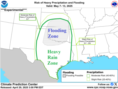
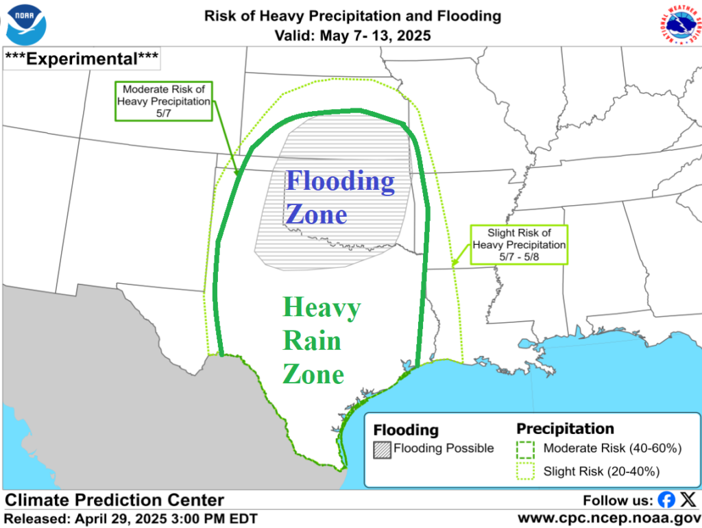
Ongoing flooding in Oklahoma to Texas will intensify as another 7-10 inches of rain is possible over the next 1-2 days. River flooding, travel hazards, power outages, and crop damage increase. A second event is likely next week! The hardest hit area for flooding is Oklahoma likely to exceed the intensity of the Ohio/Mississippi River flooding event of early April.
