U.S. D2-D4 Drought Covers Whopping 44.5% of U.S. Why?
05/25/2026, 10:05 am EDT
Ocean and Soil Moisture Climate Guides for Early Summer in the U.S.
05/28/2026, 9:47 am EDT
Climate Impact Company ENSO Climate Diagnostics
Issued: Tuesday May 26, 2026
Highlight: Caveats are emerging in the strong El Nino forecast. Forecast confidence of “historical” El Nino intensity decreases.
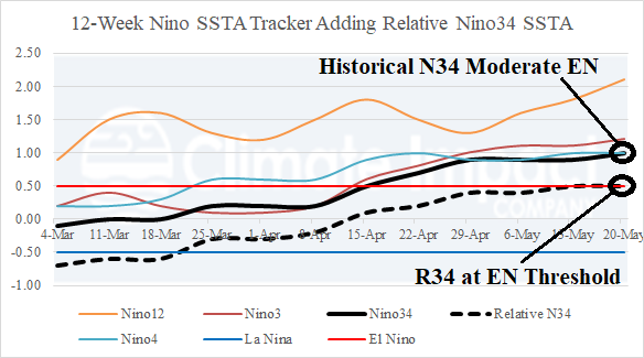
Fig. 1: The Nino SSTA regions are well within the El Nino threshold. The NEW relative Nino34 SSTA index is at the EL Nino threshold. NOAA will not announce El Nino onset until the threshold is crossed for several weeks.
Discussion: The weekly Nino SSTA observations indicate steady moderate-to-strong El Nino warmth while the relative Nino34 index is at the El Nino threshold (Fig. 1). Based on a comparison of relative Nino34 index and multivariate ENSO index (MEI) for this decade, Climate Impact Company favors the new relative Nino34 index as most representative of the ENSO regime.
The upper ocean heat anomalies were broadly very warm two months ago across the length of the equatorial Pacific (Fig. 2). During May, the upper ocean heating increased dramatically and consolidated in the equatorial East Pacific (Fig. 3). The lack of (following) subsurface heat (West Pacific subsurface is marginally warm) and realization at the equatorial East Pacific surface related to the immense heat in the East Pacific subsurface raises concern over the intensity and duration of El Nino ahead.
Developing El Nino usually produces lack of trade winds or a reversal to westerly wind direction in the equatorial central/east Pacific Ocean. However, the expected trade wind regime is not present. In fact, in early June, GFS projects a swath of moderate trade winds in the Nino4/Nino34 regions (Fig. 4).
The southern oscillation index (SOI) has shifted steadily into the El Nino-like negative phase during the past 4-6 weeks (Fig. 5). SOI forecasts maintain the negative phase but increasing trade winds question the effectiveness on the ENSO climate of the -SOI regime.
NOAA/CPC continues to indicate a strong El Nino ahead with reasonable risk of a historical event (Fig. 6). However, based on current diagnostics, Climate Impact Company forecast confidence on historical El Nino for 2026 has decreased.
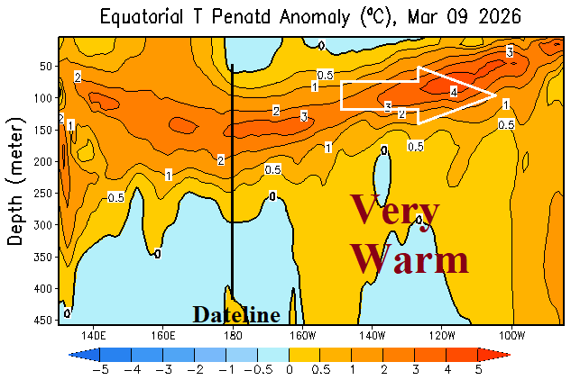
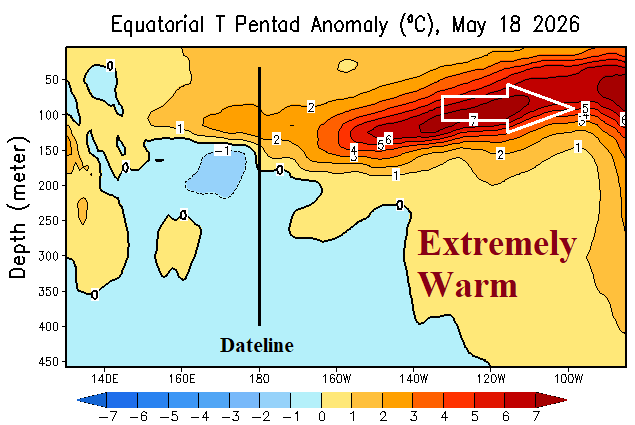
Fig. 2-3: Subsurface anomalous warmth sprawled across the equatorial Pacific 2 months ago has consolidated in the East Pacific and intensified during May.
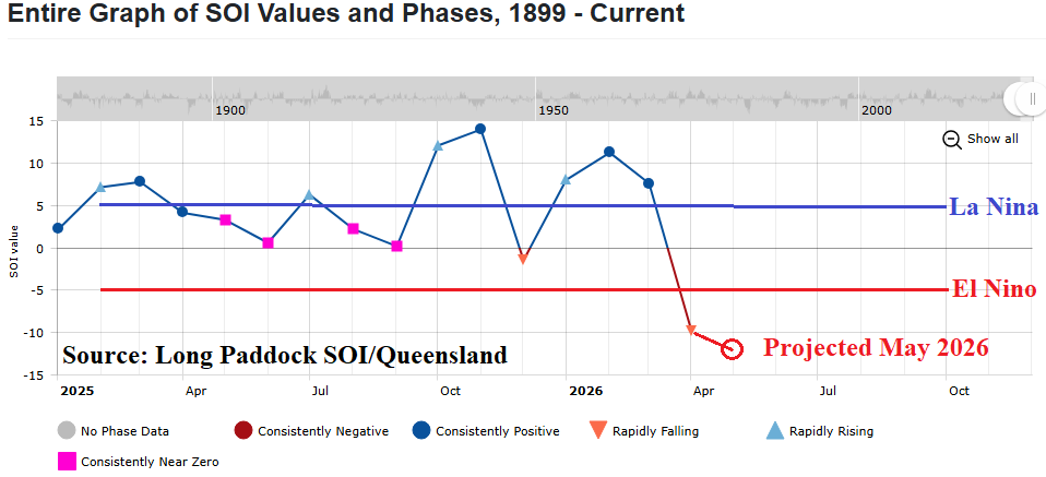
Fig. 4: The southern oscillation index has shifted into negative phase on a consistent basis signaling onset of an El Nino climate.
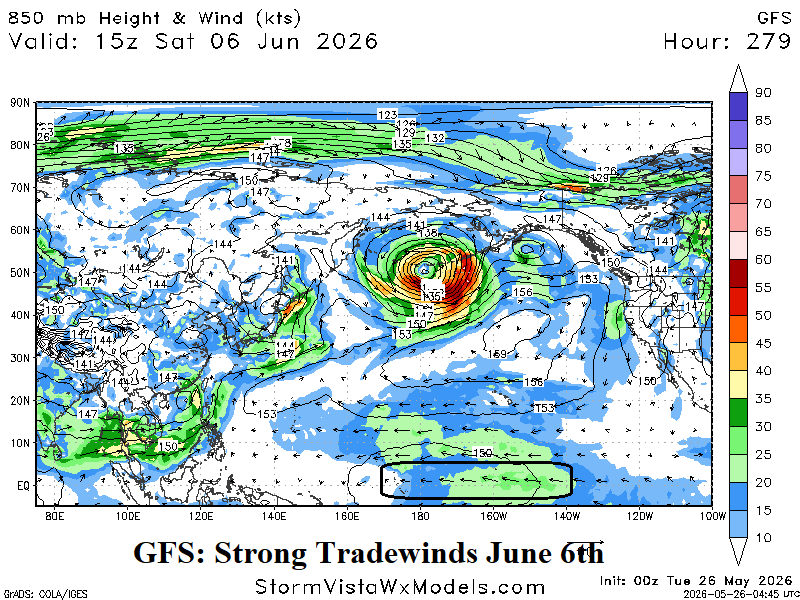
Fig. 5: The operational GFS forecast of 850 MB winds in the equatorial region of the Pacific Ocean projects a swath of moderate trade winds during early June. There is a total lack of light or westerly wind typical of a developing El Nino.
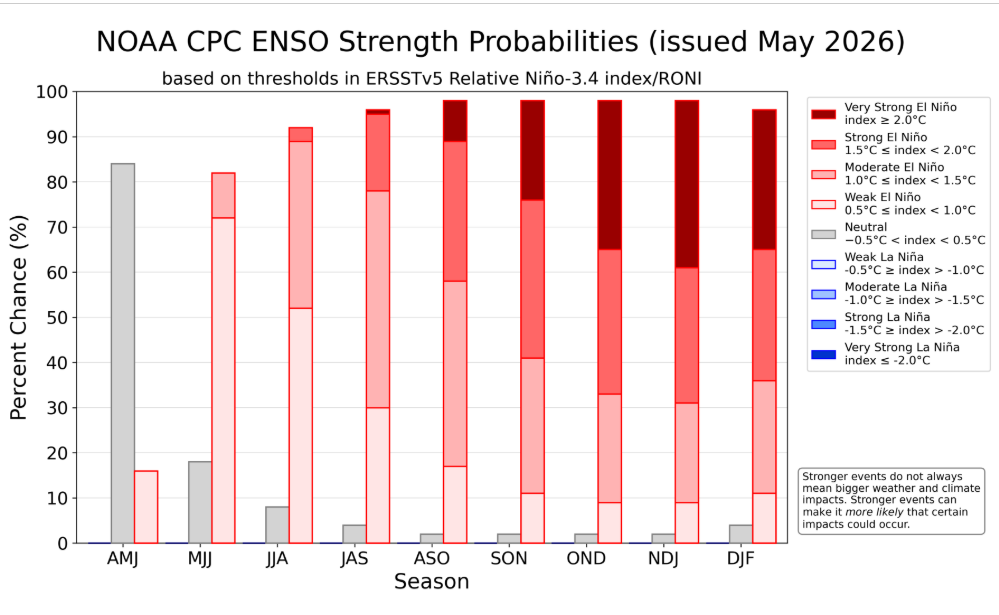
Fig. 6: The NOAA/CPC ENSO intensity probability forecast.