
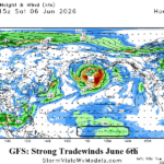
Trade Winds Strengthen Early June Equatorial East-central Pacific Ocean…Not Supportive of El Nino Development
05/26/2026, 8:43 am EDT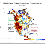
Sharp Differences in Crop Conditions In U.S./Canada
06/03/2026, 8:08 am EDT
Climate Impact Company Week 2-4 Outlook
North America
Issued: Thursday, May 28, 2026
Highlight: North-central U.S. and westward heat.
Chart of the day: Early summer North America climate bias guide.
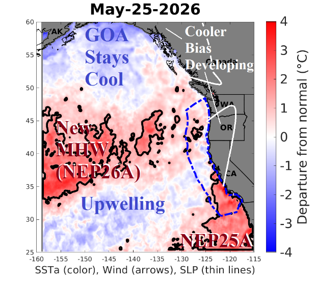
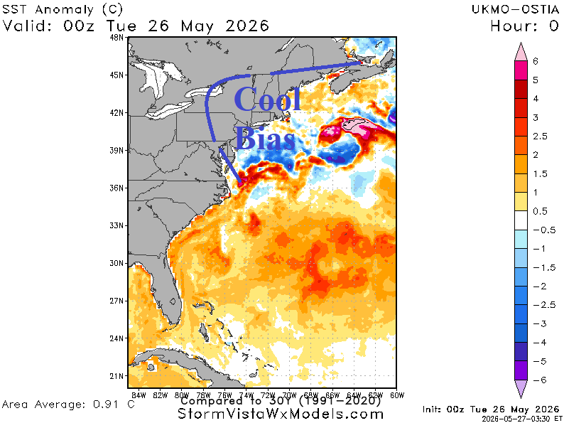
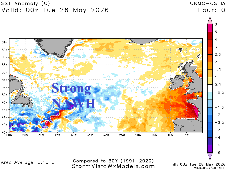
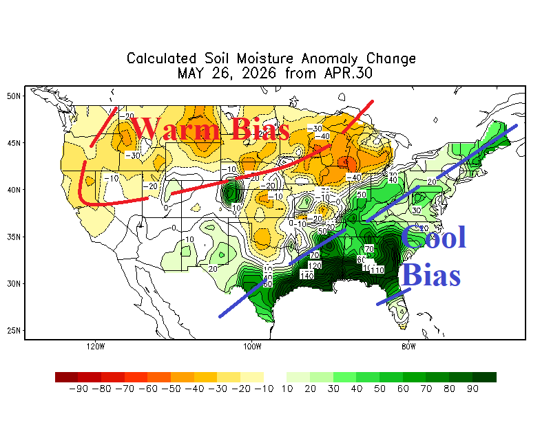
Discussion: The evolving early meteorological summer 2026 climate bias guide begins with new up-welling cooler waters off the U.S. West Coast enhanced by ocean currents taking cold water from the Gulf of Alaska into this region deflected southwestward to split marine heatwaves NEP26A and NEP25A. The cooling waters bias the prevailing climate pattern on the North America West Coast cooler for early summer. The next 2-3 days will feature an unusually windy, chilly, and rainy scenario across New England and particularly the coast fueled in part by the cold bias on the atmosphere by cooler than normal waters off the Northeast Coast provided by the Labrador Current extending southwestward from the North Atlantic Warm Hole (NAWH) south of Greenland. Finally, while much of the U.S. is encountering drought, the late spring soil moisture bias is vividly drier across the Northern U.S. and equally intense but wetter in the Southeast States. The drier regime biases the weather pattern warmer while the wetter soil trend biases the regime cooler. The biases listed are helpful guiding 8-14/11-15-day forecasts when models often differ and identify areas where extremes are most likely (such as a warm pattern over dry soil having tendency to be hotter than models).
Week-2 Ahead Forecast valid June 7-14, 2026: Warmth mostly interior continent; Midwest dryness persists.
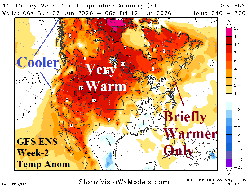
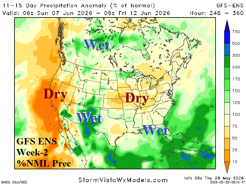
Discussion: The 06Z GFS ENS is the best fit for climate guides (above). The Interior West is hot although coastal regions stay normally warm and possibly cooler. The hot bias is strongest across soil moisture drying areas of the North-central U.S. (It’s not the drier soil moisture regime causing the pattern, but the emerging climate pattern [identified by drying soils]). New England is BREIFLY warm before the cool ocean inspired air mass returns. The Midwest STAYS (very) dry.
Week-3 Ahead Forecast valid June 14-21, 2026: Warmth shifts westward: Northeast warming in doubt.
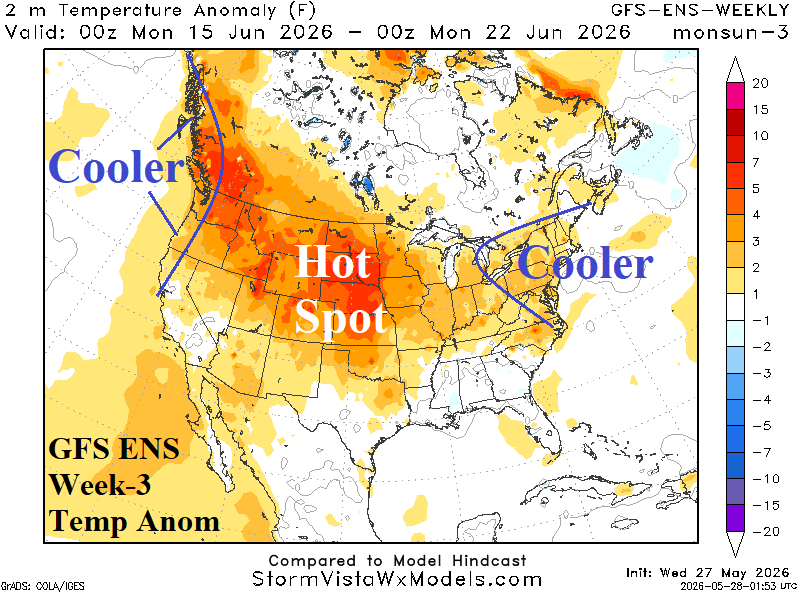
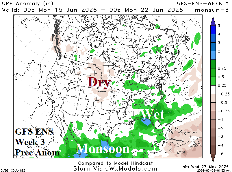
Discussion: An upper trough in East Canada extending toward the Northeast is the preferred upper air pattern most closely matched by the GFS ENS. The Northeast is likely cooler than shown due to stronger amplification of the upper trough. To compensate for the trough, the ridge pattern in the West is stronger forcing North-central U.S. warmth westward although near the coast the pattern is likely cooler than indicated. Wet weather also suppresses heat risk in the Southeast States.
Week-4 Ahead Forecast valid June 21-28, 2026: Persistence is a winner.
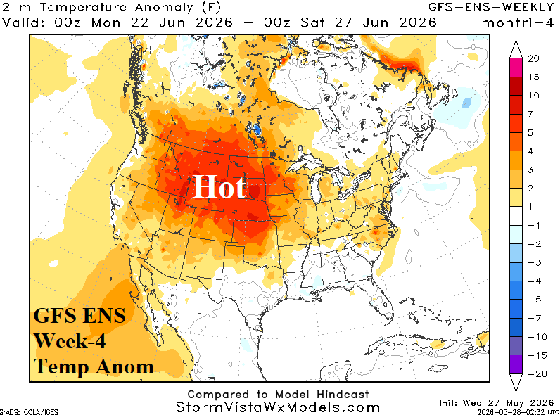
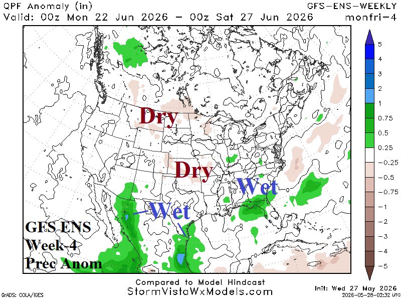
Discussion: Persistence is a winner to close June. Hot weather across an intensifying western Great Plains to Northwest U.S. drought while a wet regime in the Southeast U.S. suppresses Gulf States anomalous heat. There may be a pulse of heat through the Mid-Atlantic States (missing New England).