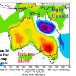
Australia High Impact Weather Pattern…Victoria Wildfires/Queensland Flooding
01/11/2026, 11:49 am EST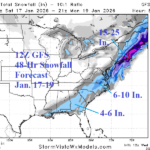
Strong -AO, Sneaky Cold and Snowy Surprises Possible
01/14/2026, 12:42 pm EST![]()
Climate Impact Company Midday Update
Issued: Tuesday January 13, 2026
Highlight: DEC-25 U.S. climate review. 12Z GFS trends (arctic) cold extended range.

Fig. 1: The NOAA/CPC U.S. state temperature rankings for December 2025.
Discussion: DEC-25 was the 5th warmest early winter in the 131-year historical record (Fig. 1). Almost the entire West observed the warmest December on record while the Northeast was seasonably cold. The U.S. precipitation pattern during DEC-25 ranked 37th driest on record featuring the driest December on record in Oklahoma with near record dryness for surrounding states, a classic La Nina signature (Fig. 2). Meanwhile a wet La Nina bias was exceptional across the Northwest States.
The 12Z GFS likes the morning forecast philosophy of an aggressive -AO pattern causing Eurasia chill to shift cross-polar and into North America. Consequently, a cold 6-10-day forecast shifts colder in 11-15 days and features arctic air (Fig. 3-4).
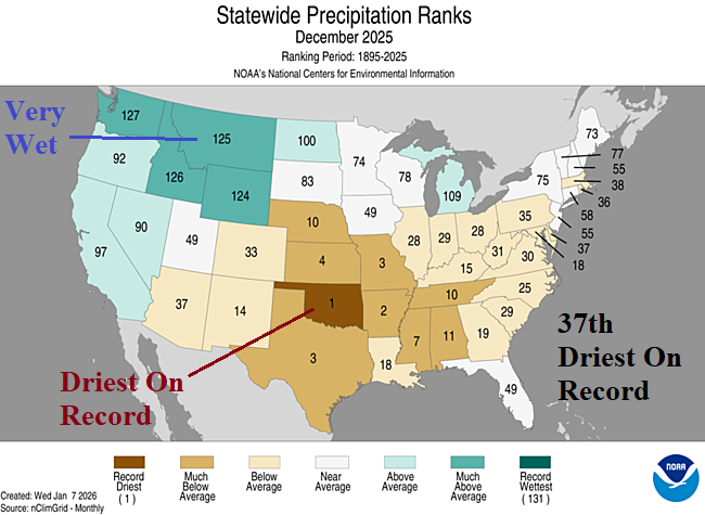
Fig. 2: The NOAA/CPC U.S. state precipitation rankings for December 2025.
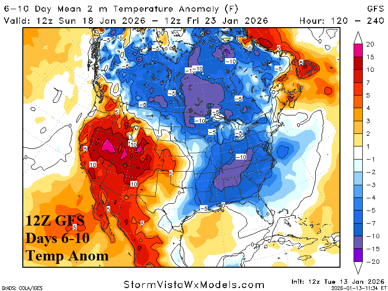
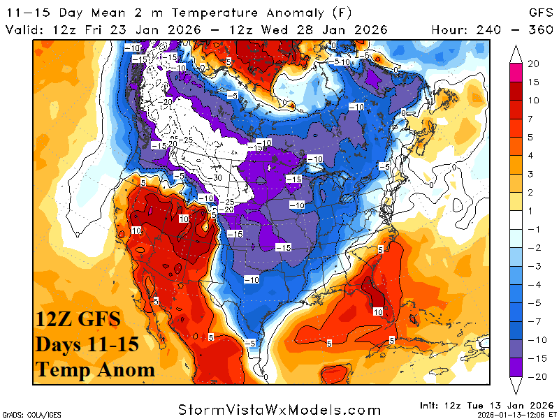
Fig. 3-4: The 12Z GFS medium range temperature anomaly forecast.
| EIA End | Forecast | 12-Hour Change | 24-Hour Change | 30-Year Normal | 10-Year Normal |
| 1/15 | 172.2 | -0.2 | -1.1 | 211.0 | 201.2 |
| 1/22 | 227.2 | +8.6 | +22.0 | 212.6 | 204.8 |
| 1/29 | 230.6 | +37.5 | +22.2 | 211.7 | 204.3 |
Table 1: The midday 12Z GFS U.S. gas population weight HDD projections into later January.