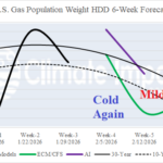
Fluctuating Heating Demand Ahead in the U.S.
01/09/2026, 8:02 am EST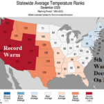
5th Warmest December on Record in U.S.
01/13/2026, 12:34 pm EST
Climate Impact Company AG Hot Spot
Issued: Sunday January 11, 2026
Highlight: Australia high impact weather pattern.
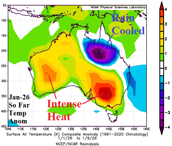
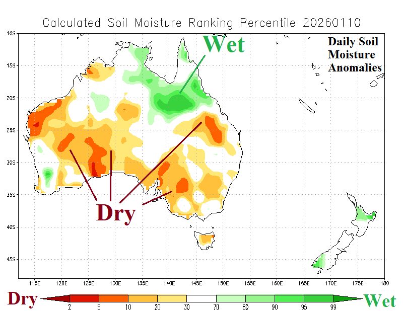
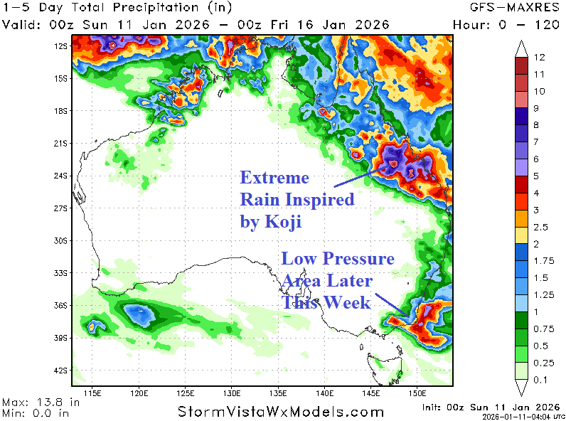
Fig. 1-3: The JAN-26 (so far) Australia temperature anomalies, daily soil moisture anomalies analysis, and the GFS 5-day rainfall amount forecast.
Discussion: Australia starts January with hostile brush fires northeast of Melbourne while flooding rains from a tropical system (Koji) pounce on Queensland. So far, JAN-26 has produced unusually hot weather across Interior Southeast Australia where the brushfire regime emerged (Fig. 1). Intense anomalous heat has covered all Western Australia. Northeast Australia is cooled by persistent heavy monsoon rains. Soil moisture conditions, based on NOAA/CPC analysis, are drier than Bureau of Australia, due to the influence of extreme heat (Fig. 2). In the short-term, inland-moving Koji causes widespread heavy rains in Queensland while another low-pressure area causes heavy rains on Coastal Southeast Australia not affecting the wildfires but helping to ease the heat (Fig. 3). The GFS 15-day forecast reveals the intense Australia heat continues but mostly over northwest and west continent possibly regenerating in the Southeast in the 11-15-day period (Fig. 4). Eastern Australia is susceptible to heavy rainfall, possibly related to tropical cyclones, throughout the 15-day period (Fig. 5). Areas not receiving rain are exceptionally hot!
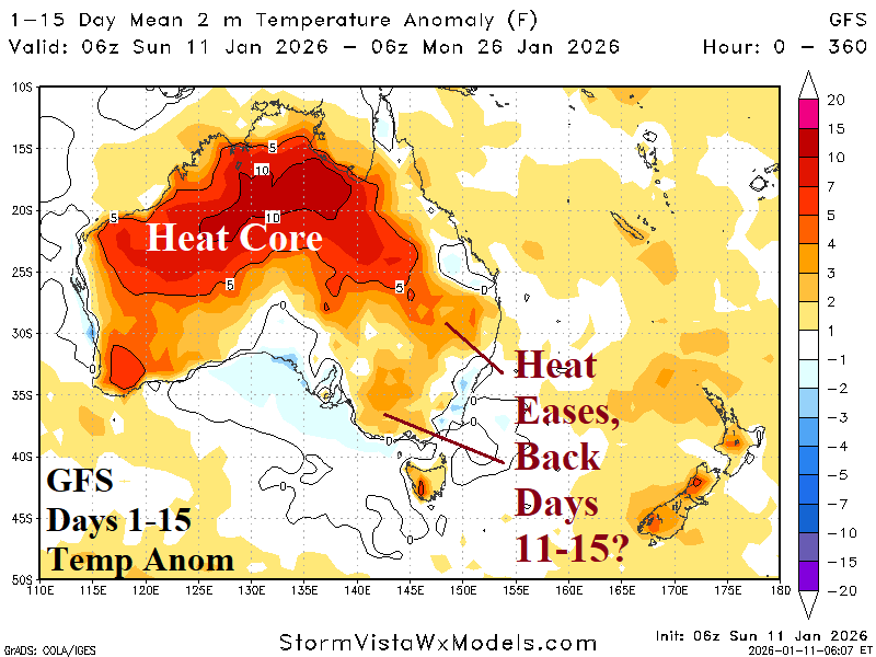

Fig. 4-5: GFS 15-day temperature anomaly and percent of normal rainfall forecast across Australia.