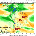
Dry-biased Graph Cast Preferred Model to Project South America Rainfall in Current Pattern
01/05/2026, 4:31 am EST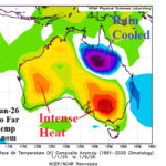
Australia High Impact Weather Pattern…Victoria Wildfires/Queensland Flooding
01/11/2026, 11:49 am EST
Climate Impact Company U.S. Medium Range Report
Issued: Friday January 9, 2025
Highlight: Cold ahead is not as cold as previously indicated.
Chart of the day: Latest 6-week HDD forecast.
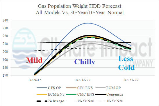
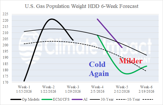
Discussion: The latest U.S. gas population weight HDD forecast identifies the mild week ahead shifting much colder Jan. 16-22 and moderating back to near normal late month. AI and CFS/ECM each indicate another cold week to start February followed by milder weather. Arctic air risk is not indicated (for the U.S.) during the period.
Medium-range 6-10 Day Forecast Valid January 14-18, 2026 (ECM ENS left and 24-hour change right)
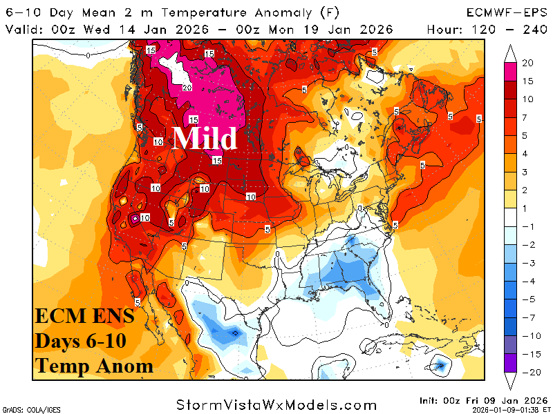
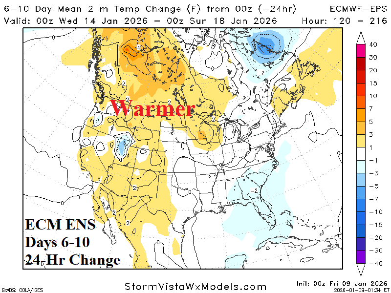
Discussion: Anomalous warmth lingers days 6-10 and overall, the forecast is slightly warmer.
Medium-range 11-15 Day Forecast Valid January 19-23, 2026 (ECM ENS left and 24-hour change right)
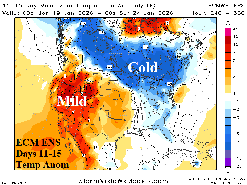
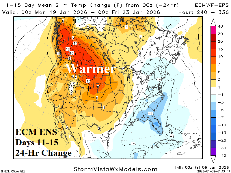
Discussion: Earlier this week, a comment was made that climate signals support for a colder pattern change are weak. Today’s 11-15-day forecast indicates the evolving cold but considerably less cold than yesterday’s outlook.
U.S. Medium-range Precipitation Forecast
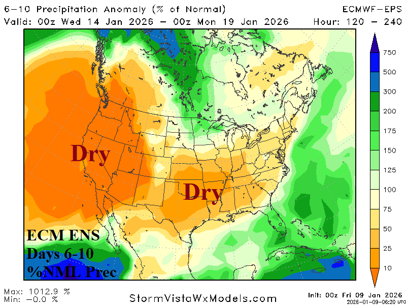
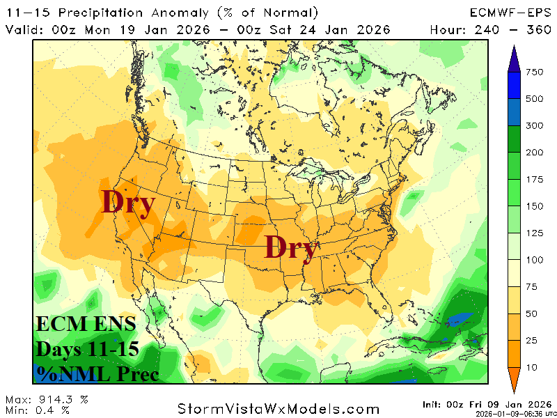
Discussion: The warm to colder transition in the U.S. medium range forecast is accomplished without significant storms.
Days 16-20 Extended range Temperature Forecast valid January 24-28, 2026
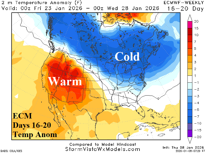
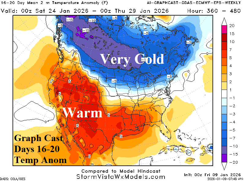
Discussion: The extended-range cold is driven mostly by expanding snow cover. ECM is tilted colder into the U.S. while Graph Cast keeps most of the cold north of the border.