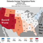
5th Warmest December on Record in U.S.
01/13/2026, 12:34 pm EST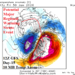
Regional Stratospheric Warming Episode Eastern North America Late January
01/15/2026, 12:25 pm EST![]()
Climate Impact Company Midday Update
Issued: Wednesday January 14, 2026
Highlight: Strong -AO, sneaky cold and snowy surprises possible.
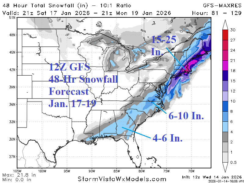
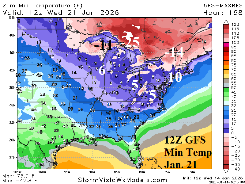
Fig. 1-2: The 12Z GFS snowstorm forecast for early next week and low temperature projection for next Wednesday.
Discussion: Is the heavy snowstorm indicated by 12Z GFS on the East Coast early next week correct (Fig. 1). Of course not! However, the model makes the point that the climate pattern is in a strong negative arctic oscillation. Arctic air is forecast to drift cross-polar from Siberia and infiltrate North America. In this pattern, a snowstorm in the East is possible. Additionally, given the cross-polar arctic air flow driven by the -AO pattern, very cold weather across fresh snow cover is possible as indicated by 12Z GFS for next Wednesday morning when 5F is forecast for Richmond, VA (Fig. 2). Bottom line? Sneaky cold and snowy is possible in the developing -AO pattern!
The 12Z GFS was colder in the East in the 6-10-day period (Fig. 3) staying very cold in New England during the 11-15-day period (Fig. 4). The stronger cold is driven by snow cover. The warming influence of the East Pacific environment is evident in the 11-15-day period across the West U.S. to the Great Plains.
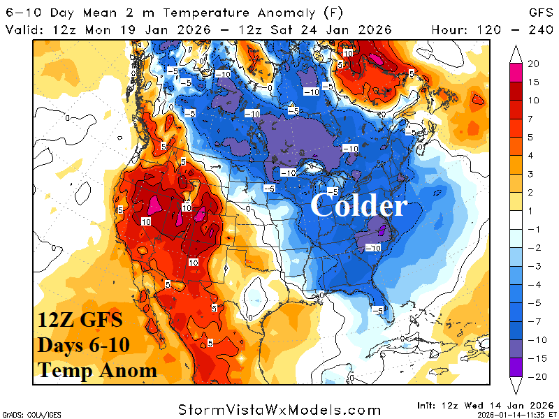
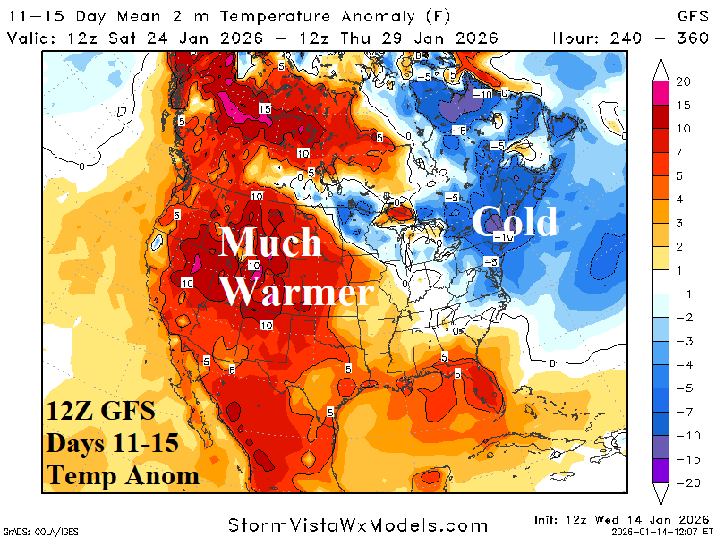
Fig. 3-4: The 12Z GFS medium range temperature anomaly forecast.
| EIA End | Forecast | 12-Hour Change | 24-Hour Change | 30-Year Normal | 10-Year Normal |
| 1/15 | 171.1 | 0.0 | -0.9 | 211.0 | 201.2 |
| 1/22 | 238.0 | +9.4 | +10.8 | 212.6 | 204.8 |
| 1/29 | 198.3 | -31.2 | -32.3 | 211.7 | 204.3 |
Table 1: The midday 12Z GFS U.S. gas population weight HDD projections into later January.