Early Season Chicago Snowstorm
11/28/2025, 6:20 am EST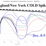
The Cold Spike for PJM and NEPOOL Starting Meteorological Winter 2025-26
12/01/2025, 5:56 am EST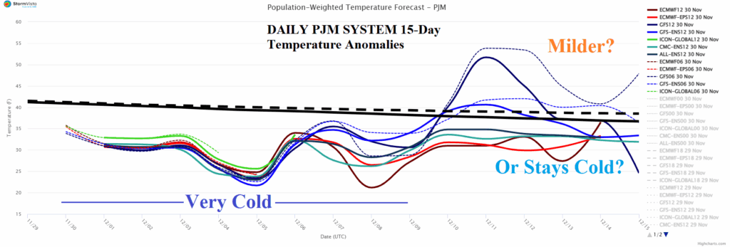
Climate Impact Company U.S. Sunday Report
Issued: Sunday, November 30, 2025
Highlight: The December bias, support for less cold/warmer days 11-15/16-20, and the important PJM outlook biased cold.
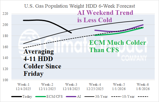

Fig. 1-2: The latest U.S. gas population weight HDD forecast utilizing all models through Dec. 18 and CIC estimate of HDD for weeks 4-6 combining ECM/CFS and comparing to AI. Advised temperature bias for DEC-25 is identified by the latest Climate Impact Co. DEC-25 temperature outlook.
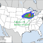
Discussion: The U.S. gas population weight HDD forecast utilizing ALL models through December 18th indicates a slightly colder revision (4-11 HDD) compared to 48 hours ago (Fig. 1). The week 4-6 forecast is quite cold by ECM and much warmer by CFS V2 with a consensus averaging near the 10-year normal. AI projections are slightly milder than indicated from Friday averaging in between the 10-year and 30-yeart normal. The best guidance for temperature expectations in December is a cold bias across the snow covered North and warmer than normal south of snow cover (Fig. 2). The U.S. medium range forecast utilizing the 12Z ECM ENS indicates very cold weather across Canada extending across U.S. snow cover in the 6-10-day period (Fig. 3) followed by moderation in the 11-15-day forecast (Fig. 4). ECM ENS moderates Western Canada cold in the 11-15-day period while majority of other operational and AI models generate new cold. On day 15, there is general agreement by GFS and ECM on a cold stratosphere across North America which supports warmer temperatures in the troposphere extending into the 16-20-day period. The week ahead features significant snowfall across the North and Interior Northeast/Mid-Atlantic States. Midwest snow cover is already significant due to weekend storms. Additional snow is likely early week (Fig. 5). However, focus of snowfall this week is mostly across the Interior Northeast early week and Interior Mid-Atlantic later week (Fig. 6). The snow cover helps to enhance the cold pattern in place for PJM the next 10 days which may moderate in the 11-15-day period or possibly turn warmer than normal (Fig. 7).

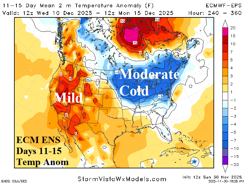
Fig. 3-4: The 12Z ECM ENS U.S. medium range temperature anomaly forecast.
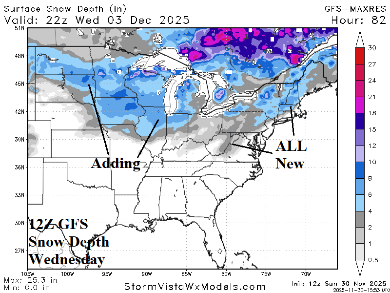
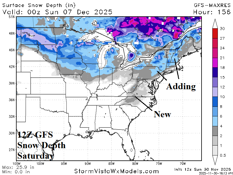
Fig. 5-6: The 12Z ECM ENS U.S. medium range temperature anomaly forecast.

Fig. 7: The PJM 15-day daily average temperature forecast.