Snow Cover Bias Supports Cold PJM Forecast
11/30/2025, 2:15 pm EST
Is La Nina Starting to End?
12/02/2025, 1:11 pm EST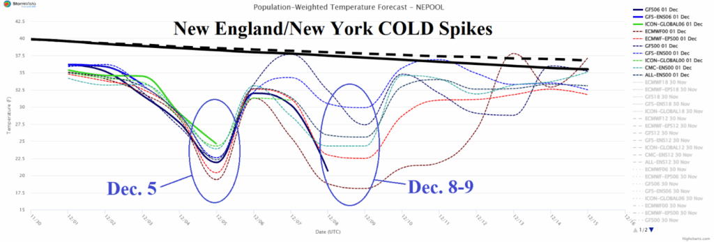

Climate Impact Company Early U.S. Notes
Issued: Monday December 1, 2025
Highlight: Snow and very cold start to meteorological winter Midwest and East.

Fig. 1: Latest NOAA/NWS weather watch warning, watch, and advisory areas.
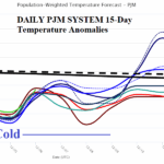
Discussion: Winter Storm Watch (Fig. 1) for 5-10 inches of snow (Fig. 2) is posted for tomorrow stretching from Northeast Pennsylvania through central New England to Downeast Maine. Winter Weather Advisories are issued for 2-4 inches of snow today from Kansas to Pennsylvania with sleet and ice as far south as Arkansas. More significant snow is possible in the Mid-Atlantic region away from the coast on Friday (Fig. 3). An exceptionally cold start to meteorological winter 2025-26 in the East with a frigid 15-day forecast for New England/New York (Fig. 4) including 2 cold spikes (Dec. 5 and Dec. 8-9) and a long stretch of cold for the PJM Sector although some moderation in the extended range (Fig. 5). The brutal cold in the East follows a month of November when much of the U.S. was milder than normal (Fig. 6) and quite dry in the East (Fig. 7). However, late month snow caused the continental snow cover to expand above normal (Fig. 8) and is the catalyst for a cold first half of December in the East (Fig. 9).
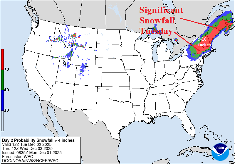
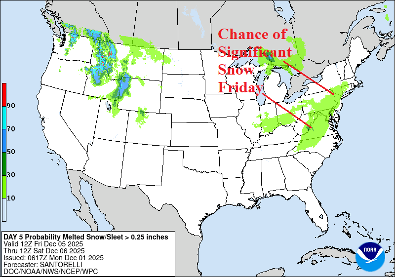
Fig. 2-3: NOAA/WPC significant snowfall East U.S. areas this week.

Fig. 4: Population weighted average daily temperature for the next 15 days across New England/New York.
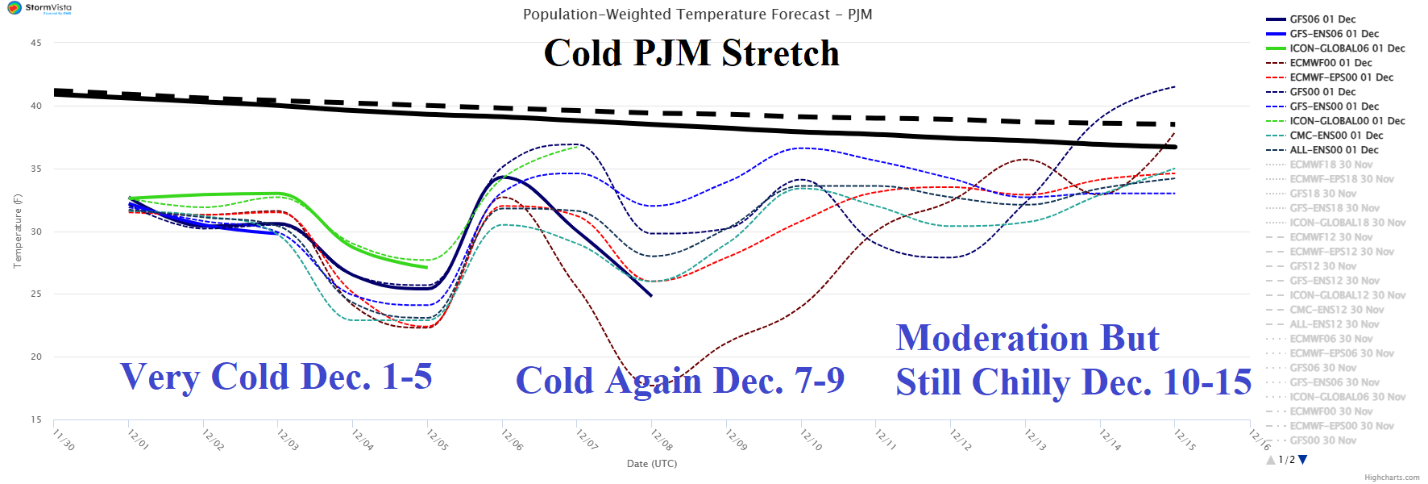
Fig. 5: Population weighted average daily temperature for the next 15 days across PJM.
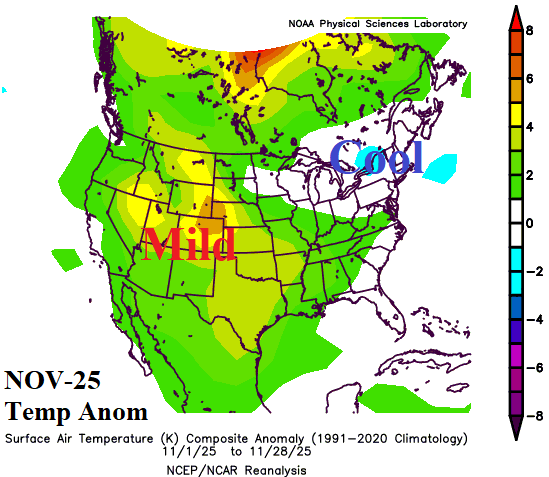
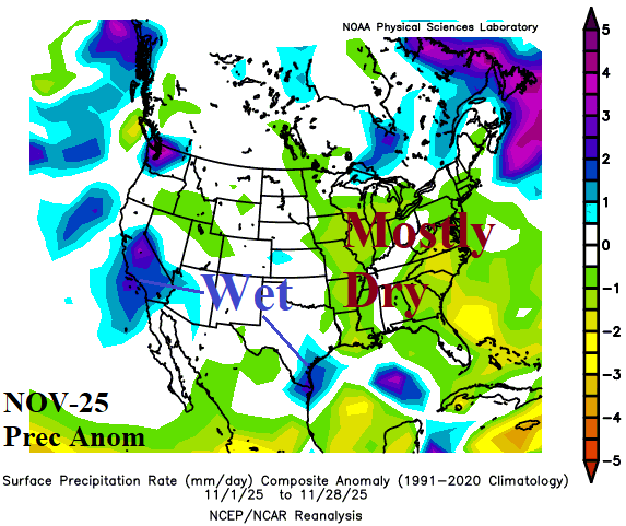
Fig. 6-7: November 1-28, 2025, temperature and precipitation anomalies across the U.S.
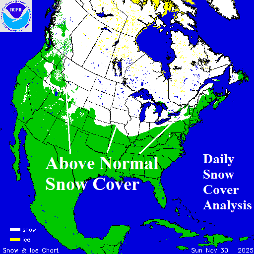
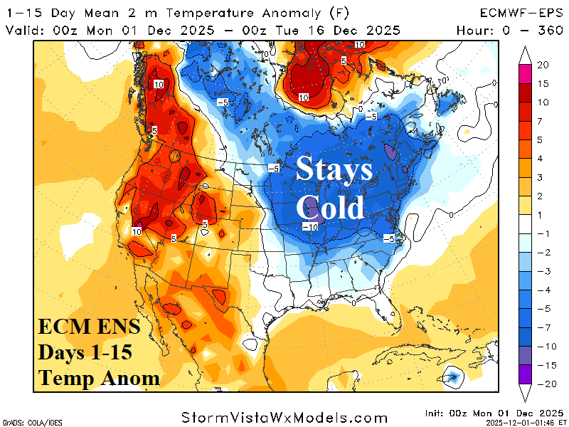
Fig. 8-9: Daily snow cover analysis across North America plus the ECM ENS 15-day temperature anomaly forecast.