
The U.S. Cold Pattern Arrives and Settles on Chicago!
11/26/2025, 8:39 am EST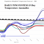
Snow Cover Bias Supports Cold PJM Forecast
11/30/2025, 2:15 pm EST
Climate Impact Company Early U.S. Notes
Issued: Friday November 28, 2025
Highlight: Widespread early season snows.
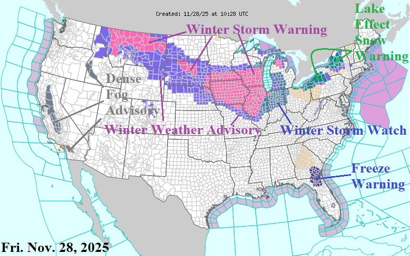
Fig. 1: Latest NOAA/NWS weather watch warning, watch, and advisory areas.
Discussion: A substantial part of the Northern U.S. is affected by a combination of winter storm warnings and watch areas including Lake-effect Snow Warnings valid for today and tomorrow (Fig. 1). Jackpot snowfall amounts stretch from North Dakota to Iowa today/tonight (4-6 inches) increasing to 6-14 inches Iowa to Indiana (and centered on Chicago) tomorrow (Fig. 2-3). After the snowstorm abates, afternoon temperatures on Sunday are a frigid 5F in western North Dakota to only 25F in Chicago and near 30F from Kansas City to Cleveland (Fig. 4). By Tuesday morning, an area of subzero settles on Central Iowa to Southwest Wisconsin and Northwest Illinois (Fig. 5). The snowstorm shifts to Quebec and Northern New England Sunday with another round of moderate snow Interior Northeast possible on Tuesday (Fig. 6). The GFS projects hefty snow depth to bias temperature cold from the Midwest to Northeast U.S. by middle of next week (Fig. 7).
![]()
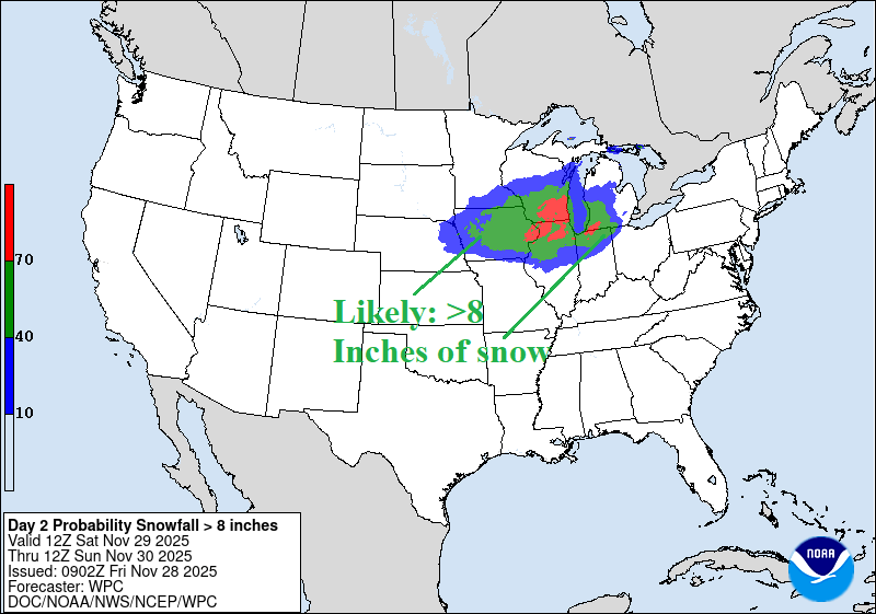
Fig. 2-3: NOAA/WPC snowfall amount risk for tomorrow in the Midwest U.S.


Fig. 4-5: Cold temperature forecasts by GFS for Sunday afternoon and Tuesday morning.
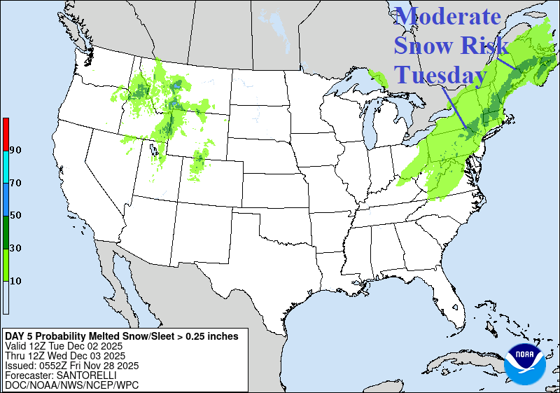
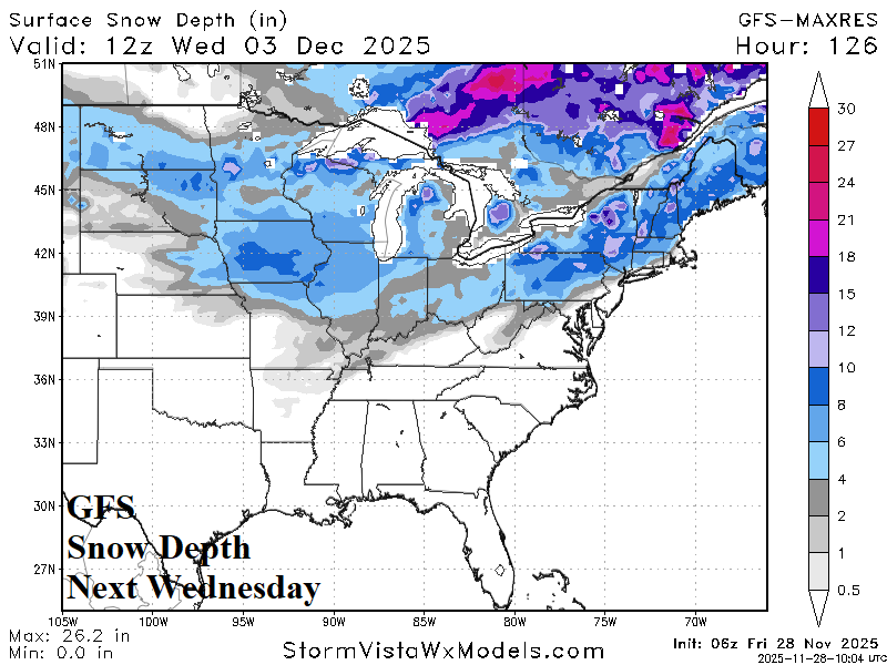
Fig. 6-7: The NOAA/WPC risk of moderate snow Interior Northeast forecast for next Tuesday and GFS snow depth projection for next Wednesday morning.