Piles of Western Canada Snow; When Does it Melt?
04/22/2026, 8:31 am EDT
Very Dry Brazil (Except Southeast) and Midwest U.S. Ahead
04/29/2026, 5:45 am EDT![]()
Climate Impact Company Midday Update
Issued: Tuesday April 28, 2026
Highlight: 12Z GFS stays cool 8-14/11-15-day period despite +NAO.
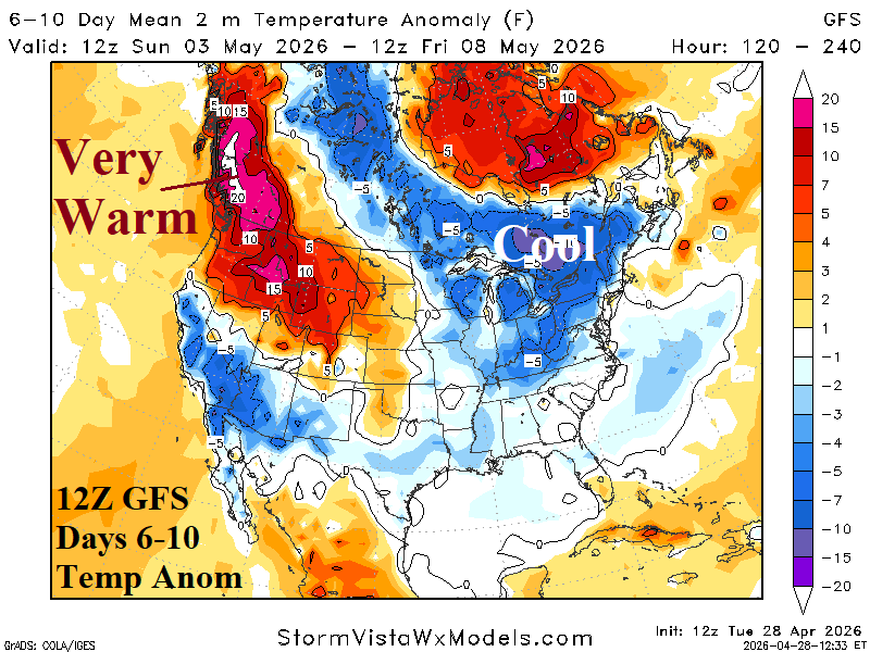
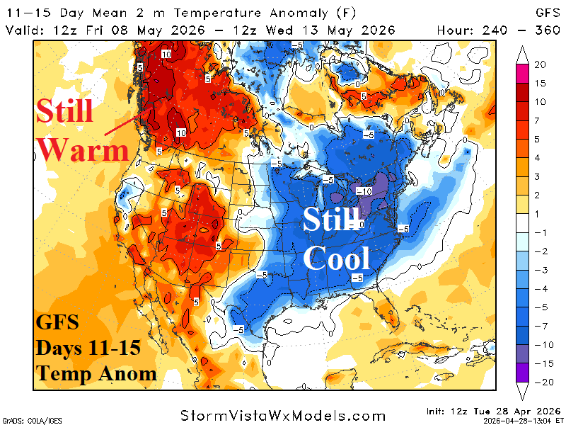
Fig. 1-2: 12Z GFS medium range temperature anomaly forecast.
Discussion: From overnight, climate signals forecasts were generally weak-to-moderate with strongest signature from the arctic oscillation (AO) in the -0.6 to -1.1 range. At midday, both the West and East Pacific oscillations are strongly negative for middle of next week supporting a chilly regime but flatten neutral later in the 11-15-day period. Both the arctic and North Atlantic oscillation is shifting (very) positive later in the 11-15-day period. Despite support for a warmer East U.S. 11-15-day forecast from climate signals, GFS stays chilly in the East. The chilly East regime is compensated by very warm weather in Southwest Canda to the West U.S.
| HDD EIA End | Forecast | 12-Hour Change | 24-Hour Change | 30-Year Normal | 10-Year Normal |
| 4/30 | 64.3 | +0.3 | +0.6 | 62.0 | 59.5 |
| 5/7 | 62.6 | -0.1 | -3.9 | 51.0 | 48.0 |
| 5/14 | 50.3 | +4.5 | +4.3 | 40.8 | 37.2 |
Table 1: The midday 12Z GFS U.S. gas population weight HDD projections into middle May.