All Nino SSTA Regions Reach El Nino Threshold
04/21/2026, 11:05 am EDT
12Z GFS Cooler in the East Despite Emerging Positive North Atlantic Oscillation
04/28/2026, 4:42 pm EDT
Climate Impact Company Daily Feature
Issued: Wednesday, April 22, 2026
Highlight: Piles of Western Canada Snow; When does it melt?
Discussion: In June, during development of the strongest El Nino’s on record (82-83, 97-98, 15-16, and 23-24), high pressure ridging has tendency to amplify and drop anchor on Southwest Canada leading to a dry and warm start to meteorological winter. West/Southwest Canada has endured a snowy 2025-26 winter snow season. A rapid melt would cause serious flooding.
Climate Impact Company is projecting an upper ridge pattern to evolve over this region during the first half of meteorological summer 2026 anticipating a rapid snowmelt and attendant flooding.
However, early signs of this potential pattern are on hold. The Gulf of Alaska is cooler than normal (Fig. 1) and has cooled slightly in April. The upper ridge into Southwest Canada requires a northward expansion of marine heatwave NEP26A. Global SSTA forecasts are generally in favor of warming SSTA in June off the Northwest U.S./Southwest Canada Coast (Fig. 2). However, current observations reveal no warming yet.
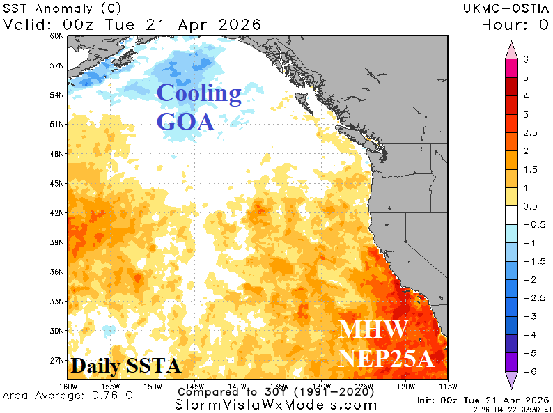
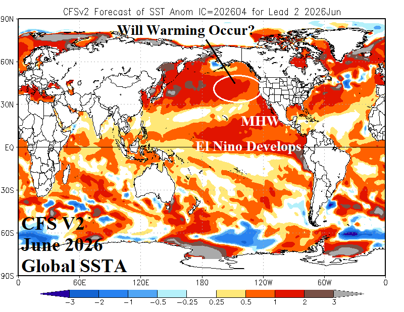
Fig. 1-2: Current Northeast Pacific daily SSTA observations and the CFS V2 June 2026 global SSTA forecast.