
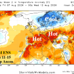
Evolution and Migration of the Next Europe Heatwave
07/28/2026, 8:33 am EDT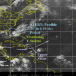
Watching Waters Near the Bahamas in the 6-10-Day Period
07/31/2026, 1:38 pm EDT
Climate Impact Company U.S. Medium Range Report
Issued: Thursday July 30, 2026
Highlight: Super-heat in the West pulses into the East; Mid-south turns hot afterward while Northeast cools.
Charts of the day: NEP25A and West U.S. drought and heat.
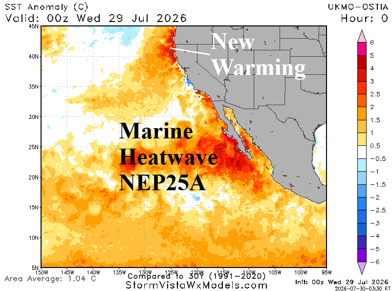
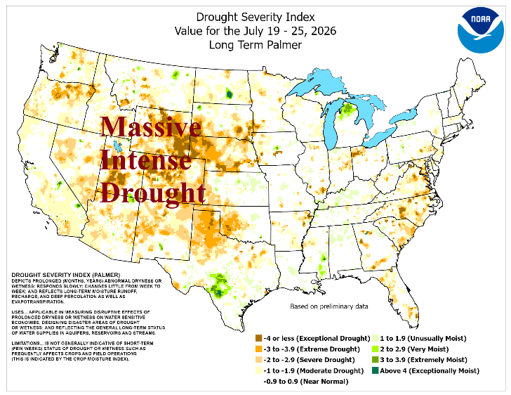
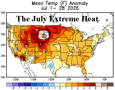
Discussion: The ongoing campaign by Climate Impact Company promoting marine heatwaves as catalysts to drought and heat continues. Summer of 2026 has certainly produced two extreme examples: 1.) The Western Europe heatwaves and 2.) The Western U.S. heatwaves. Marine heatwave NEP25A formed last year in the southeastern North Pacific and continues into late summer 2026. Aloft, the tendency for stronger than normal high pressure ridging across and poleward of this massive anomalous warm water region has caused historic warmth and dryness across much of the West all of 2026. As July closes, NEP25A is causal to the massive and dangerous drought centered on the West-central U.S. and the intense mid-summer 2026 heat stretching from the Desert Southwest to the northwest Great Plains.
Medium-range 6-10 Day Forecast Valid August 4-8, 2026 (AIFS ENS and 24-hour change)
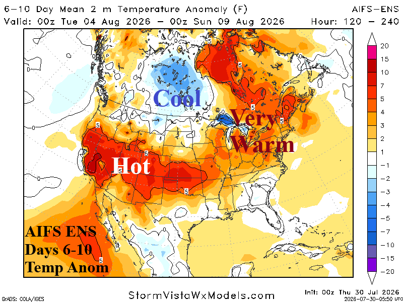
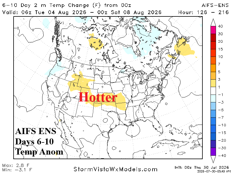
Discussion: Negative West Pacific oscillation (-WPO) develops causing a vigorous trough to form in West-central Canada. The upper trough pushes the West U.S. heat dome southward and increased westerlies aloft pull the heat eastward into the East.
Medium-range 11-15 Day Forecast Valid August 9-13, 2026 (AIFS ENS and 24-hour change)
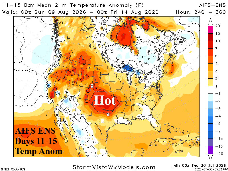
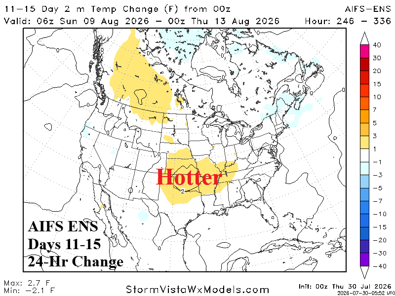
Discussion: The upper trough broadens shifting to Quebec with an extension into the East. The Southwest to Great Basin wet monsoon activates causing the hot weather to budge eastward to the South-central U.S. The East is hot early period then cooler as the upper trough amplifies.
U.S. Medium-range Precipitation Forecast
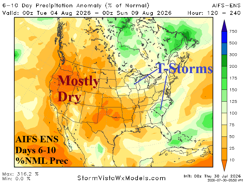
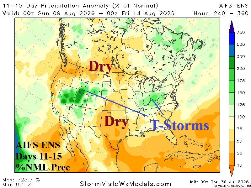
Discussion: AIFS ENS is arid in the 6-10-day period leaving only the Ohio Valley and Southeast susceptible to thundershowers. In the 11-15-day period, wet monsoon moisture may extend to parts of the Great Plains and farther east to the Southeast Ohio Valley.
Days 16-20 Extended range Temperature Forecast valid August 14-18, 2026
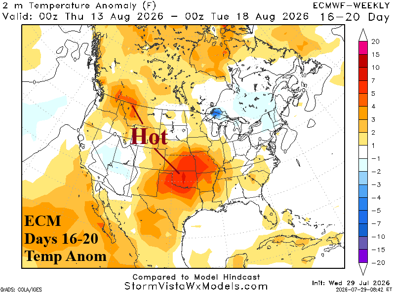
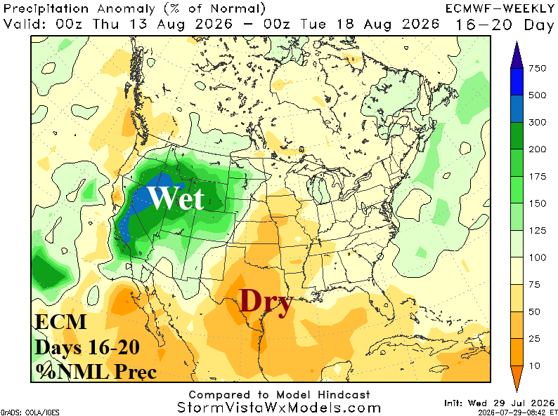
Discussion: The summer 2026 heat is difficult to erase. The Interior West wet monsoon supports the heat core staying in the Mid-south U.S. The Northeast is cooled by an upper trough.