
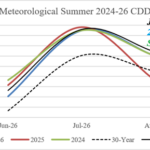
Latest U.S. CDD Assessment for Summer 2026
07/13/2026, 5:14 am EDT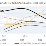
Historic Hot CDD Count for Summer 2026 in Europe
07/19/2026, 11:40 am EDT
Climate Impact Company U.S. Medium Range Report
Issued: Tuesday July 14, 2026
Highlight: Excessive heat possible days 6-10 Northwest, eases days 11-15, reborn Mid-south U.S. days 16-20.
Charts of the day: Global wind oscillation phase_7 dominates!
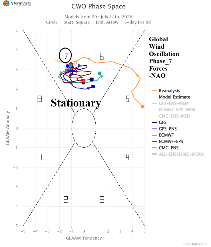
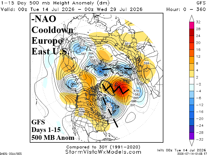
Discussion: A strong positive phase global atmospheric angular momentum combined with the convection phase of the Madden Julian oscillation in the tropical East Pacific helps to force a semi-permanent global wind oscillation in phase_7. In this regime, there is a tendency to force negative North Atlantic oscillation. -NAO ahead forces an upper ridge near and southeast of Greenland with compensating upper troughs in northeast/east portions of North America and through Eastern Europe. Cooling results for Eastern Europe and eventually the Eastern U.S.
Medium-range 6-10 Day Forecast Valid July 19-23, 2026 (ECM ENS and 24-hour change)
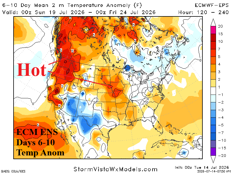
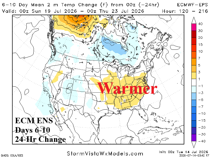
Discussion: -NAO effect seen in the East as a temperate thermal pattern evolves although warmer than 24 hours ago. +PNA sponsors the hottest regime in the Northwest with some of the attendant heat pulsing eastward into the Midwest States.
Medium-range 11-15 Day Forecast Valid July 24-28, 2026 (ECM ENS and 24-hour change)
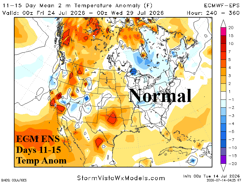
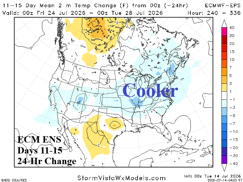
Discussion: The -NAO effect is vividly on display during the 11-15-day outlook according to ECM ENS. The East is near normal with 24-hour cooler changes. The cooler changes reach westward to the Missouri Valley. The drier pattern emerging across Texas during the medium range enables a steady increase in anomalous hot weather risk. -PNA dwindles and the Northwest is shifting cooler during the period.
U.S. Medium-range Precipitation Forecast
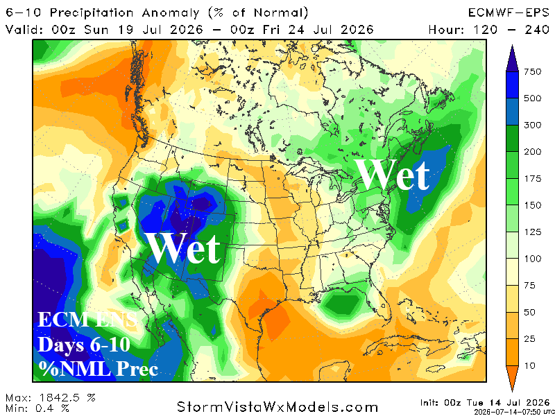
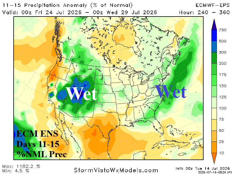
Discussion: The Southwest U.S. wet monsoon is potentially buoyant with convection and attendant rainfall in the 6-10-day period. The MJO phase_7/phase_8 presence enhances this event. Cloudiness associated with the convection is widespread although California manages to stay hot. In the 11-15-day period, the Southwest U.S. Monsoon is ongoing. MJO support remains strong. Additionally, the medium-range forecast has shifted wetter in the Northeast, a by-product of the -NAO pattern.
Days 16-20 Extended range Temperature Forecast valid July 29-August 2, 2026
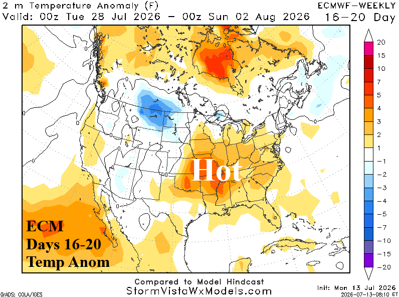
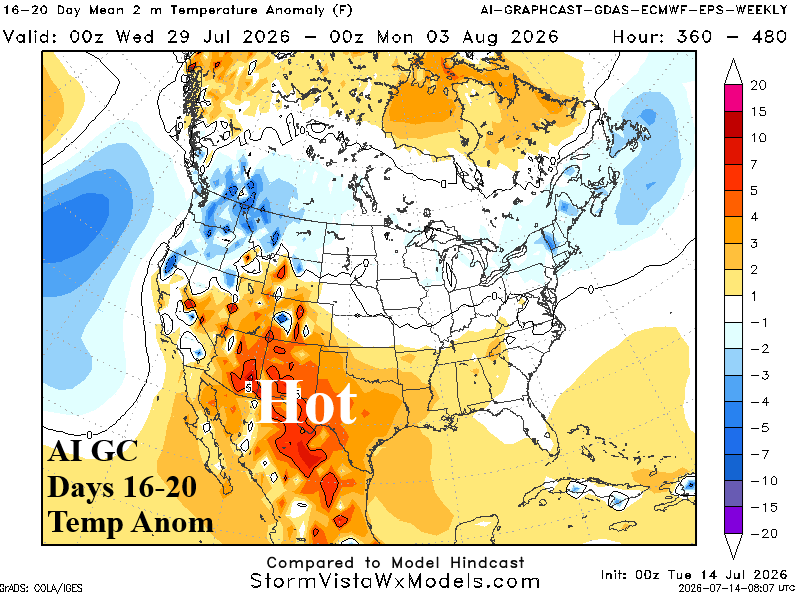
Discussion: Favored is a weak upper trough near the Northwest U.S. and New England with an upper ridge in the Central U.S. The U.S. temperature anomaly projection is a combination of the East-central heat forecast by ECM and the farther west and south heat offered by AI Graph Cast. Implied is the anomalous hot weather risk eastward is likely limited to the Appalachian Spine, the core of the heat is likely centered on the Southern Plains, and the Southwest leans normal due to lingering Southwest U.S. Monsoon Rains. The Northwest and New England are normal to slightly cooler than normal.