
Historic Hot CDD Count for Summer 2026 in Europe
07/19/2026, 11:40 am EDT
Sharp Regional SSTA Patterns Guide The U.S. Week 2-4 Outlook
07/21/2026, 10:35 am EDT
Climate Impact Company North Atlantic Basin 10-Day Monitor
Issued: Monday July 20, 2026
Highlight: What is TD 2/Bertha potential?
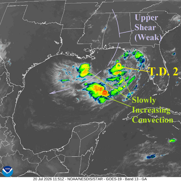
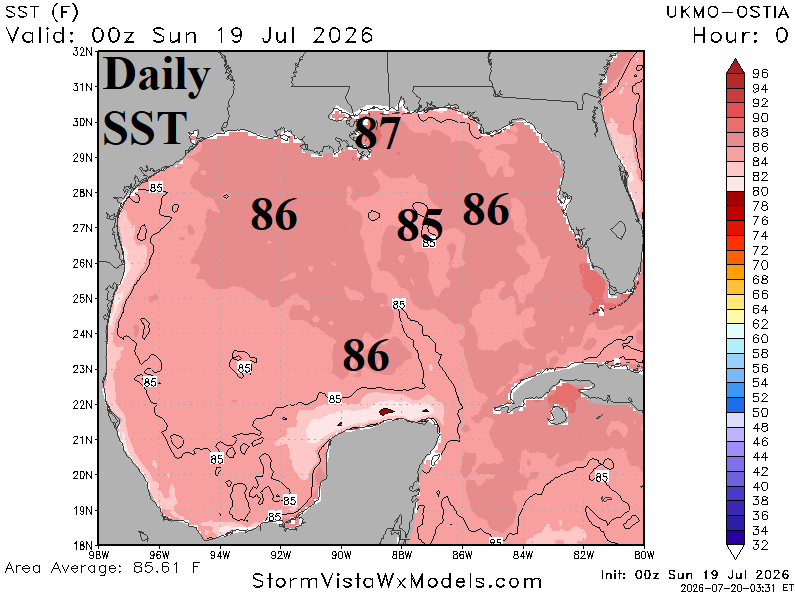
Fig. 1-2: Gulf of America weather satellite view and Gulf of Mexico SST analysis.
Discussion: At 8AM EDT, Tropical Depression 2 was located at 28,6N/85.6W or about 110 miles south of Panama City, FL moving northwest at 3 mph with top wind near 35 mph and surface pressure 1006 MB. Convection surrounding TD 2 is disorganized but increasing (Fig. 1). NOAA/NHC expects a circulation around TD 2 to generate later today causing an upgrade to a tropical storm (Bertha). During that transition, surrounding convection is invited toward the storm center. TD 2 is in a generally light shear zone except for a narrow northeasterly wind axis directly through the convection zone. TD 2 is moving across 85F/29C water which warms slightly during the northwest trek of the next day or two causing strengthening (Fig. 2). Waters are in the 86-87F/30-31C range off the Louisiana Coast, which is warmer than normal and certainly capable of enabling TD 2 to become a strong system. The dilemma (for intensity) is the problematic track near or over the coastline as forecast by NOAA/NHC (Fig. 3) which prevents full-throttle development. Tropical cyclone models project tropical storm force intensity (Fig. 4) although if the storm stays offshore a minimal hurricane is possible as indicated by HMON (Fig. 5). Forecast confidence should improve once Bertha is an organized tropical storm.
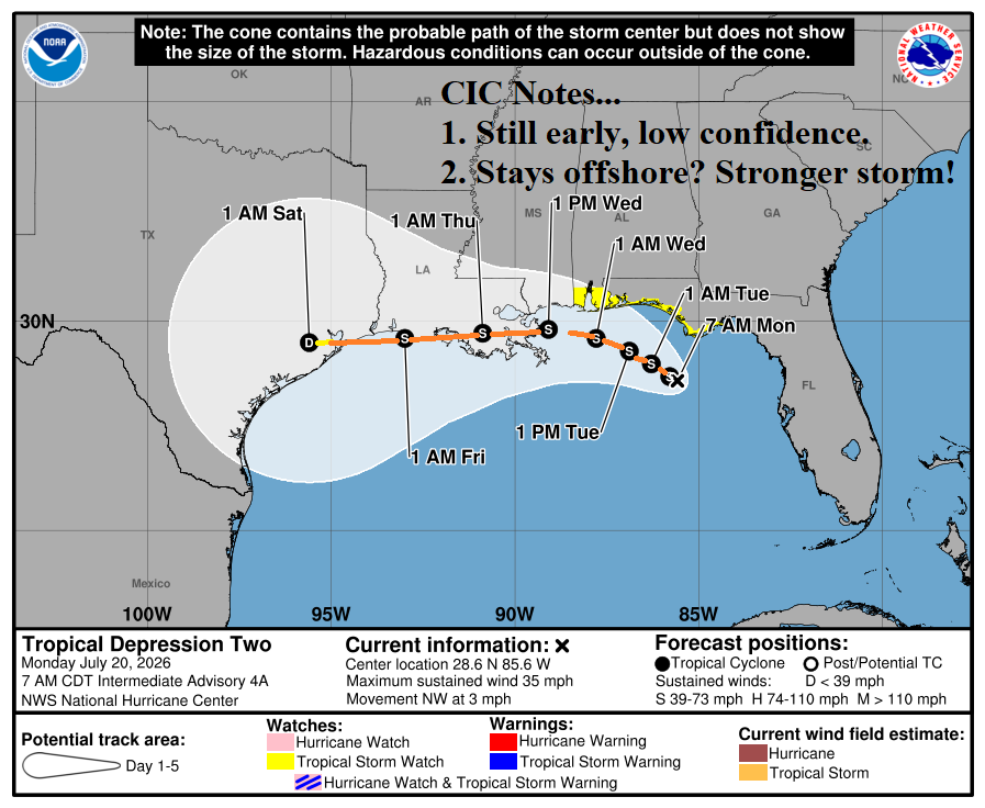
Fig. 3: NOAA/NHC 5-day forecast track for T.D. 2.
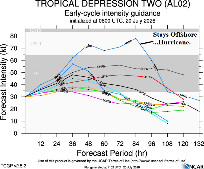
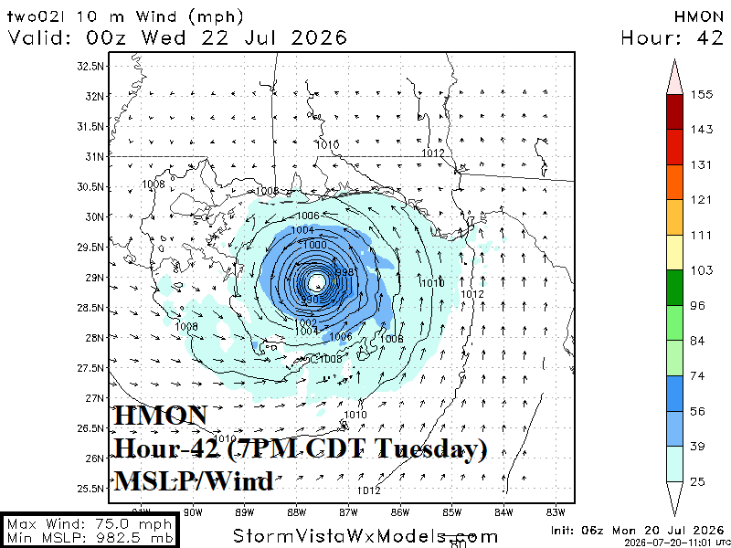
Fig. 4-5: Tropical cyclone models intensity forecasts for T.D. 2 and the HMON SLP/wind forecast at 42 hours indicting minimal hurricane intensity south of Alabama.