
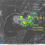
What is TD 2/Bertha Potential?
07/20/2026, 8:49 am EDT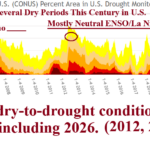
La Nina Climate Key to Intense U.S. Dry Regimes
07/26/2026, 8:45 am EDT
Climate Impact Company Week 2-4 Outlook
North America
Issued: Tuesday July 21, 2026
Highlight: Slowly, the hot pattern grows, Northeast most resistant.
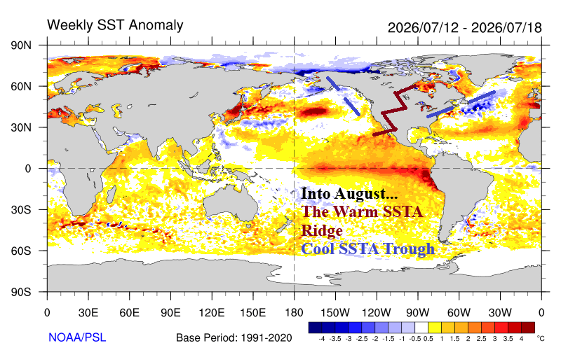
Chart of the day: GFS+ECM 10-day percent of normal rainfall forecast. Reginal SSTA SHOULD guide upper air pattern into August.
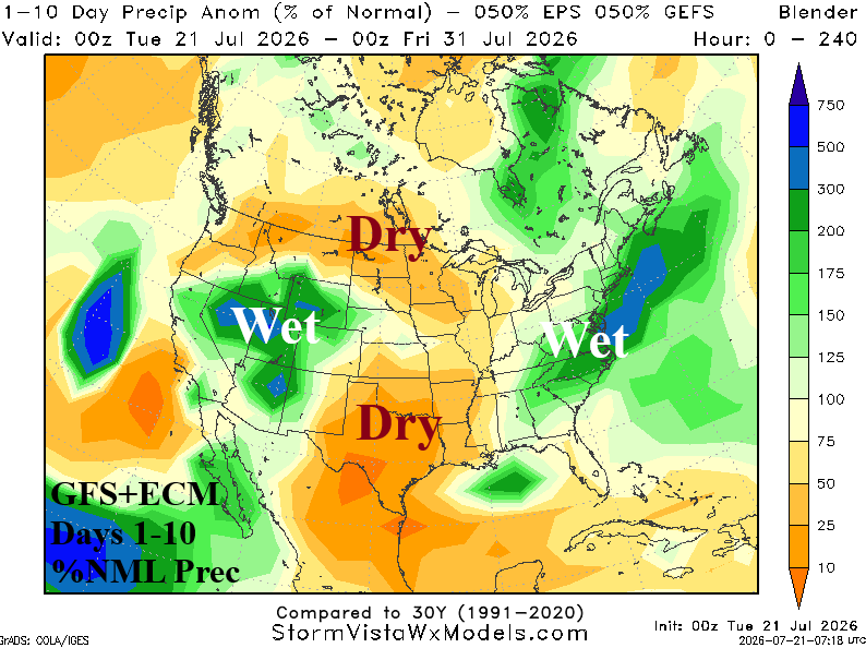
Discussion: Equally combining GFS and ECM through 10 days renders a dry forecast for Texas where heatwave conditions develop extending to the Mid-south U.S. The northern Great Plains to the Canadian Prairies are (also) dry.
Leading into August, sharp regional SSTA conditions support a semi-permanent trough near and southwestward the North Atlantic warm hole (NAWH) and south-southeast from the Gulf of Alaska Cool Pool. Extending northeastward across the Southwest U.S. toward Hudson Bay from the immense marine heatwave (MHW) off the Southwest Coast of North America is a semi-permanent high-pressure ridge.
Week-2 Ahead (August 2-9, 2026): West and Mid-south heat.
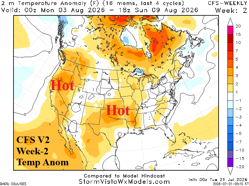
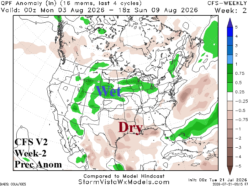
Discussion: Southwest wet monsoon arcs through the Continental Divide States splitting the hot regime centered on the Mid-south and along the West Coast (away from the shoreline). The wet monsoon may be over-forecast, if so, the Western U.S. heat is broader. The East remains temperate.
Week-3 Ahead (August 9-16): West, Central, and Southeast het; Mid-south dryness persists.
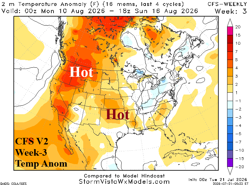
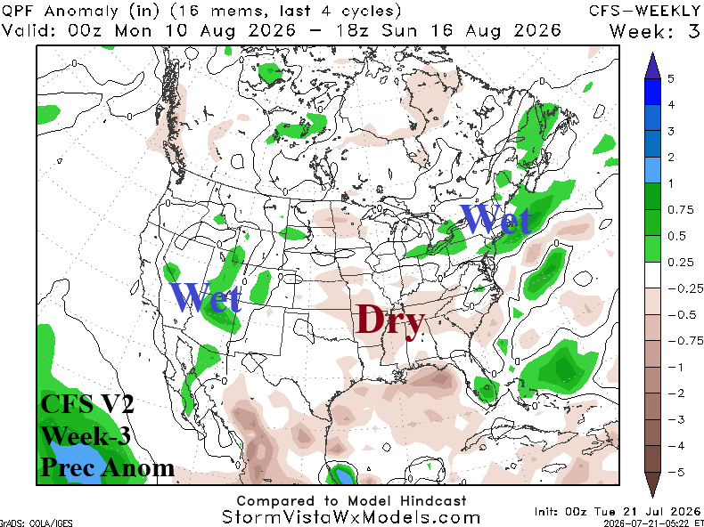
Discussion: CFS V2 remains biased hot across the western half of the U.S. The Central and Southeast may be hotter than indicated and the West slightly less hot. Dryness centered on the Mid-south States remains an issue.
Week-4 Ahead (August 16-23): Widening heat.
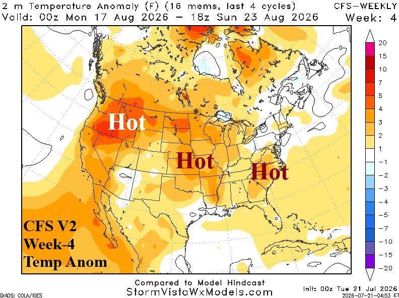
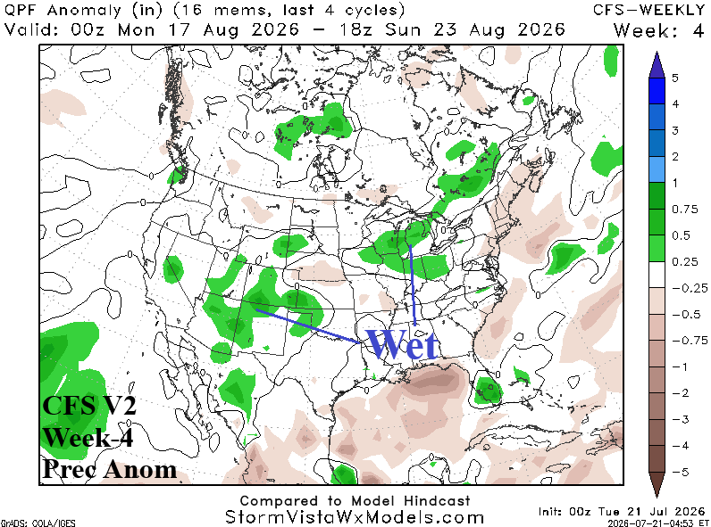
Discussion: The heat source region is not held back forever. Expect widespread anomalous heat just after mid-August.