
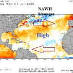
Strengthening NAWH Is Factor Increasing Trade Winds in Tropics
07/02/2026, 8:46 am EDT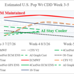
Week 3-5 Cooling Degree Projections Continue Hot ECM, Much Cooler AI
07/07/2026, 9:25 am EDT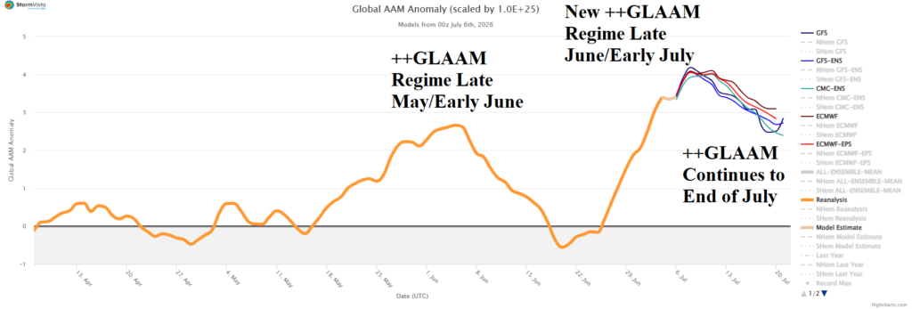

Climate Impact Company Daily Feature
Issued: Monday, July 6, 2026
Highlight: Super positive global atmospheric angular momentum regime likely to maintain hot bias to U.S. temperature pattern.
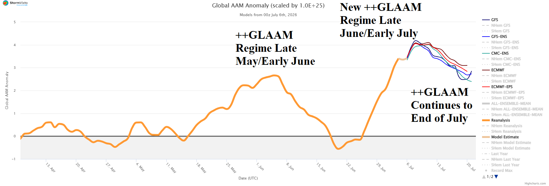
Fig. 1: The 15-day global atmospheric angular momentum forecast utilizing all operational models and 90-day history.
Discussion: During late June/early July, emergence of a strong positive phase global atmospheric angular momentum (++GLAAM) regime has returned (Fig. 1). The new surge of +GLAAM is related to the onset of an El Nino climate. Previously, a pulse of ++GLAAM was observed during late May/early June, elated to a strong Madden Julian oscillation (MJO) episode, and the correlating U.S. temperature anomalies were extremely warm, especially for the Central U.S. (Fig. 2). ++GLAAM episodes have tendency to cause warmer than normal mid-latitude temperature regimes due to increased westerly wind aloft influence. The onset of the latest ++GLAAM episode has caused very warm temperature across the Central and East U.S. (Fig. 3) while this time, the West was cool influenced by the cooling Northeast Pacific of the past couple weeks (Fig. 4). Note the warm bias in the East U.S. is (also) supported by a big warm-up in West Atlantic SSTA (Fig. 5). The ++GLAAM regime is forecast to linger through the end of July and is certainly well-intact during the middle third of July. Consequently, (mostly) dominant warm anomalous temperature should continue across the U.S. most strongly indicated by the AI GFS 15-day outlook (Fig. 6). The intensity of the heat is likely to budge westward, more forcefully as implied by medium-range excessive heat risk forecasts by NOAA/CPC (Fig. 7). However, given the mid-summer occurrence, history of 2026 ++GLAAM temperature regimes so far, and the warming West Atlantic, the anomalous heat could continue to extend eastward as implied by AIFS ENS suggesting AI 8-14-day cooler forecasts in the East are too cool (Fig. 8).
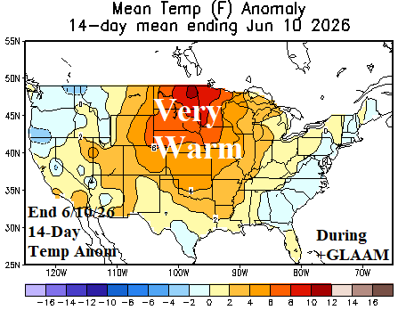
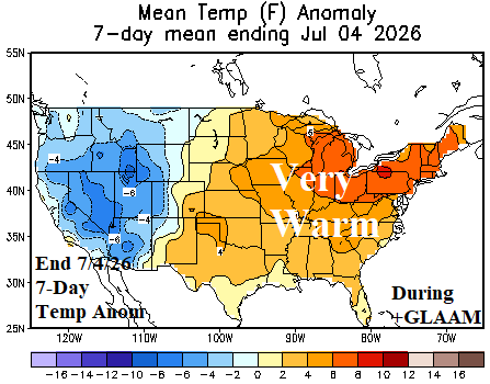
Fig. 2-3: U.S. temperature anomalies analysis for the 14-day period ending June 10th and 7-day period ending July 4th.
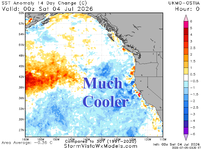
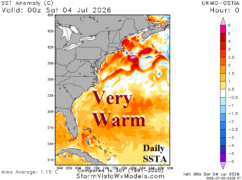
Fig. 4-5: Northeast Pacific sea surface temperature 14-day change and current sea surface temperature anomaly analysis for the Western North Atlantic.
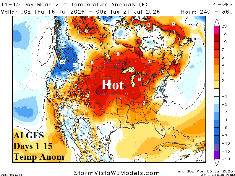
Fig. 6: The AI GFS 15-day U.S. temperature anomalies forecast.
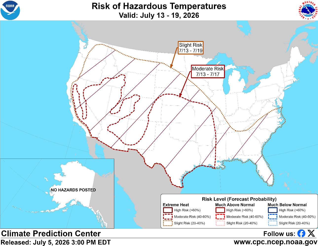
Fig. 7: NOAA/CPC projects excessive heat July 13-20 across much of the U.S.
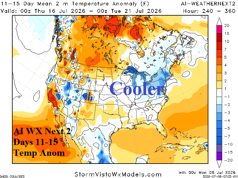
Fig. 8: Some forecast models, mainly AI (and GFS), are much cooler in the 11-15-day period unlikely given the +GLAAM regime.