
A Short Summary of AI in Weather Prediction and Its Use as a Tool for Forecast Development
12/27/2023, 3:29 am ESTFrigid Arctic Air Mass Should Break in About 12 Days
01/09/2024, 4:31 pm ESTCharts of the day: Marine heat waves affecting upper air pattern in Australia.
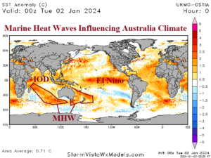
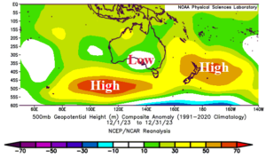
Discussion: Emergence of a marine heat wave (MHW) east of Australia extending to the east of New Zealand coupled with another elongated MHW across the central and southeast Indian Ocean are well-correlated to high pressure ridge areas. In-between the ridge areas, a low-pressure area has spawned over the central coast of South Australia. The upper trough combined with the warmer SSTA off the East Coast is causing excessive rainfall in Eastern Australia so far during meteorological summer 2023-24.
Week-2 Ahead Forecast valid January 7-13, 2024: More rains East.
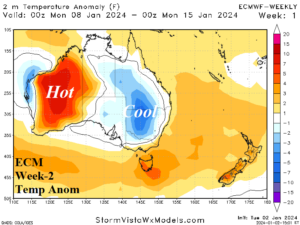
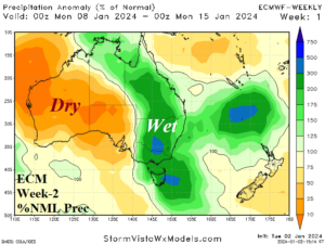
Discussion: The persistent upper trough causing the excessive rain in the East continues through next week. Hot and dry weather dominates Western Australia.
Week-3 Ahead Forecast valid January 14-20, 2024: Widening wet weather zone.
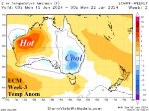
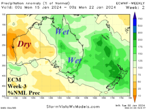
Discussion: A large area of tropical/subtropical rains extend from East Australia to New Zealand. Dry and hot weather persists across Western Australia.
Week-4 Ahead Forecast valid January 21-27, 2024: Hot/dry West Australia.
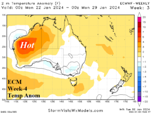
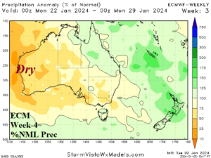
Discussion: Later in January the wet weather pattern across East Australia eases.