Heavy Rain Followed by Cold Outbreak in China Late FEB/Early MAR
02/19/2026, 9:19 am EST
El Nino Analogs for U.S. Corn Belt JUN-SEP
02/22/2026, 1:31 pm EST
Climate Impact Company AG Hot Spot
Issued: Friday February 20, 2026
Highlight: Wet pattern change for Brazil; Warm Nino12 helps to produce the rain.
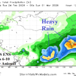
Discussion: The warming of the equatorial East Pacific Ocean subsurface caused by a robust Kelvin Wave has extended to the northwest coast of South America where the Nino12 region has warmed to 1.25C above normal (Fig. 1). The anomalous warmth is well above the El Nino threshold. The warming has generated within the past 30 days (Fig. 2). Interestingly, the warm sea surface temperature anomalies off the South America West Coast and now the Nino12 region have biased the 30-day anomalous wet rainfall pattern to the western portion of the continent (Fig. 3). To compensate the eastern half of the continent, especially Northeast Argentina has been exceptionally dry and coupled with anomalous het caused intensifying drought. There is a pattern change in the forecast. Vigorous upper troughs moving across the continent and amplifying off the East Coast entrain moisture from the warm SSTA regions and cause a heavy rain scenario across Brazil initializing this weekend and potentially lasting into early March (Fig. 4). Meanwhile, subsidence on the backside of the convective rains keeps Northeast Argentina dry!
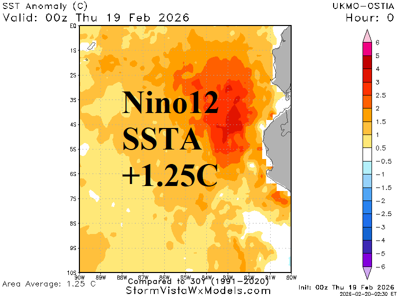
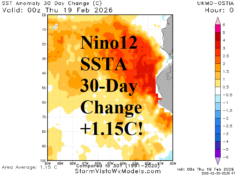
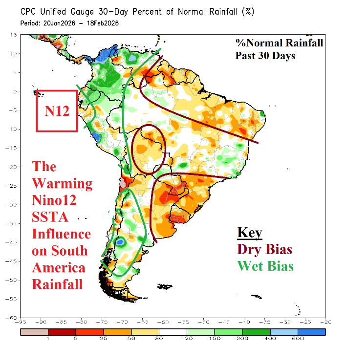
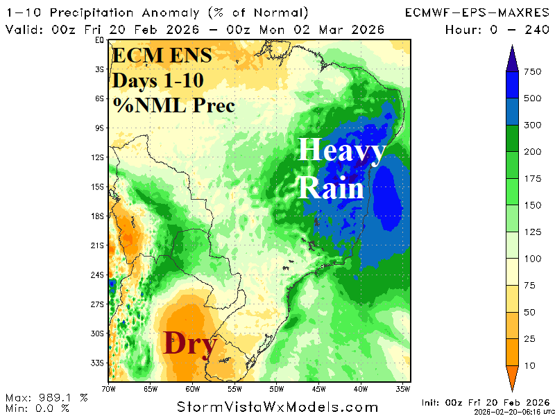
Fig. 1-4: The daily Nino12 SSTA observation, 30-day change, and 30-day percent of normal rainfall observations across South America plus the ECM ENS 10-day percent of normal rainfall outlook.