
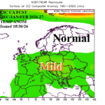
Europe Month 1-4 Outlook: Mild Start/Cold Finish and Cold January for Europe
10/30/2026, 8:36 am EDT
Climate Impact Company North America Medium Range Report
Issued: Tuesday November 3, 2026
Highlight: Stormy West/Very warm Central and East.
Charts of the day: Atmospheric River pattern to emerge on West Coast.
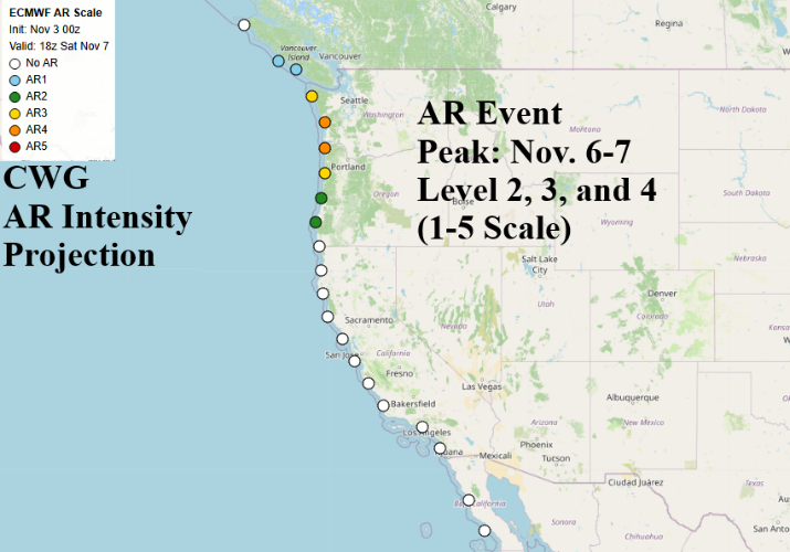
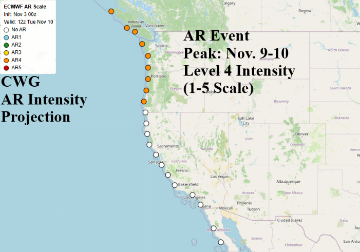
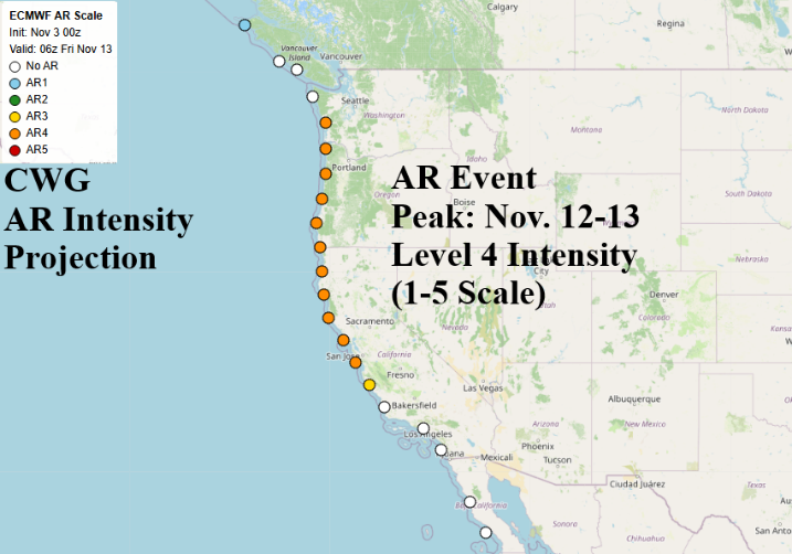
Discussion: Using the NEW CWG atmospheric river intensity forecast via the ECMWF model, Climate Impact Company identifies peak intensity for 3 events centered on Nov. 6-7, Nov. 9-10, and Nov. 12-13. The last episode on Nov. 12-13 produces the largest aerial coverage (South Washington Coast to Central California Coast). Most to all peak intensity is 4 on the 1-5 AR scale. Level 4 AR events are considered hazardous: Widespread flooding, rapid precipitation intensity, substantial stress on local infrastructure such as storm drains, reservoirs, including elevated mudslide potential, debris flows, and significant travel disruption.
Medium-range 6-10 Day Forecast Valid November 8-12, 2026 (AI WX NEXT V3 and 24-hour change)
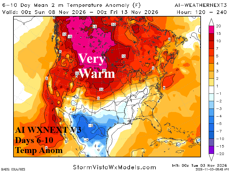
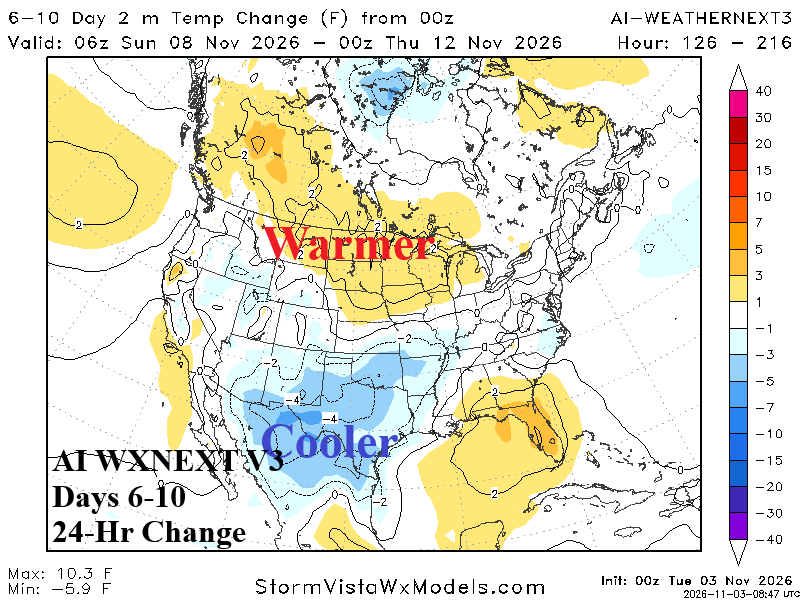
Discussion: Despite a trough in the East, the 4-day average is warmer than normal while the upstream upper ridge warms the West/North-central U.S. and Canada. The 24-hour change is warmer in the East as the cool air associated with upper trough is brief.
Medium-range 11-15 Day Forecast Valid November 13-17, 2026 (AI WX NEXT V3 and 24-hour change)
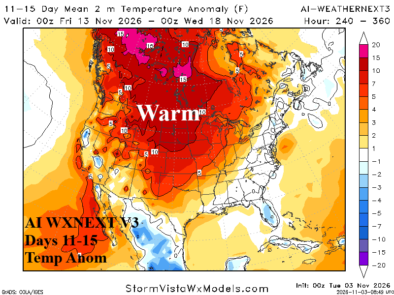
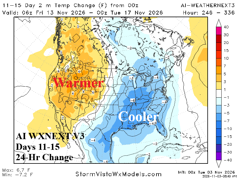
Discussion: Broadening upper ridge warms the U.S. east of the Continental Divide while an upper trough produces a storm track suppressing warm risk West.
U.S. Medium-range Precipitation Forecast (ECM)
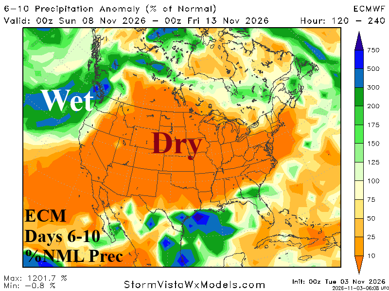
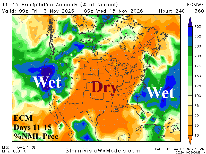
Discussion: Tracking incoming atmospheric river events according to ECMWF during the medium range. The AR pattern emerges on the Northwest U.S./Southwest Canada Coast in the 6-10-day period shifting south and intensifying into California in the 11-15-day period. On the East Coast, ECMWF projects a potential significant coastal storm in the 11-15-day period.
Days 16-20 Extended range Temperature Forecast valid-November 18-22, 2026
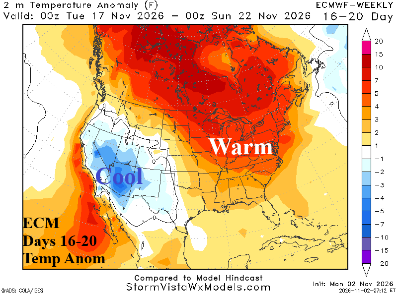
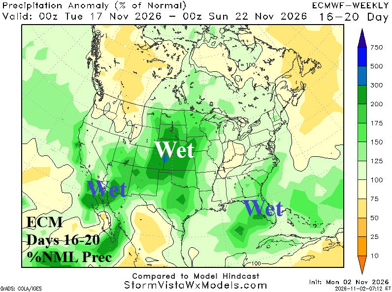
Discussion: In the extended range, the trough West/ridge East pattern continues. Cool Interior Southwest with storms from Northwest Mexico to the Great Plains while east of the Continental Divide is warm.