

North Atlantic Tropics Busy With POTENTIAL Events
09/22/2026, 7:11 am EDT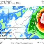
Weekend Stormy Impacts Increasing for Mid-Atlantic Coast
09/25/2026, 1:54 pm EDT
Climate Impact Company Early U.S. Report
Issued: Thursday September 24, 2026
Highlight: Tropical cyclones influencing the weather pattern! Major ocean storm batters Mid-Atlantic/Northeast this weekend; Great Plains turn wet.
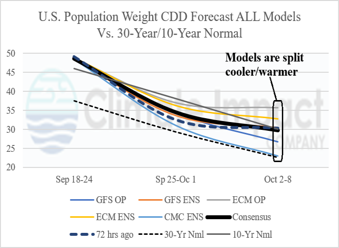
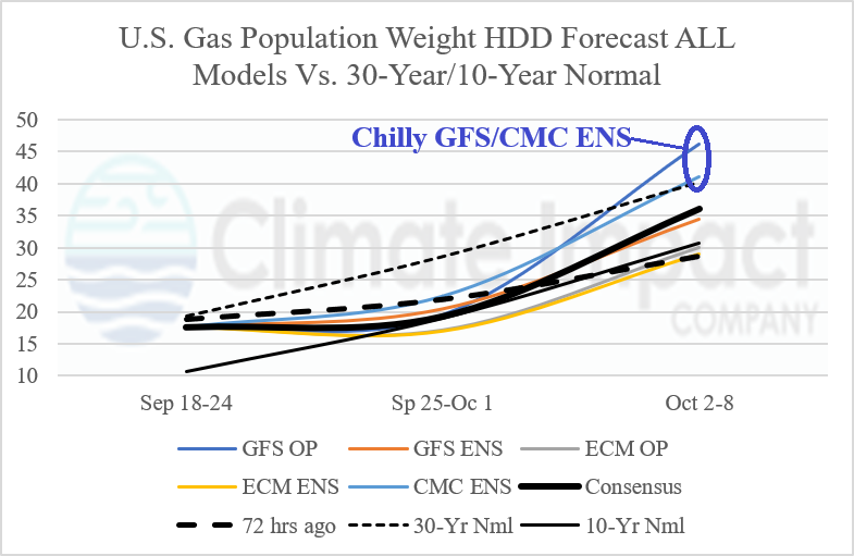
Fig. 1-2: The late season U.S. population weight CDD forecast cools for next week while models have varying cool/warm opinions for the week ending October 8. Note the chilly GFS and CMC ENS U.S. gas population weight HDD forecast for the week ending October 8.
Discussion: In early October, HDD climbs past CDD and (interestingly) offers cool (HDD) projections by both GFS and CMC ENS (Fig. 1-2). The GFS and CMC ENS are strongest with negative arctic oscillation (-AO) index forecasts for the week of October 2-8 while other models are milder and indicate very weak upper troughs in the East. In fact, the 00Z GFS is alone projecting a buoyant high pressure (blocking) ridge over Greenland. Is the blocking ridge singularly forecast by GFS possible? Yes! Due to the potential latent heat released poleward by up to 7 tropical systems in the northern hemisphere (Fig. 3).
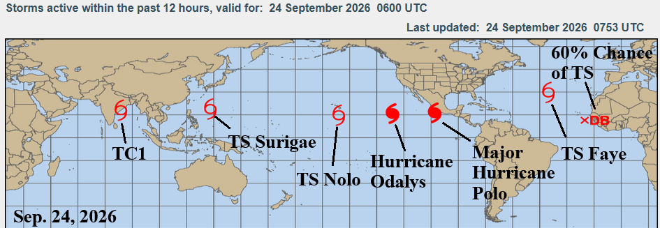
Fig. 3: Current tropical cyclones in the northern hemisphere.

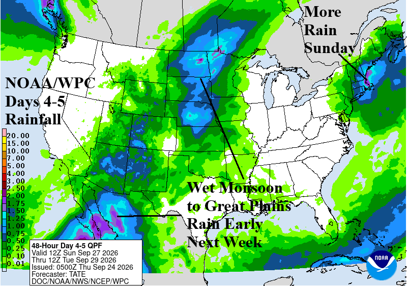
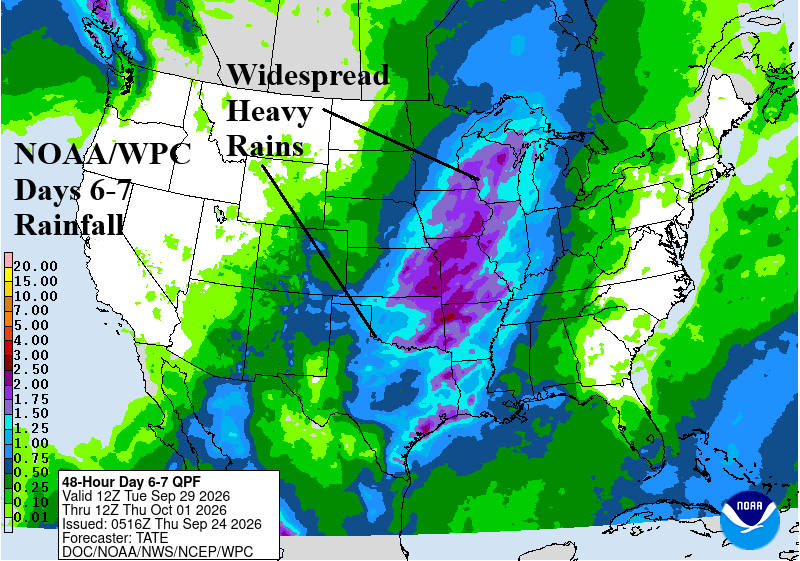
Fig. 4-6: Current tropical cyclones in the northern hemisphere.
A major ocean storm will develop during the next few days off the Mid-Atlantic/Northeast Coast causing persistent onshore gale to storm force wind and beneath astronomical high tide significant beach erosion and flooding is likely for the Coastal Northeast Corridor and worst for Cape Cod and Islands where wind gusts reach hurricane force. The NOAA/WPC quantitative precipitation forecast yields >6 inches of rain for Cape Cod to eastern Long Island (Fig. 4). An extension of the wet Mexico Monsoon enhances rainfall into the central Great Plains the next few days while today and tomorrow are rainy Coastal Northwest.
An inland shifting tropical cyclone in the East Pacific will begin to soak Mexico with a wet extension to the North-central U.S. early next week (Fig. 5). Heavy rain continues to affect New England Sunday. Middle next week maintains the wet monsoon to Great Plains heavy rain connection (Fig. 6).