
Regenerating Heat/Dryness across Southern Half of Europe Ahead
08/30/2026, 1:16 pm EDT
Climate Impact Company North Atlantic Basin 10-Day Monitor
Issued: Tuesday September 1, 2026
Highlight: MAJOR UPDATE for Tropical Storm Eduardo. Storm passes 31C water this afternoon likely to cause rapid intensification. Hurricane Watch posted northwest Gulf Coast.
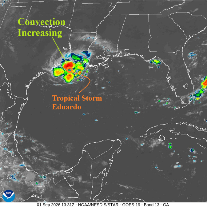
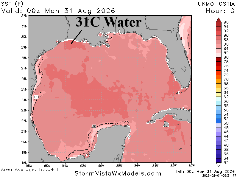
Fig. 1-2: Latest Gulf of Mexico satellite view of Tropical Storm Eduardo identifies increasing convection across 31C water.
Discussion: Eduardo (Fig. 1) is shifting over 31C surface water (Fig. 2) in a light shear environment. Rapid intensification is possible, given the light shear environment. NOAA/NHC issues a Hurricane Watch and Storm Surge Warning for the Upper Texas and Southwest Louisiana Coast (Fig. 3). The Port Arthur area is implicated for minimal hurricane hazards late today and evening. NOAA/NHC storm surge forecast is 3-5 feet for the northwest Gulf Coast (Fig. 4) with 6 feet possible just to the right of landfall. HRRR rainfall forecasts have doubled the past 1-2 hours now indicating 6-10 in. of rain along the inland tracking storm path (Fig. 5).
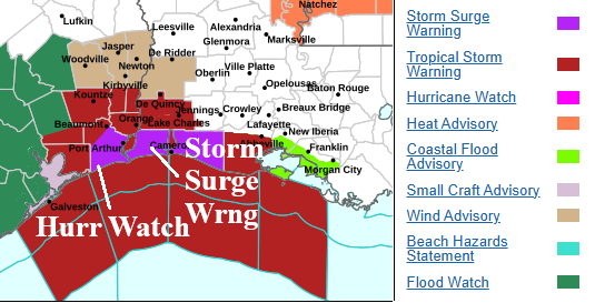
Fig. 3: Updated plethora of watch and warnings for Texas/Louisiana.
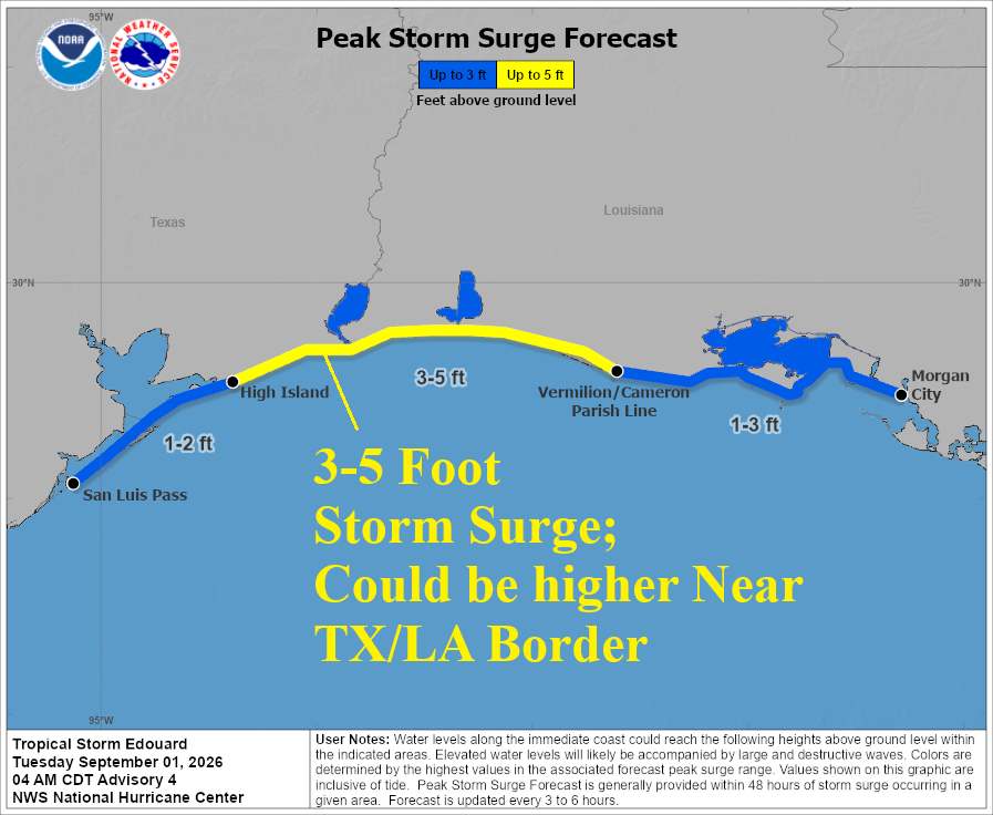
Fig. 4: NOAA/NHC storm surge projections associated with Tropical Storm Eduardo.
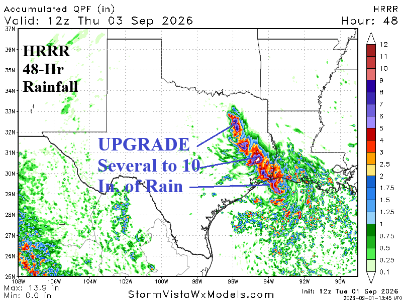
Fig. 5: HRRR indicates 5-10 in. of rain along Eduardo’s inland track.