
1,602 Severe Weather/Event Reports FRI/SAT; More Today and Tomorrow Focused on Mid-Atlantic
07/05/2026, 11:20 am EDT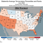
Ranking June 2026 State Climate Rankings
07/09/2026, 12:30 pm EDT
Climate Impact Company Week 2-4 Outlook
Europe/Western Russia
Issued: Tuesday July 7, 2026
Highlight: Heat abates after mid-July, regenerates as early August approaches.
Charts of the day: ECM “monthlies” develop Southwest Europe rain late summer expanding autumn.
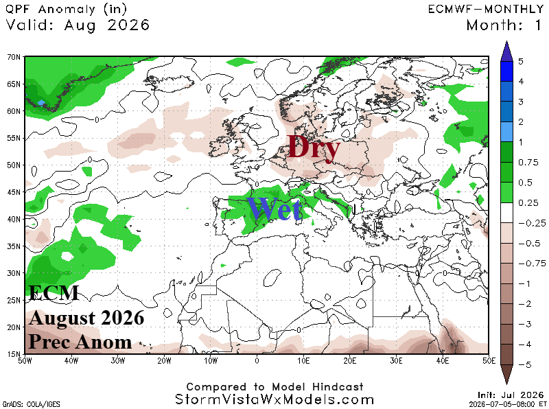
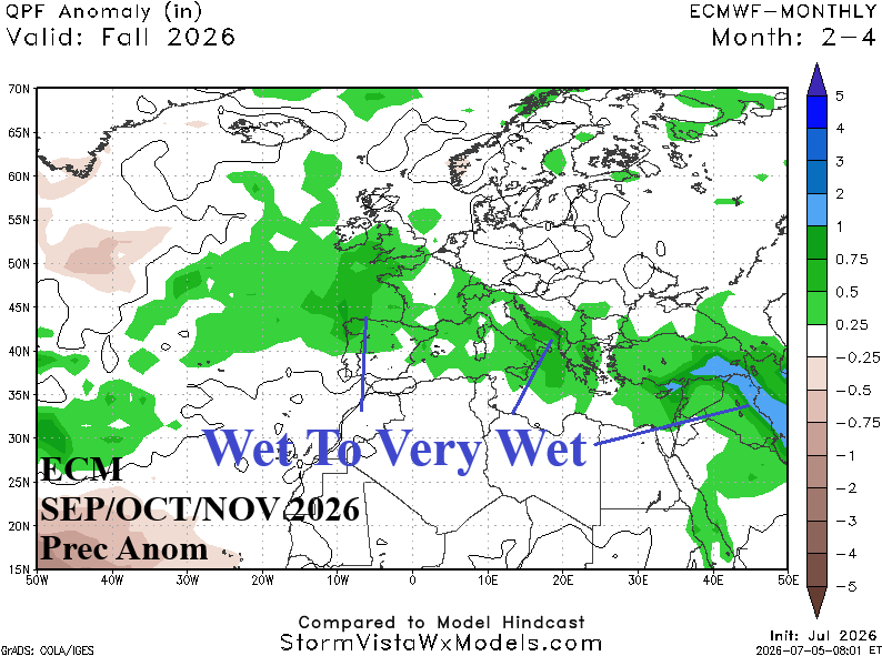
Discussion: ECM “monthlies” maintain warmer than normal risk into the autumn season but due to El Nino influence begin an expanding wet pattern across Southwest Europe to help ease the drought.
Week-2 Ahead (July 19-26, 2026): Breaking down the heat.
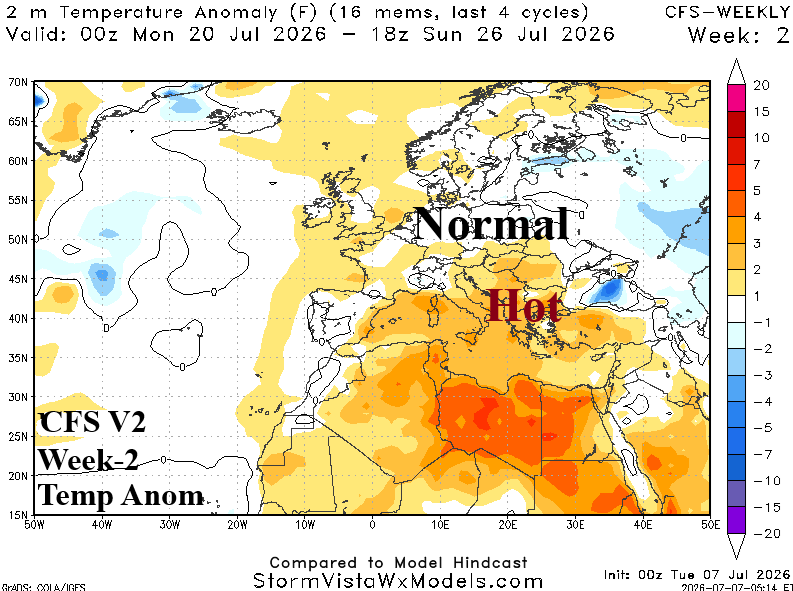
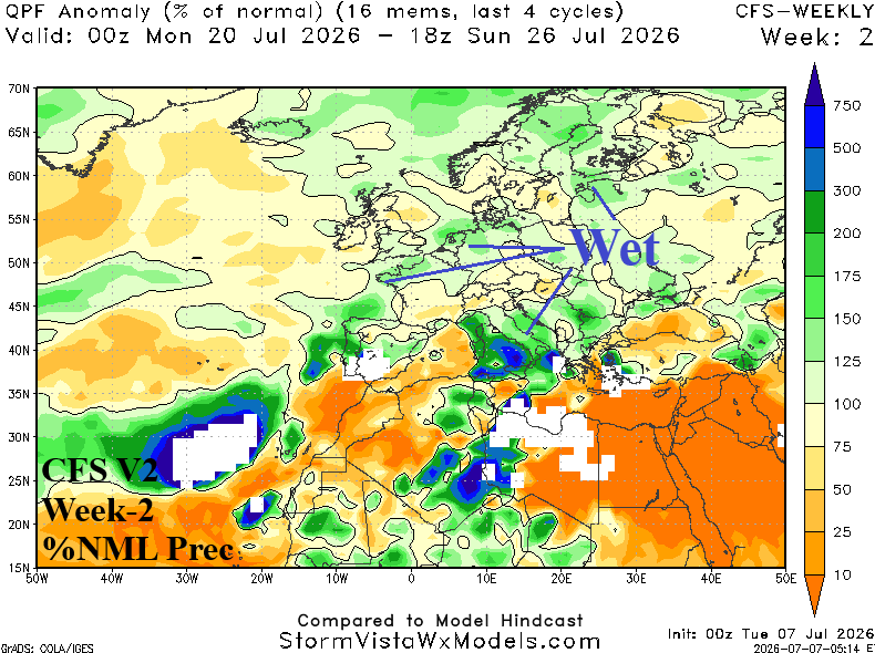
Discussion: Upper trough breaks down the heatwave of July during the final third of the month. Streaks of much needed rainfall is forecast across Italy and Southeast Europe plus much of the West Coast of Europe.
Week-3 Ahead (July 26-August 1): Drought re-accelerates as heat regenerates.
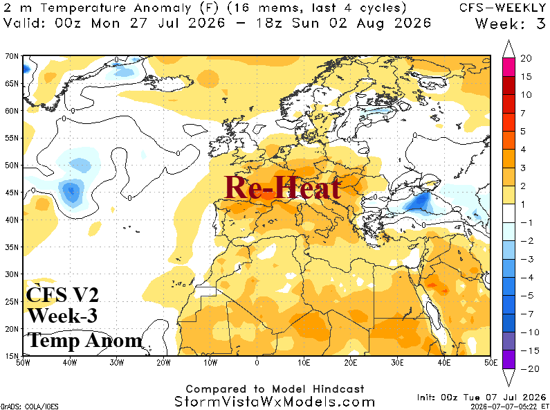
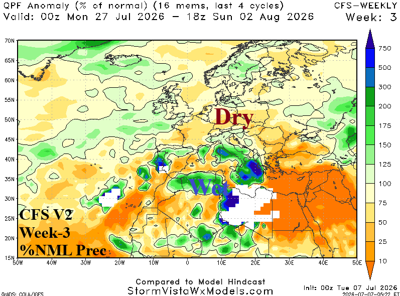
Discussion: Upper ridge rebuilds and the hot weather pattern redevelops as August 1st approaches. France to Black Sea region is dry.
Week-4 Ahead (August 1-8): East-central Europe thundershowers.
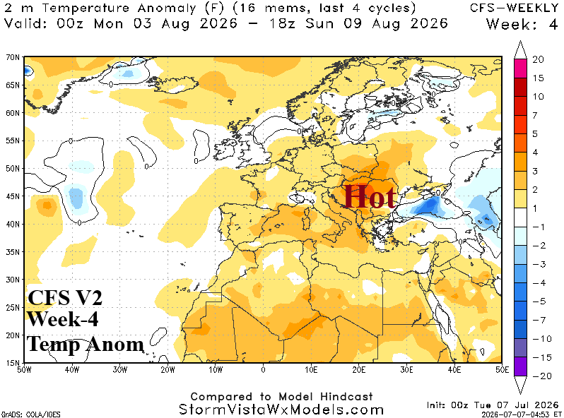
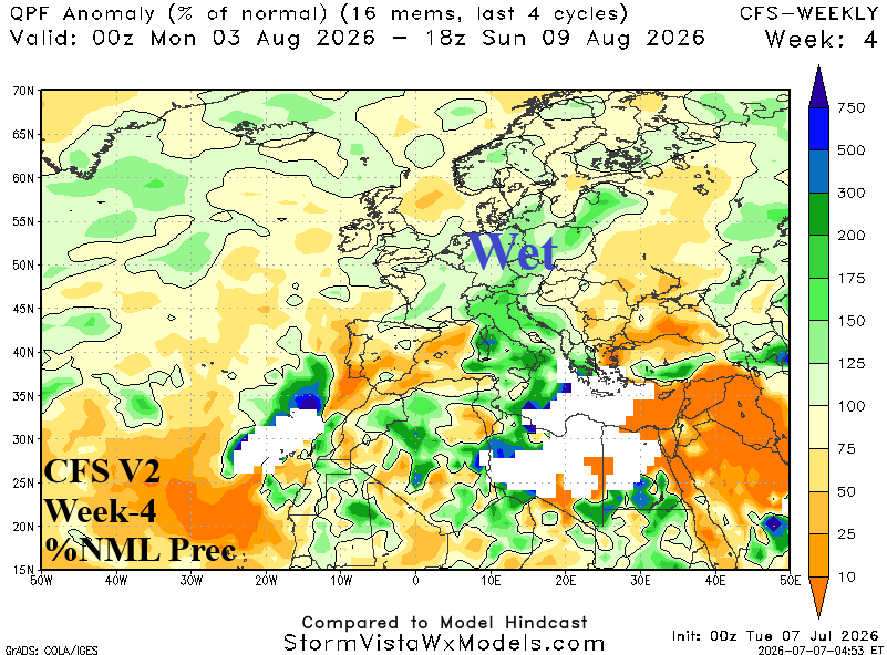
Discussion: Weak upper trough causes a thundershower pattern to develop across Italy northward toward Poland. Hot and dry weather is focused on Southeast Europe and the Black Sea region.