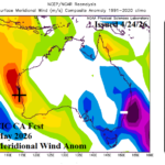
Comparing (Climate Impact Co.) Constructed Analog and (ECMWF) Probabilistic Wind Climate Forecast for Australia
04/24/2026, 8:43 am EDT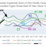
Upper Ocean Heat Rivals 1997-98 El Nino Now
05/01/2026, 8:46 am EDT
Climate Impact Company ENSO Climate Diagnostics
Issued: Tuesday April 28, 2026
Highlight: A look at relative Nino index. Maintained is potential for a record-strength El Nino later this year.
Discussion: The traditional Nino SSTA weekly observations indicate the El Nino threshold is surpassed by all Nino regions (Fig. 1). However, the new relative Nino index maintains neutral ENSO phase (Fig. 2). The relative Nino SSTA are moderately cooler than historical indices (Fig. 3). As of earlier this year, the relative Nino index is used to identify and forecast ENSO phase by NOAA and Australia Bureau of Meteorology.
The new Relative Nino Index is based on the 3-month average of the Nino34 SSTA with removal of the warm bias brought on by climate change/global warming. NOAA indicates this statistic better identifies (and forecasts) ENSO phase and strength likely to favor weaker El Nino strength and stronger La Nina strength. But does this new process do just the opposite of the claim? The 3-month Nino34 index average removes the importance of a sudden one-month change and the warming of the modern-day climate.
Despite the neutral relative Nino34 SSTA while the historical Nino34 SSTA is already within the El Nino threshold, the relative Nino34 SSTA forecast is stronger for later this year. NCEP CFS V2 continues to forecast risk of record strength El Nino (Fig. 4). Fuel in the equatorial subsurface Eastern Pacific is immense and justifies the intense El Nino forecast (Fig. 5).
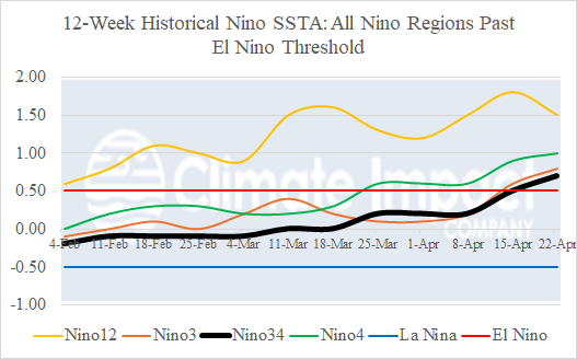
Fig. 1: The historical Nino SSTA observations for the past 12 weeks indicate the El Nino threshold is surpassed.
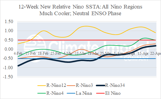
Fig. 2: The new relative Nino SSTA observations for the past 12 weeks indicate ENSO phase remains neutral (using the conventional Nino34 SSTA).
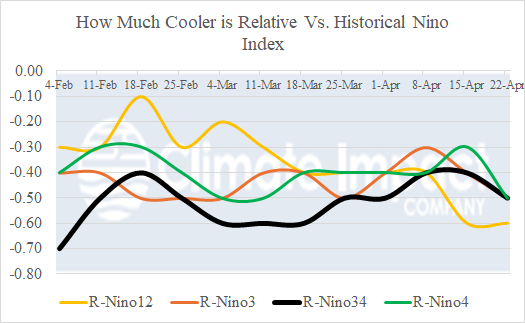
Fig. 3: The relative Nino SSTA are cooler than the historical Nino SSTA.
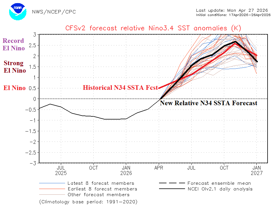
Fig. 4: The historical Nino 34 SSTA forecast begins warmer (+0.5C vs. 0.0C) for April 2026 yet the relative Nino34 SSTA forecast is stronger with El Nino development for later this year.
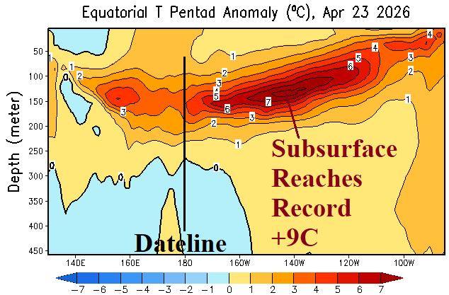
Fig. 5: The eastern equatorial Pacific Ocean subsurface temperature anomalies reach a record (warm) strength +9C for the week ending April 23, 2026.