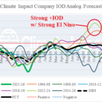
Moderate-to-Strong +IOD Forecast to Emerge With El Nino Mid-to-late 2026
03/26/2026, 8:34 am EDT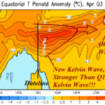
Upper Ocean Heat Surge Supports Record-strength El Nino Risk for 2026!
04/08/2026, 5:17 am EDT
Climate Impact Company ENSO Climate Diagnostics
Issued: Monday March 30, 2026
Highlight: ENSO remains neutral; Subsurface is bubbling hot!
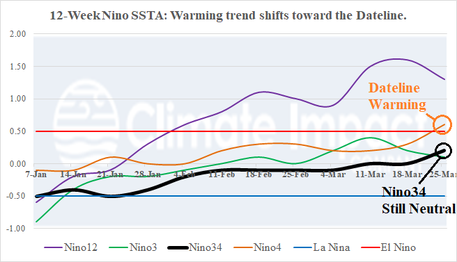
Fig. 1: The weekly SSTA observed in the Nino regions for the past 12 weeks.
Discussion: Last week, the Nino4 SSTA warmed too above the El Nino threshold (Fig. 1). The Nino4 region is located on either side of the Dateline and the warming in this region is a southwestward expansion of surface warming associated with an intense marine heatwave off the West Coast of North America (Fig. 2). NOAA reported a multivariate ENSO index for JAN/FEB of -0.9 which is slightly stronger than the DEC/JAN value. Indicated is that as of early March, the global atmosphere was locked in moderate La Nina phase. However, the equatorial East Pacific Ocean has warmed slightly in March and recently southern oscillation index (SOI) has shown an El Nino-like negative phase tendency (Fig. 3). The MEI should ease back to -0.5 or neutral when the FEB/MAR data is issued. The upper ocean heat remains immense. In fact, some intensification has been observed near the Dateline (Fig. 4). The strong subsurface warming has caused dynamic models to project a possible record strength El Nino for later this year (Fig. 5).
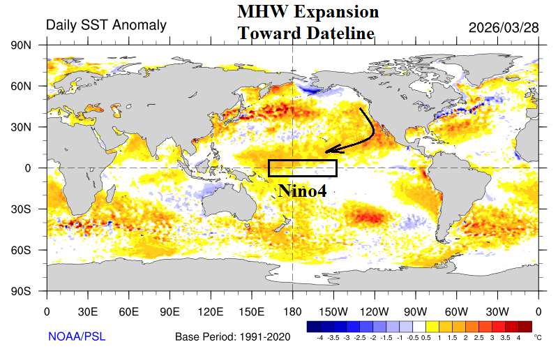
Fig. 2: daily global SSTA analysis reveals the warm water extension from the West Coast marine heatwave to the Dateline in the tropics.
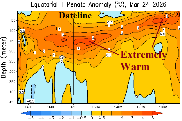
Fig. 3: The upper ocean heat anomalies across the equatorial Pacific Ocean subsurface remain impressively warm.
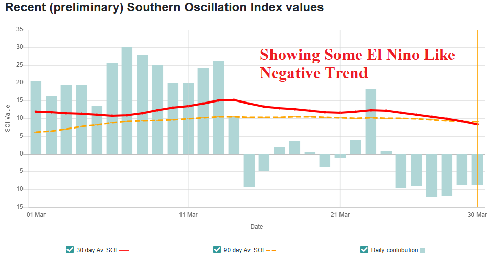
Fig. 4: Finally, negative southern oscillation index has recently generated indicting the La Nina climate is fading.
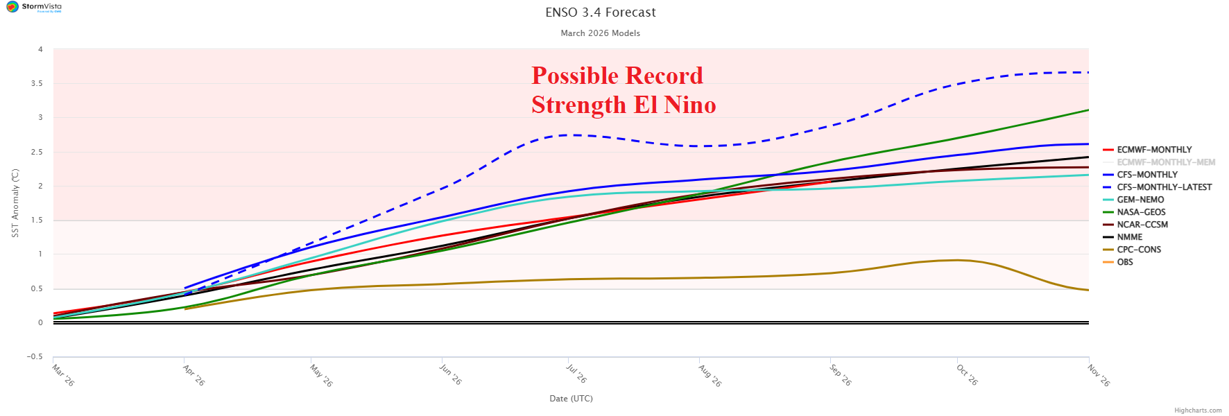
Fig. 5: The Nino34 SSTA forecast for 2026 reveals potential for a record strength El Nino.