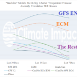
“Weeklies” Skill Scores for North America
01/16/2026, 10:23 am EST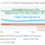
Week-4 AI HDD Forecasts from Early January Were Very Cold for Last Week of January
01/21/2026, 1:00 pm EST
Climate Impact Company ENSO Climate Diagnostics
Issued: Tuesday January 20, 2026
Highlight: East Pacific surface warms slightly; Subsurface warming eases back slightly. El Nino alert in effect but confidence remains below average.
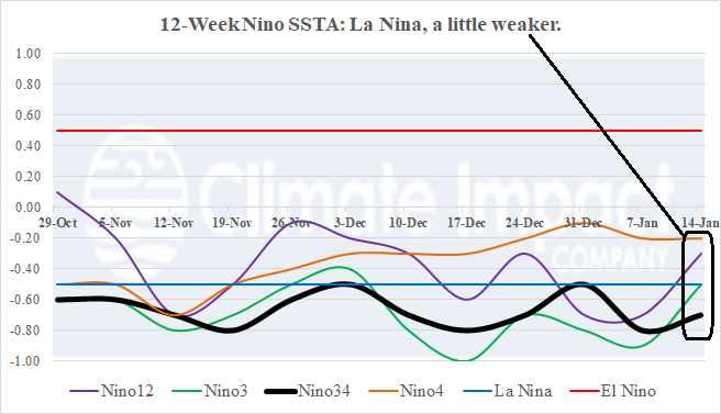
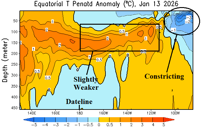
Fig. 1-2: The 12-week Nino SSTA tracker and subsurface temperature anomalies across the equatorial Pacific subsurface.
Discussion: Last week, the Nino SSTA regions warmed slightly although Nino34 remains within the La Nina threshold (Fig. 1). The slight warming is surprising given a strong southern oscillation index (+SOI) and above normal trade wind speeds. The equatorial subsurface warmed during the past few weeks although losing some intensity as mid-January approaches (Fig. 2). Also losing intensity is remnant cool waters in the subsurface off the northwest coast of South America. The latest Nino34 SSTA forecast utilizing CFS V2 indicates a less aggressive weak El Nino prediction. The latest ensemble members (blue) suggest neutral ENSO lasts through mid-year with weak El Nino delayed until Q3/2026 (Fig. 3). The early ensemble members indicate Nino34 warming during Q2/2026 followed by cooling past mid-year. El Nino 2026 is certainly not a guarantee, and predictions are generated with low confidence given the approach of the ENSO springtime prediction barrier. In Fact, Climate Impact Company analogs indicate a low confidence/uncertain Nino34 SSTA 2-year outlook (Fig. 4).
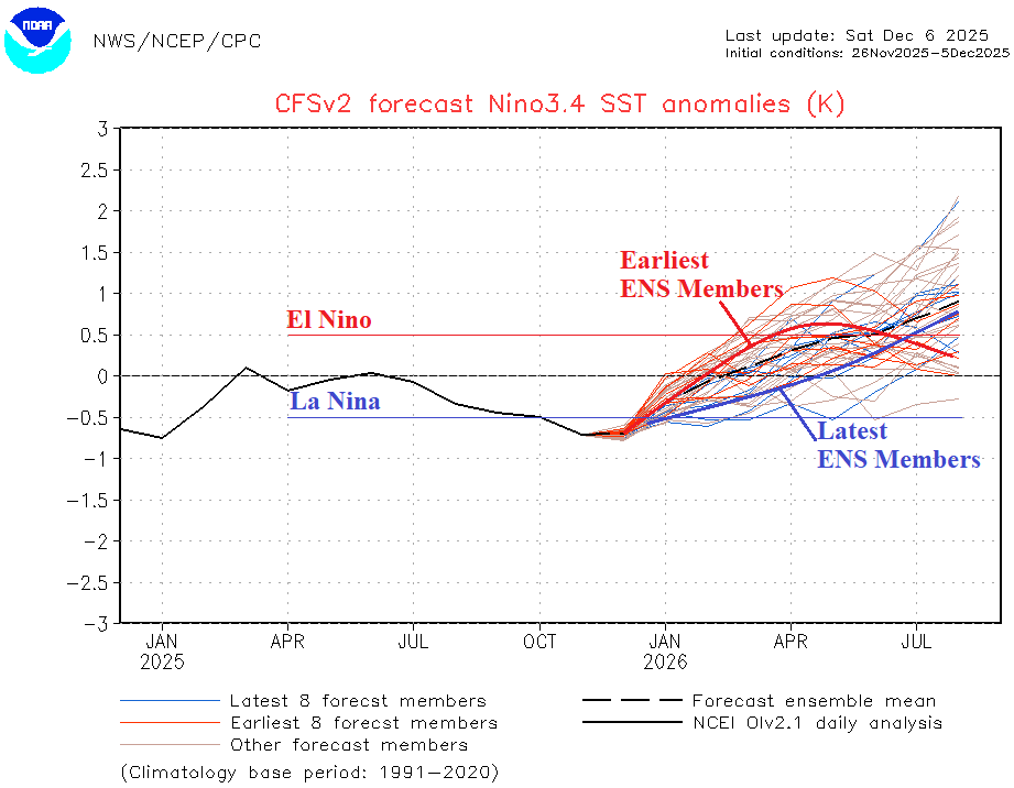
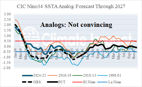
Fig. 3-4: The CFS V2 Nino34 SSTA forecast and Climate Impact Company Nin34 SSTA analog outlook.